Mount St. Helens
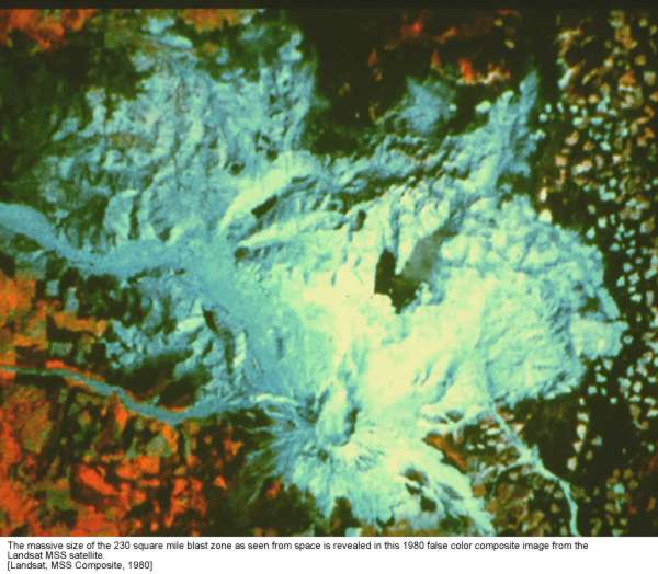
Landsat photo of 230-square mile blast area that was devastated on Sunday morning, May 18, 1980, by the largest explosion in the history of North America, with the power of a 24 megaton atomic bomb, causing a 300-mph blast filled with rock particles that flattened forests and killed everything in its path. The cloud of volcanic ash rose 12 miles high, darkened the sky and closed roads 200 miles away, and continued to cover 10 states by the next day, with ash falling on the east coast of the United States 3 days later, and encircling the globe 15 days later. The cataclysm began at 8:32 am with a 5.1 earthquake that collapsed the north slope and produced tha largest landslide in American history that filled 23 square miles of the North Fork Toutle River at depths ranging from 100 to 600 feet deep. The volcano erupted with a sudden blast of superheated gas that blew away the top 1314 feet of the mountain and burned everything in its path. This was followed by an eruption of rock and soil that joined the mudslide and floods pouring down the mountain. 57 people died, including geologist David Johnston whose early monitoring saved many lives, and the outspoken Harry Truman who refused to evacuate his home on the mountain or his tourist lodge on Spirit Lake.
Mount St. Helens National Volcanic Monument was created in 1982 from 110,000 acres of the blast zone.
Mount St. Helens remembered from Seattle Times, May 14, 2000
Mount St. Helens Gift Shop features "ashware"
Mount St. Helens, Washington from USGS
The film St. Helens in 1981 was one of the disaster films popular in the previous decade.