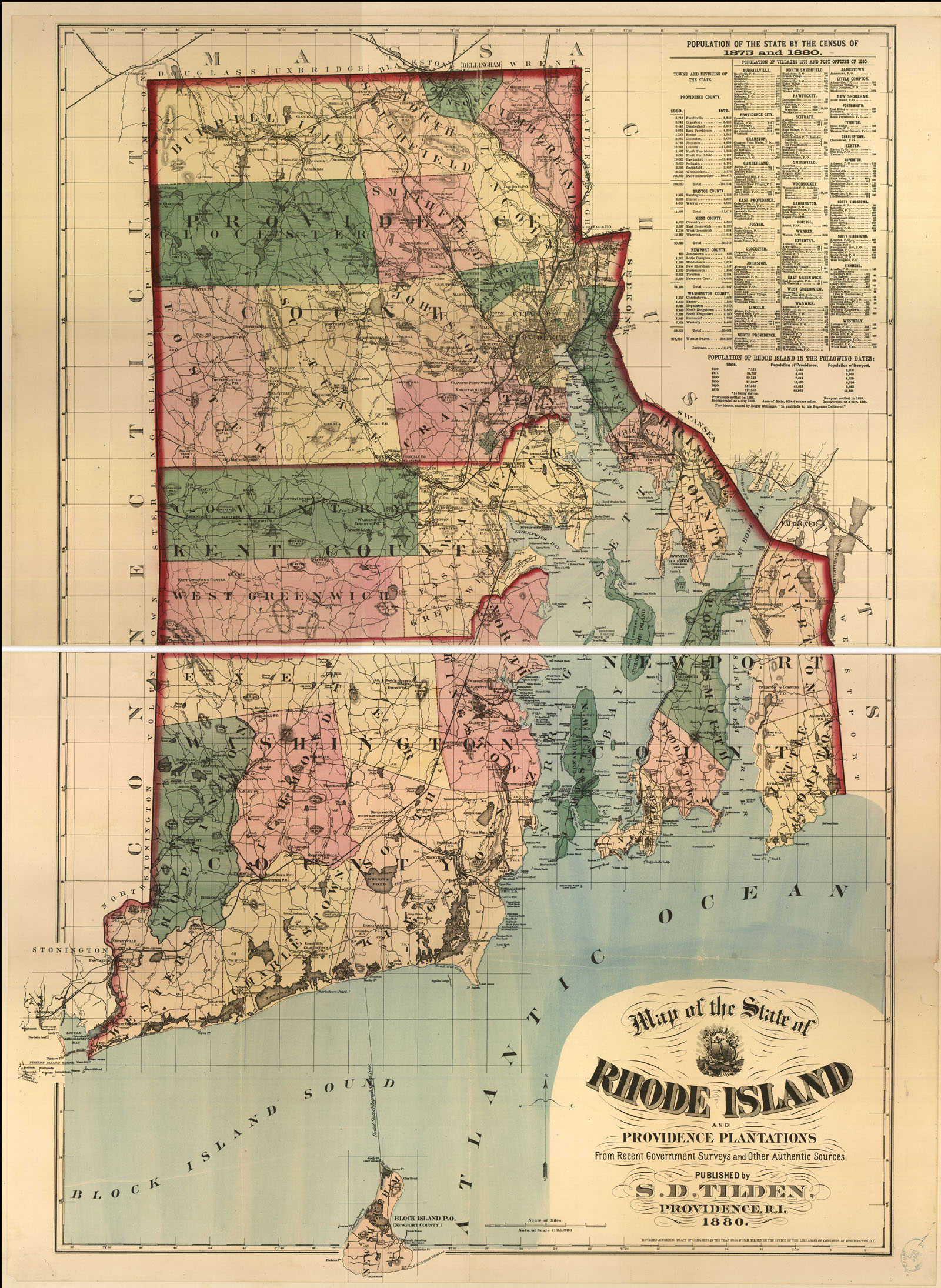
Maps of 19th Century America


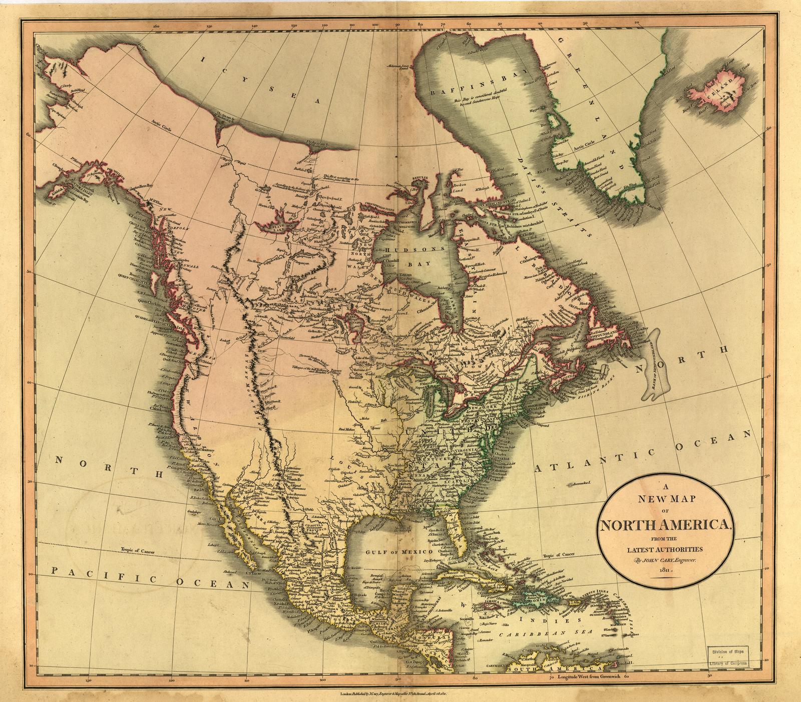
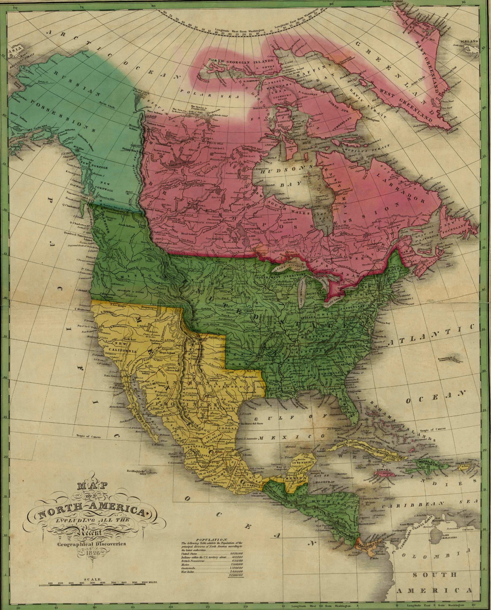
| 1826 Map of North America, by Anthony Finley (see his 1826 South America map), from LC |
|


|
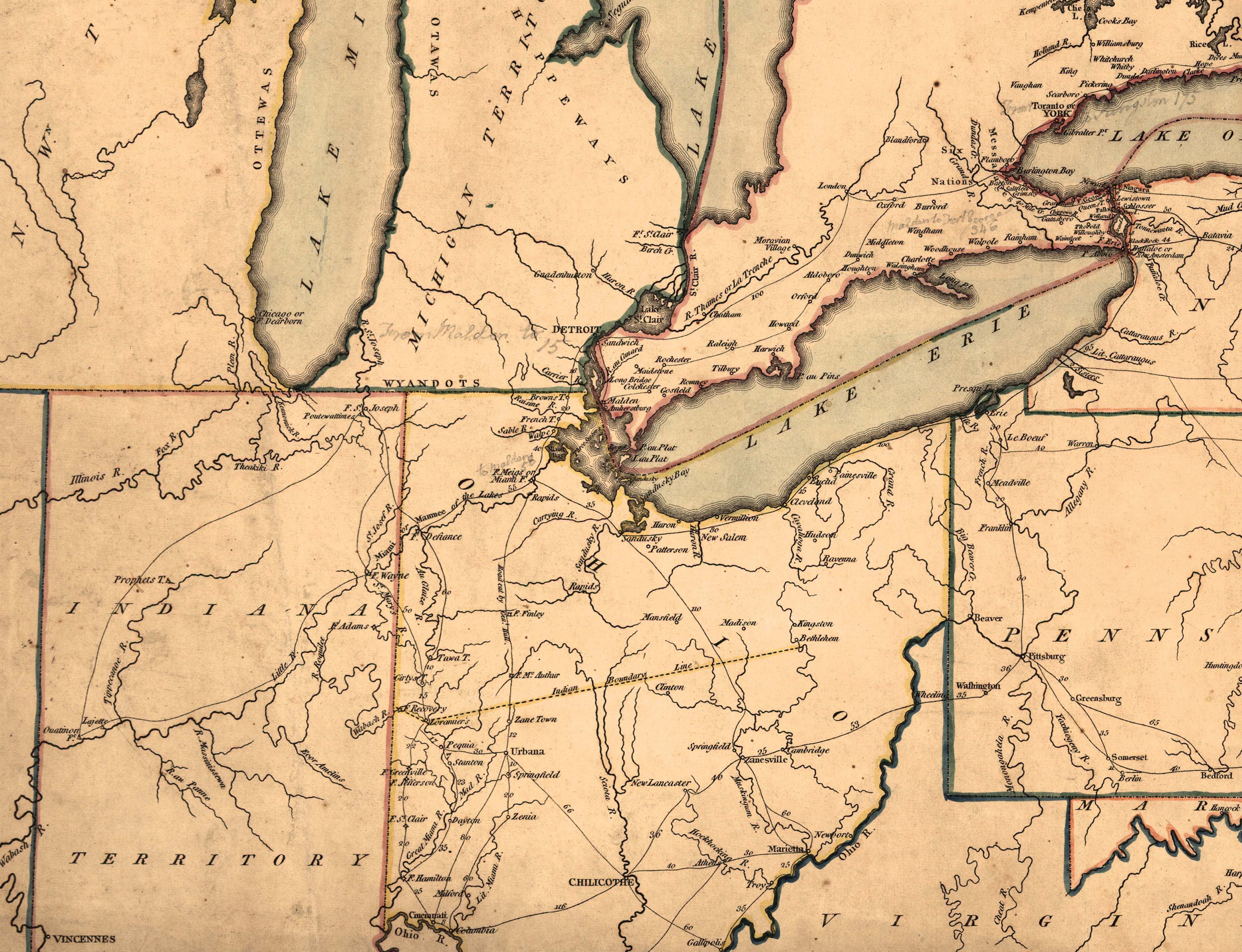
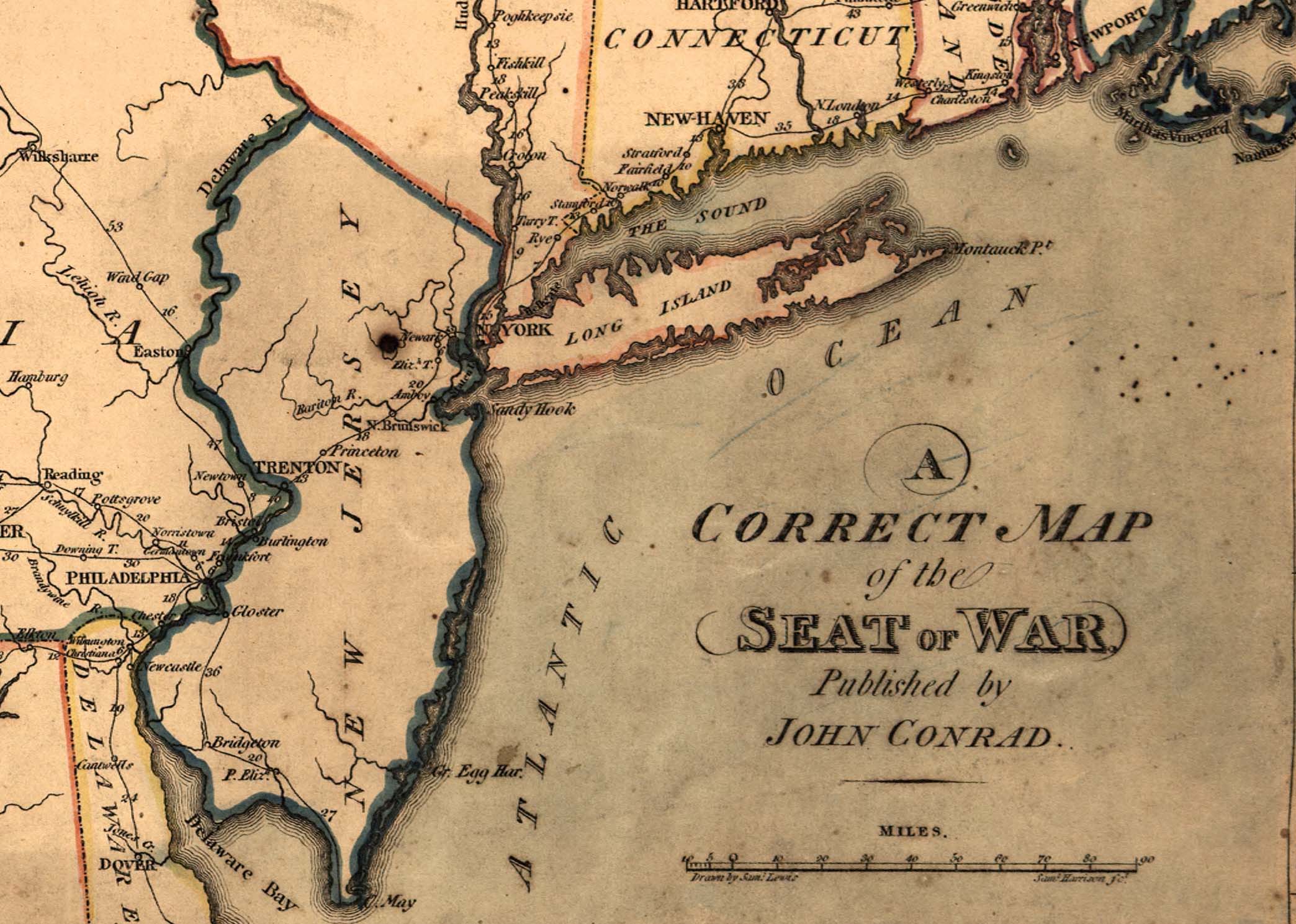
1830 Map of United States. "A map of the United States and part of Louisiana" by Mary Van Schaack. Relief shown pictorially. Pen-and-ink and watercolor. col. ; 41 x 62 cm. DIGITAL ID: g3700 ct000876 URL: http://hdl.loc.gov/loc.gmd/g3700.ct000876 SOURCE:Library of Congress Geography and Map Division Washington, D.C. |
|


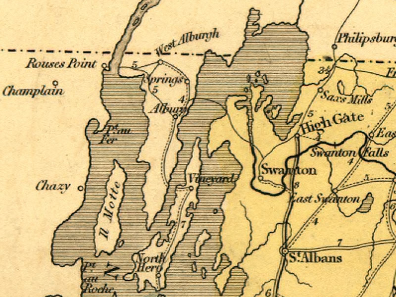
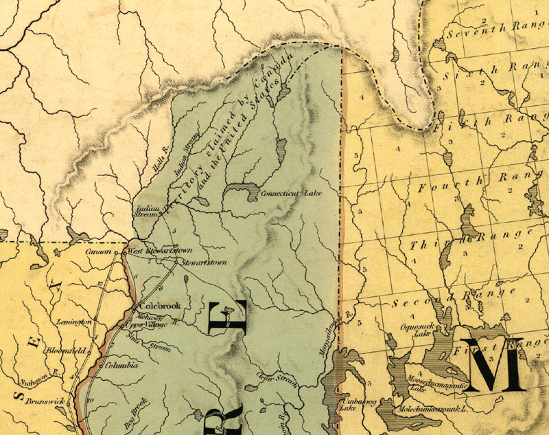
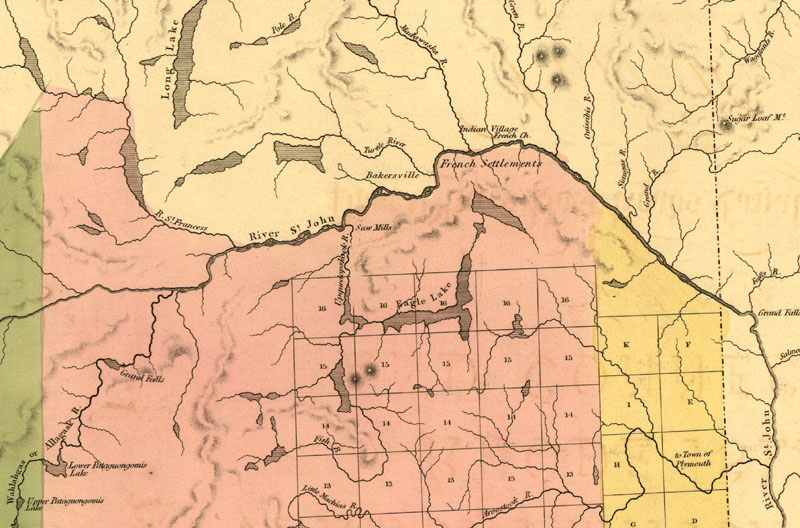
| 1839 Map of New England, from LC |
|


|
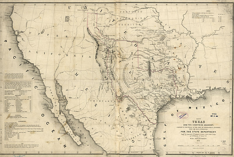
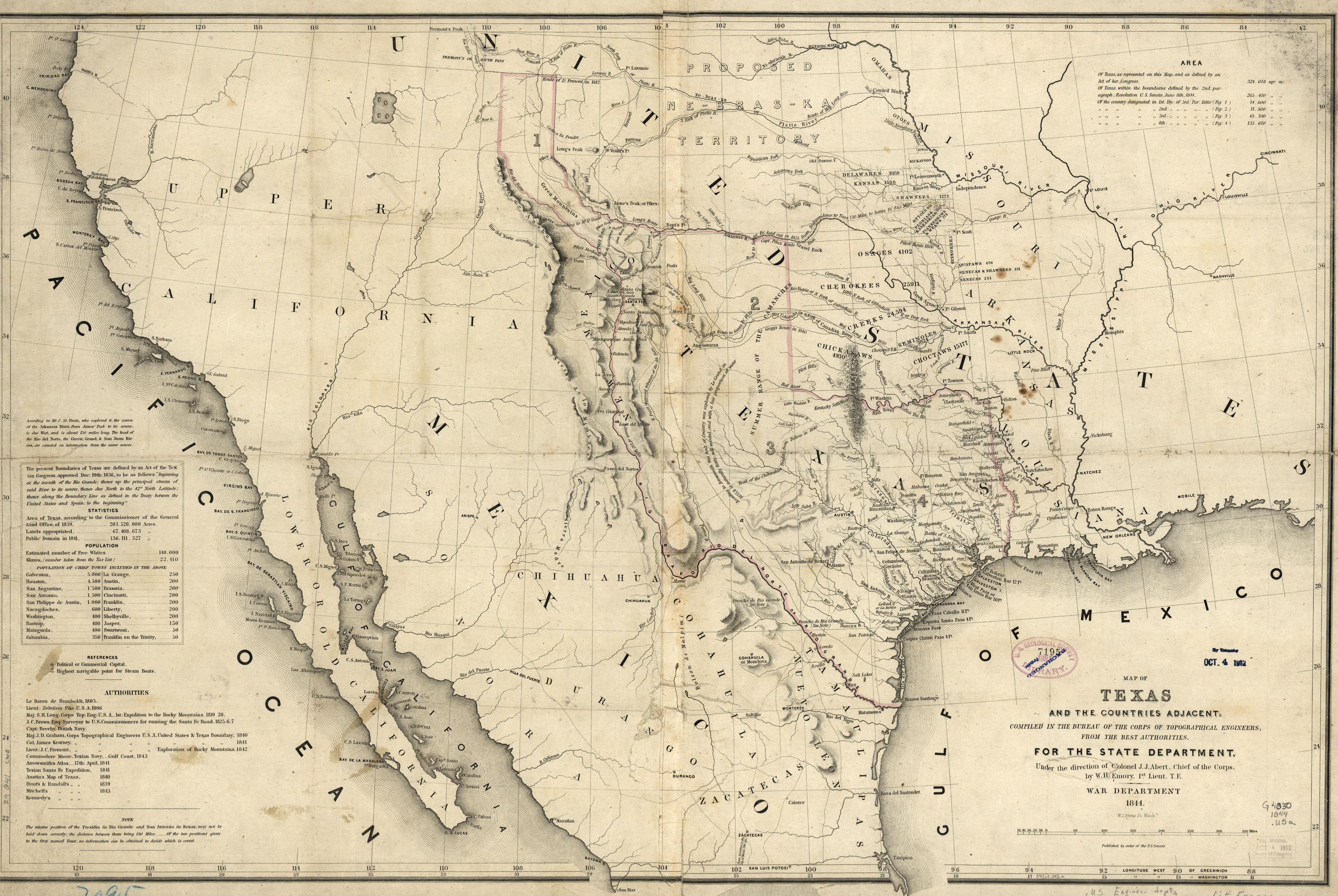
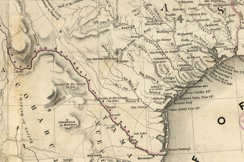
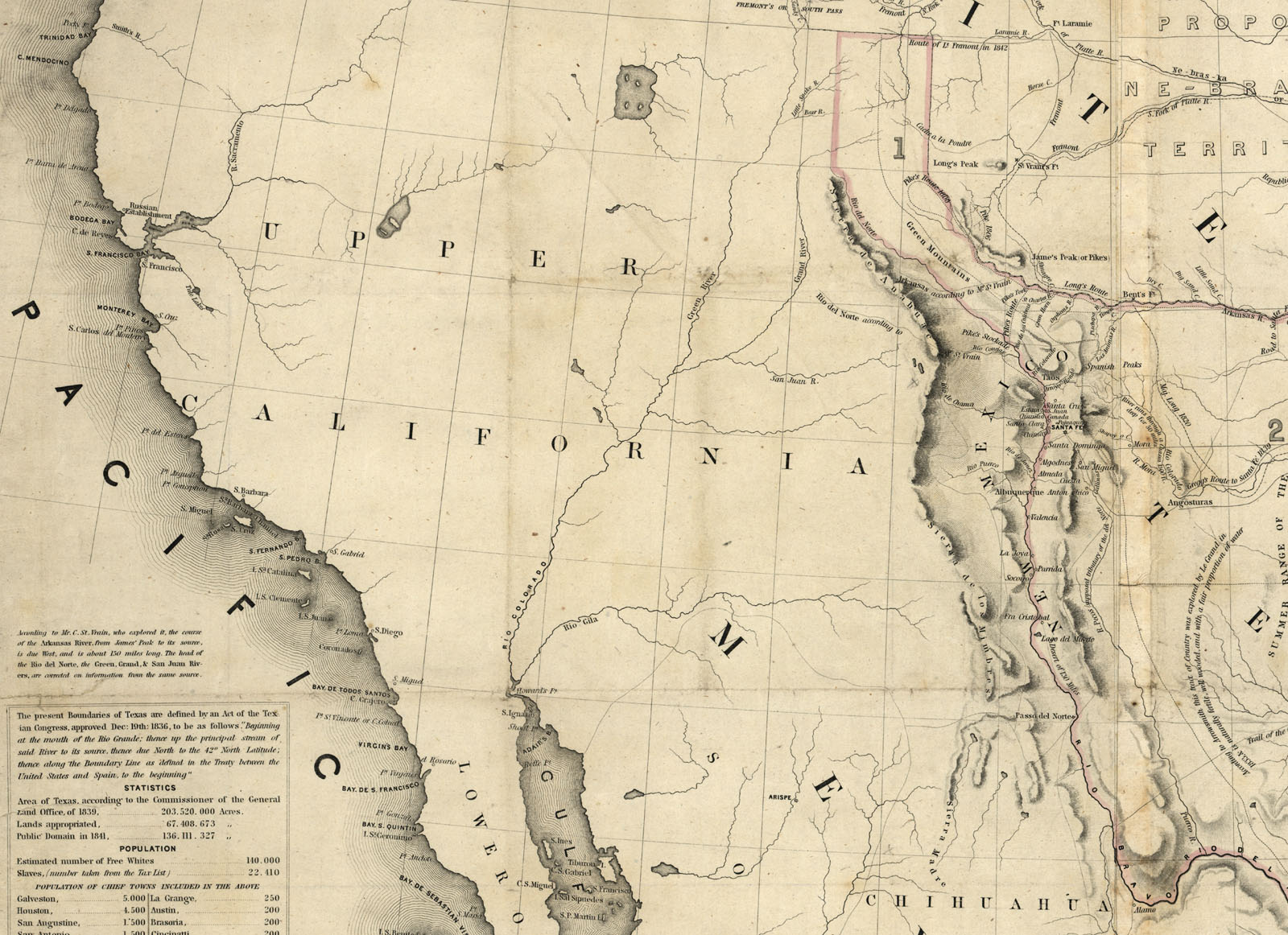
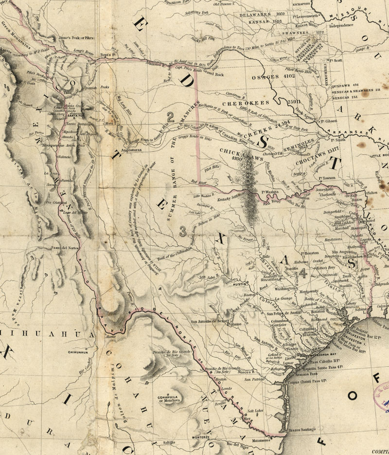
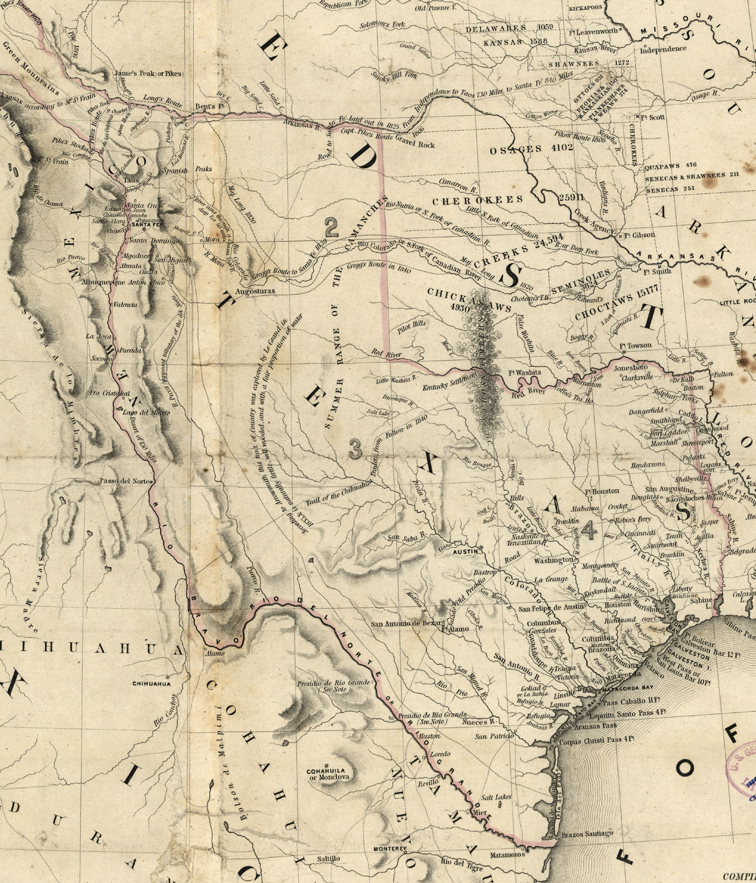
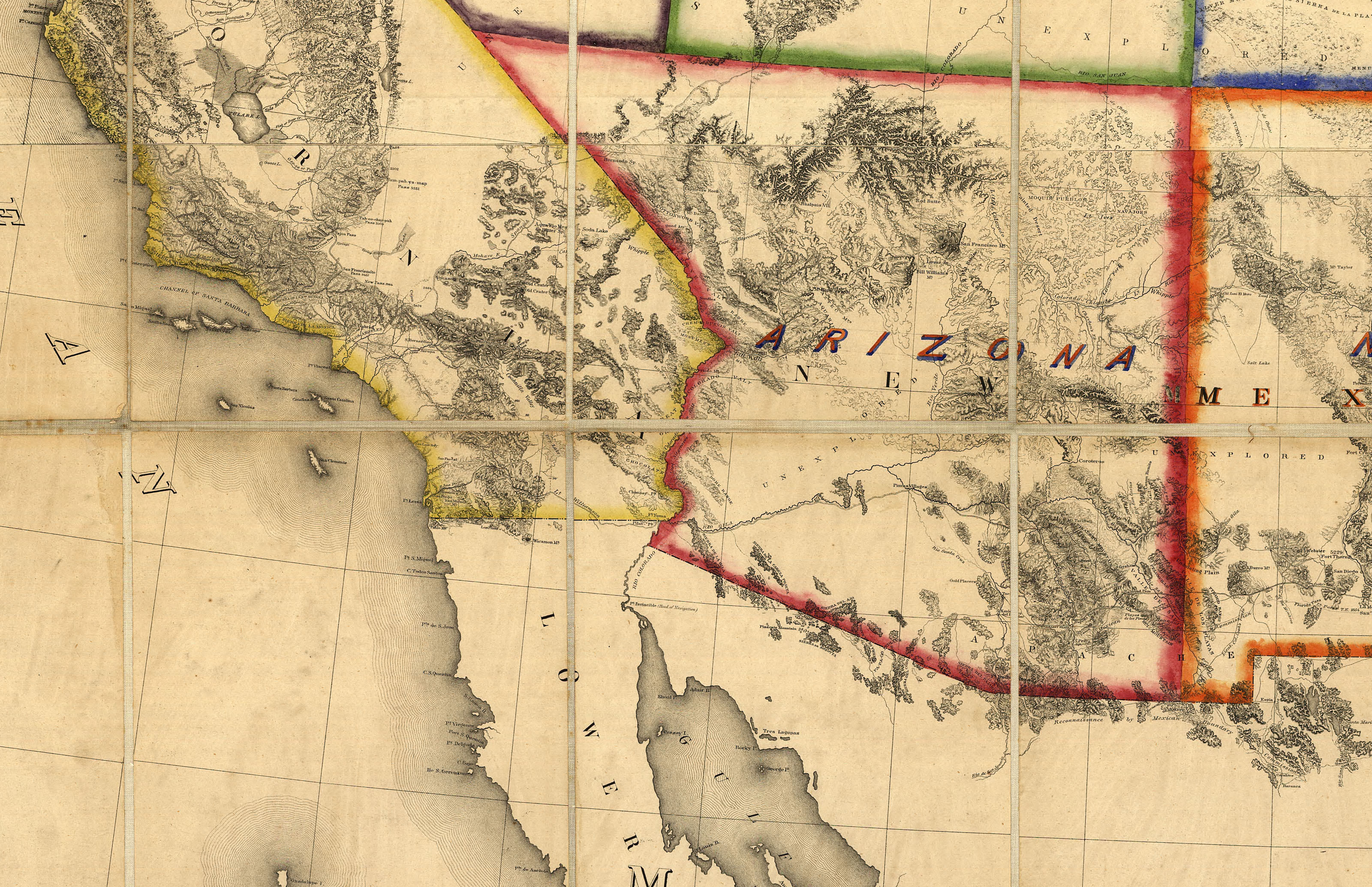
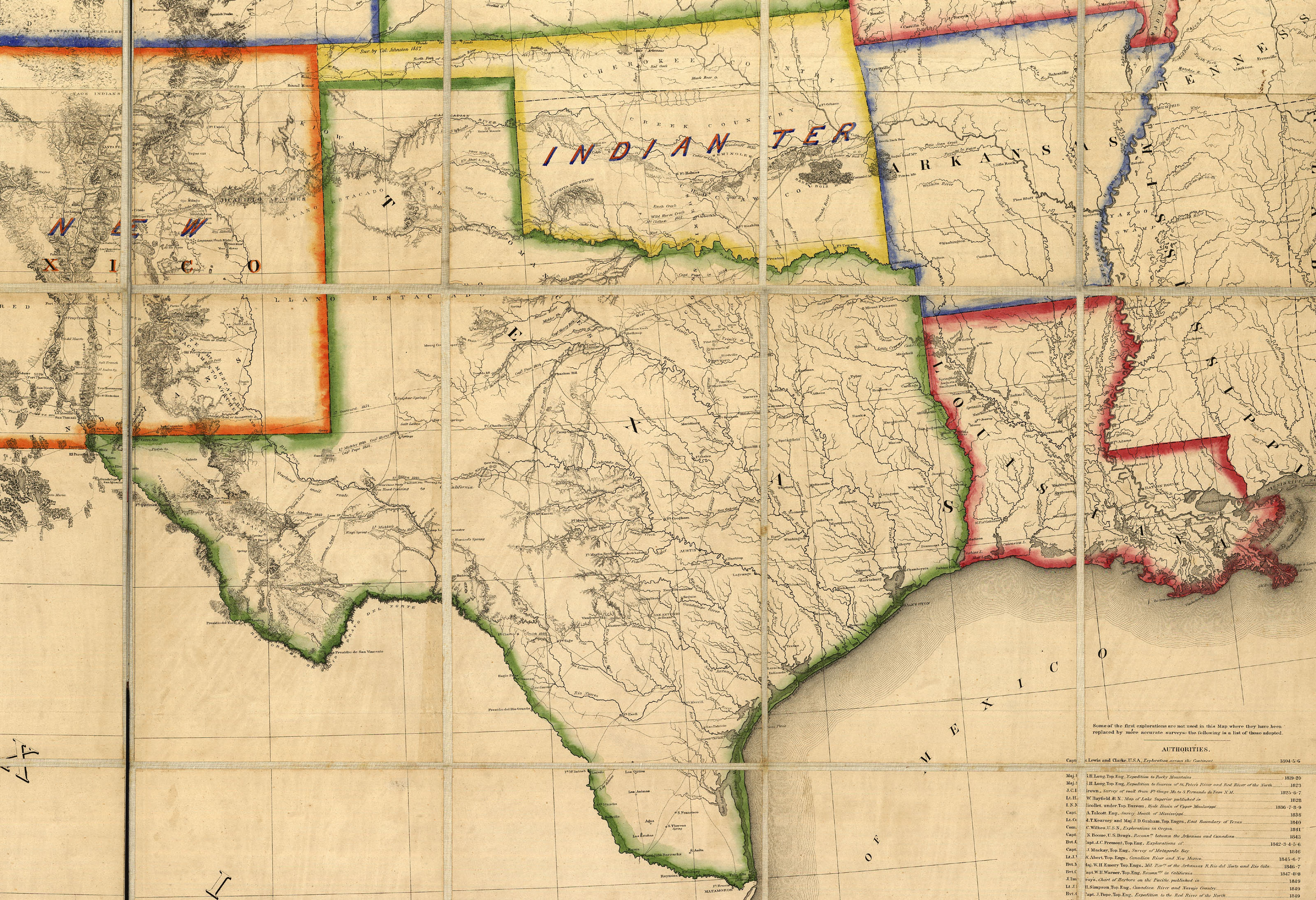
1844 Map of Texas "and the counties adjacent, compiled in the Bureau of the Topographical Engineers from the best authorities, for the State Department. Published by order of the U.S. Senate." Hand colored, 54 x 82 cm., under the direction of Col. J., J. Albert, Chief of the Corps, by Lt. William H. Emory, United States War Department. DIGITAL ID: g4030 ct001066 URL: http://hdl.loc.gov/loc.gmd/g4030.ct001066 SOURCE: Library of Congress Geography and Map Division Washington, D.C. |
|


|
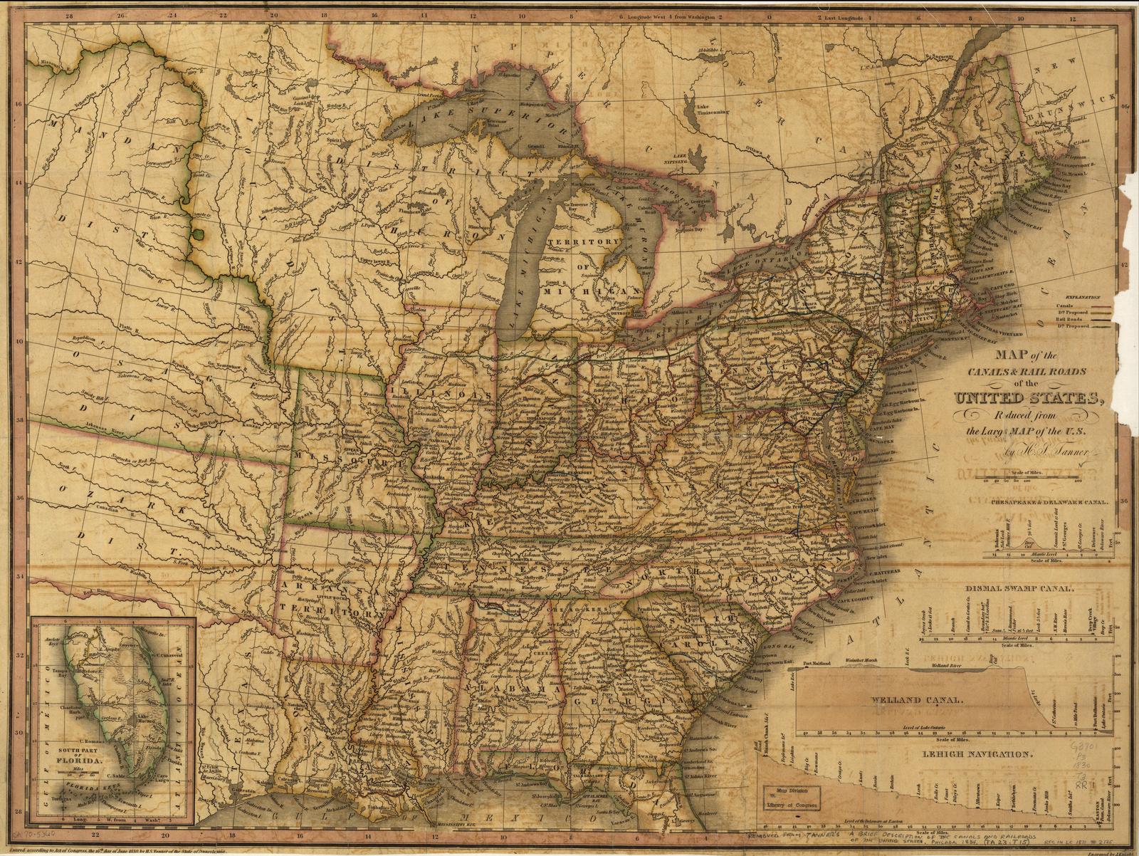
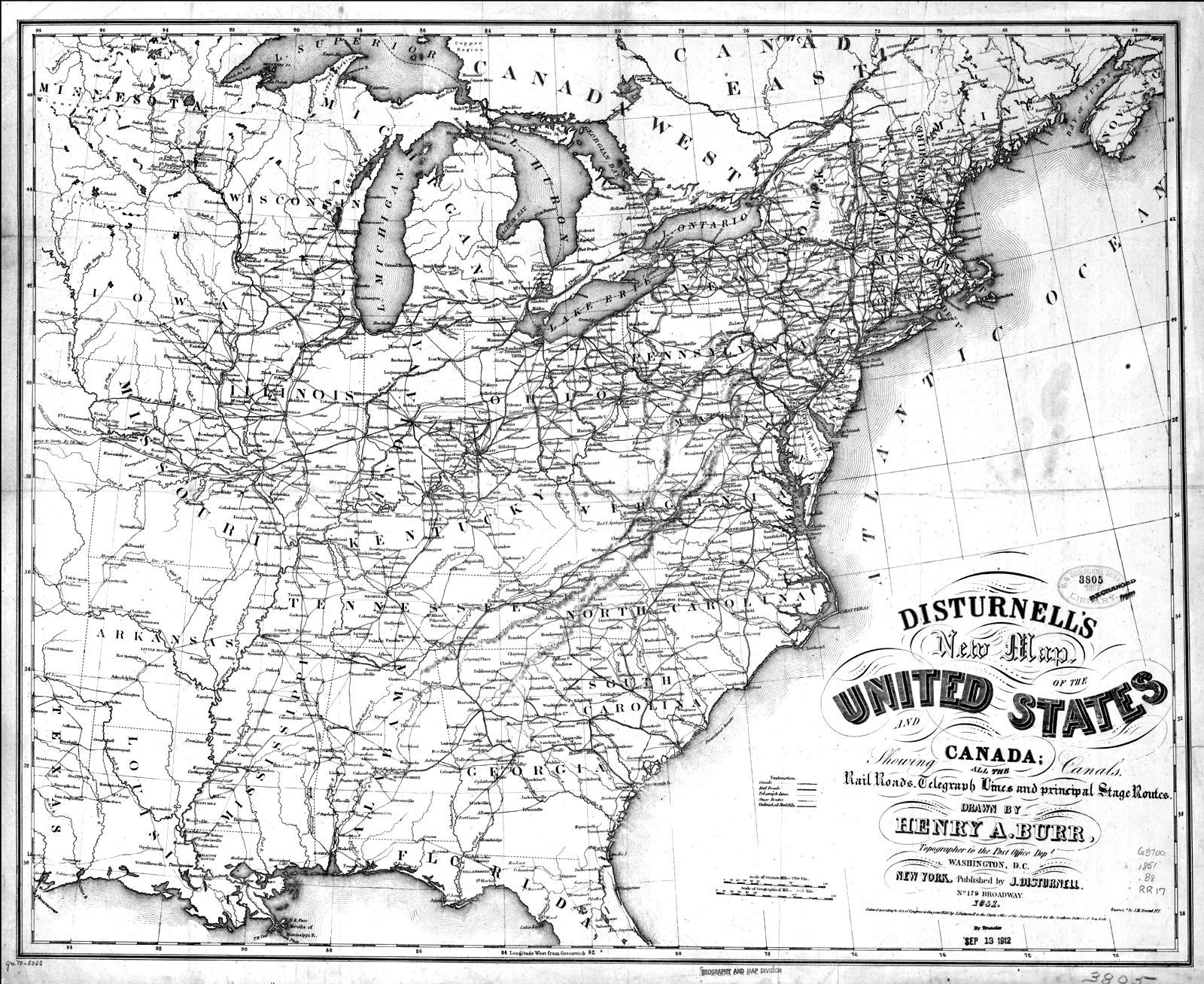
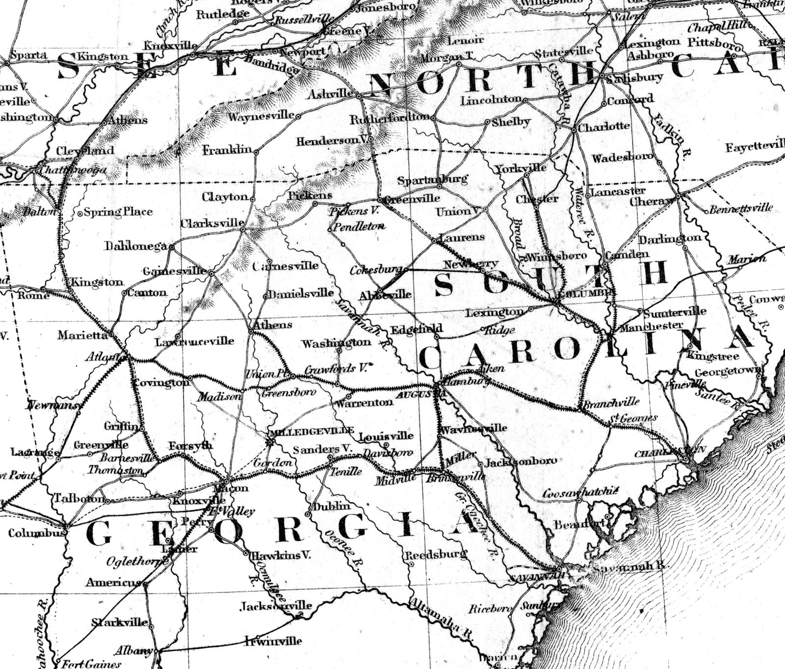
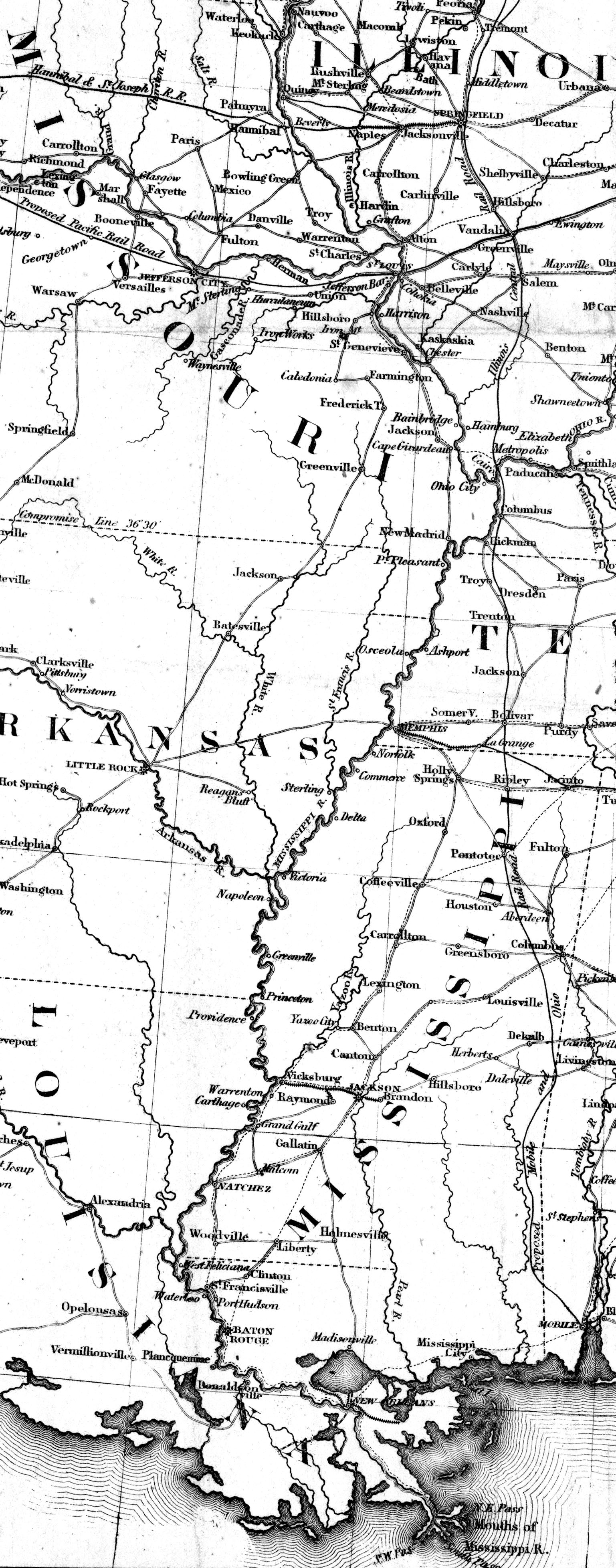
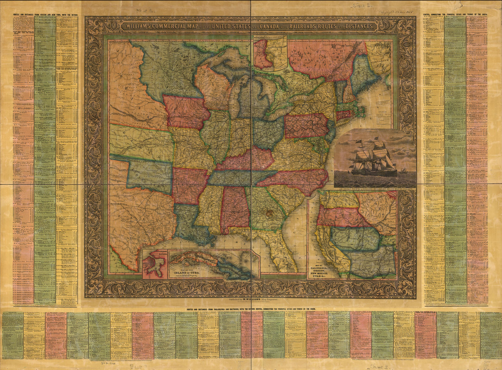
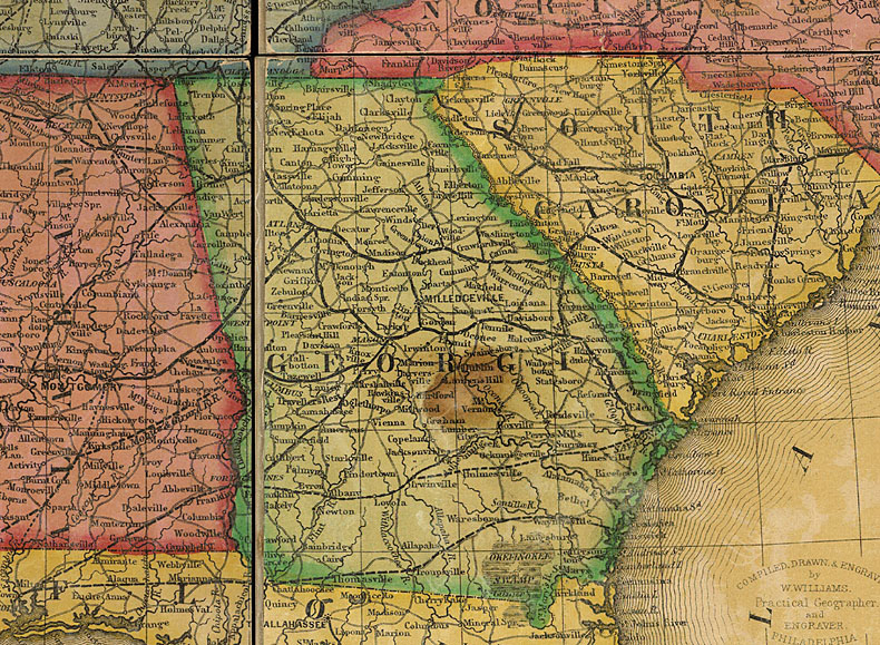
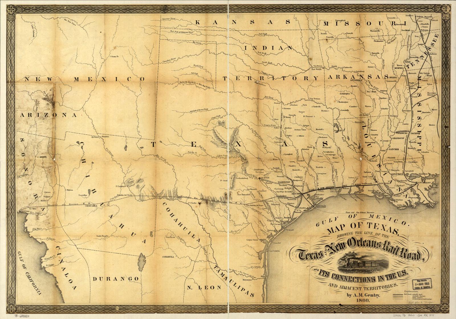
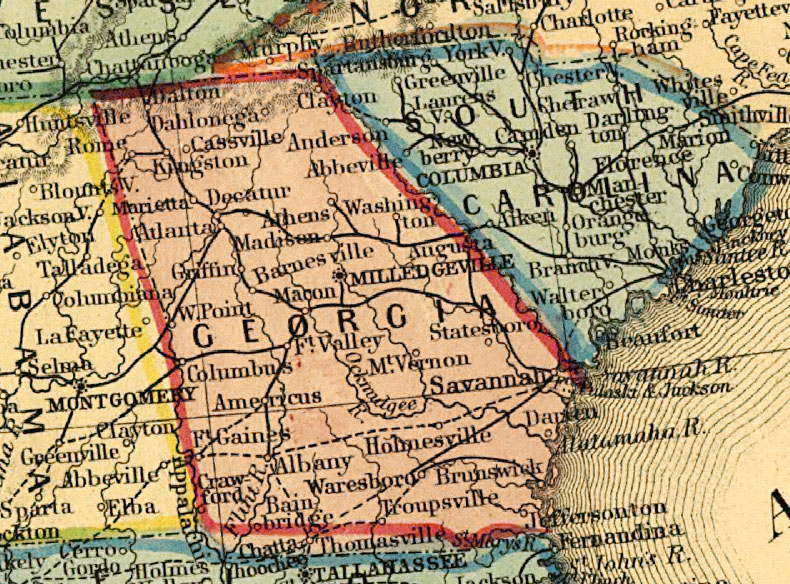
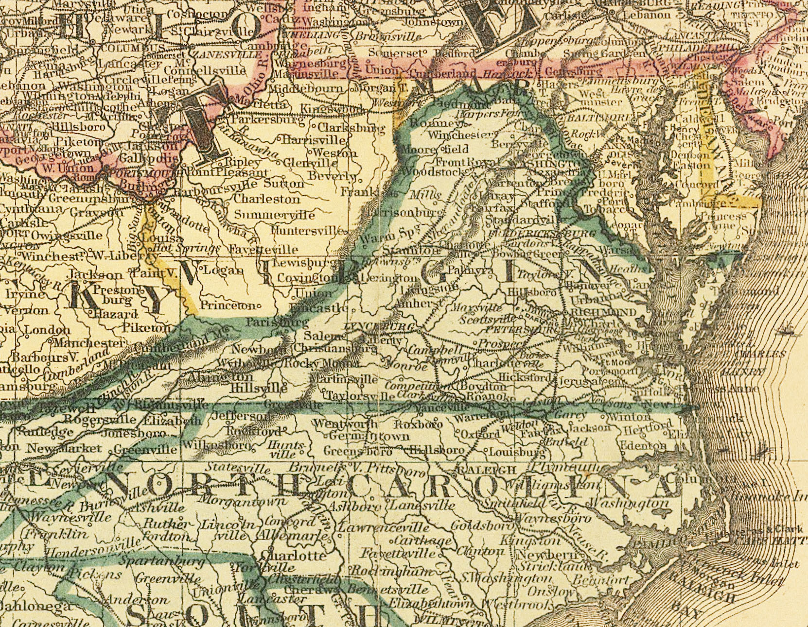
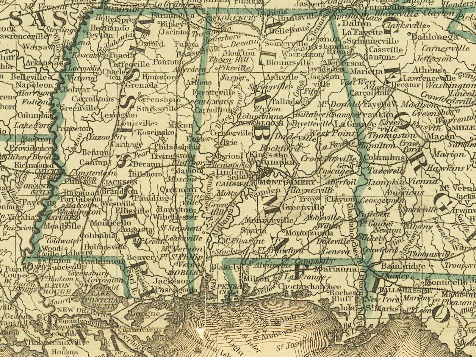
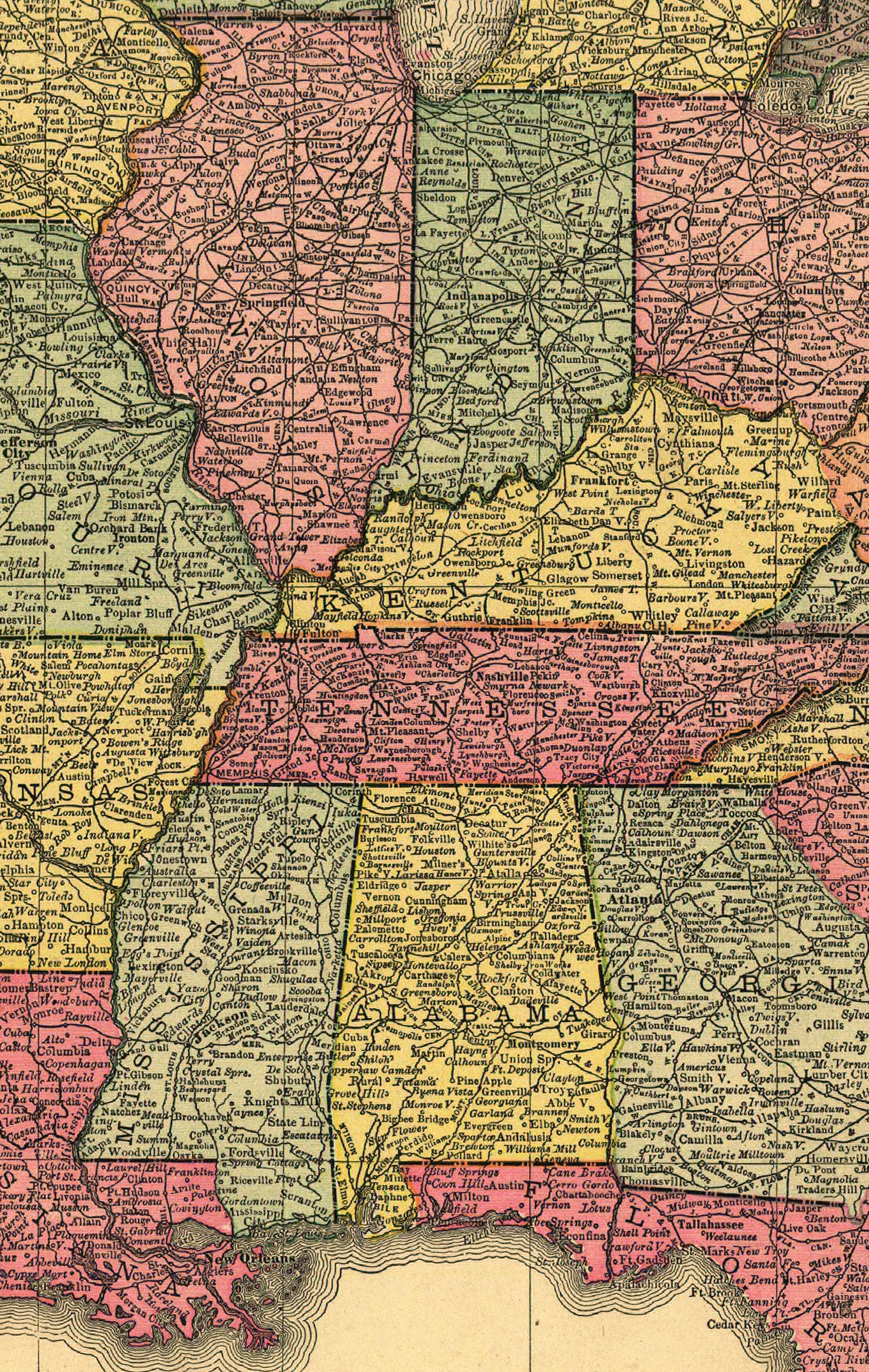
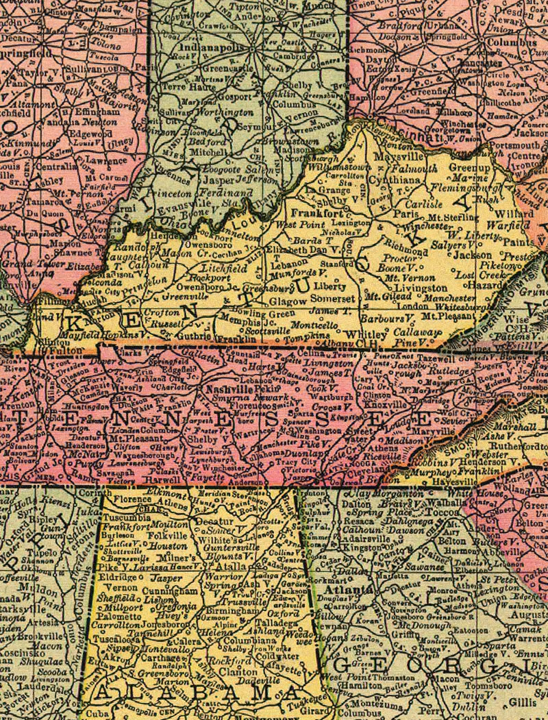
1855 U. S. by Williams. "Commercial map of the United States and Canada with railroads, routes, and distances, by Wellington Williams, Philadelphia, 1855. Includes list of distances between major cities. Insets: City & harbor of Havana. Map of the Island of Cuba. Map of the Niagara River and Falls. Map of California, Oregon, New Mexico, Utah. Summary: Detailed general map of the eastern half of the United States framed in decorative borders indicating drainage, cities and towns, canals, roads, the railroad network, and indicating the proposed railroad routes to the Pacific Ocean. Railroads in progress are indicated by dashed lines. [From published bibliography, LC Railroad maps, 29] col. map 72 x 84 cm. on 4 sheets 47 x 64 cm. DIGITAL ID: g3701p rr000290 URL: http://hdl.loc.gov/loc.gmd/g3701p.rr000290 SOURCE: Library of Congress Geography and Map Division Washington, D.C. |
|


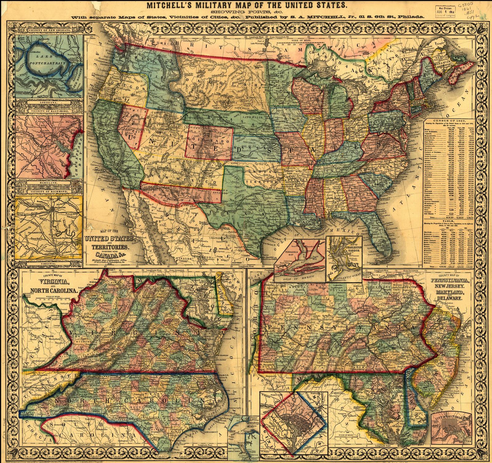
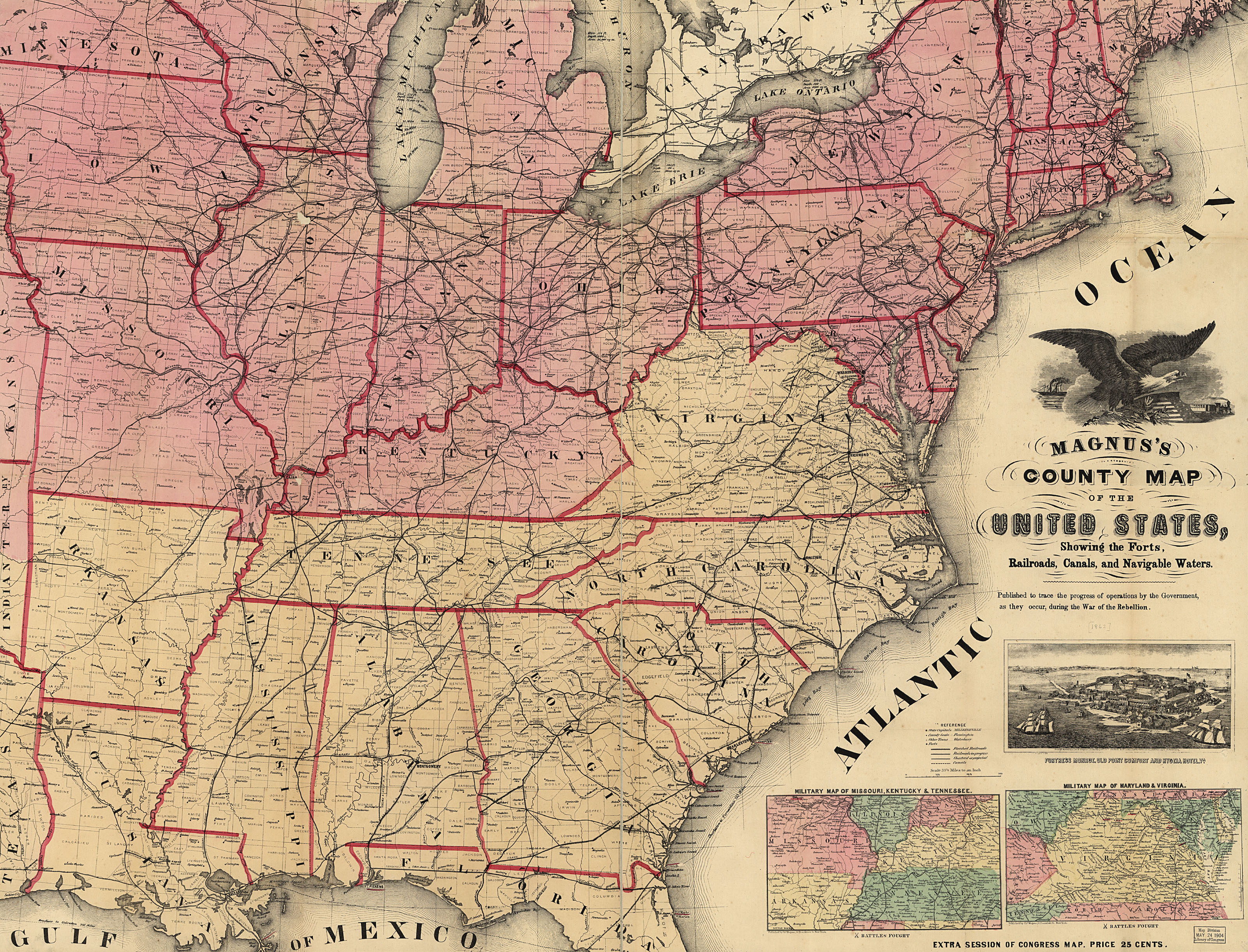
| 1862 Map of U. S. by Colton, from LC |
|


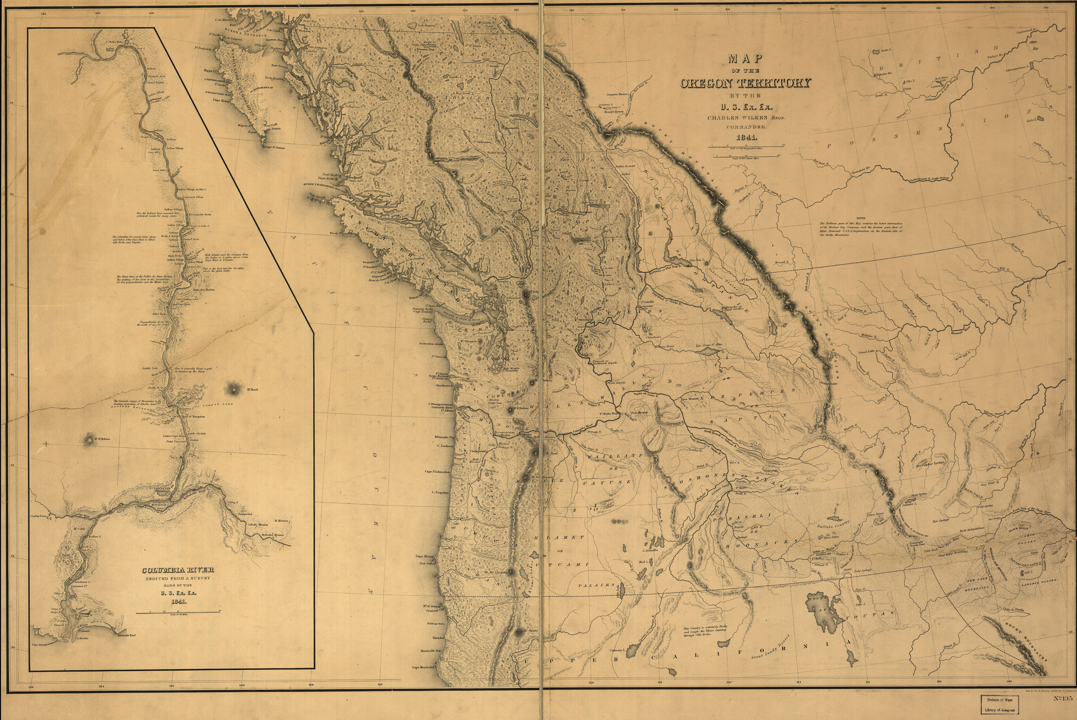
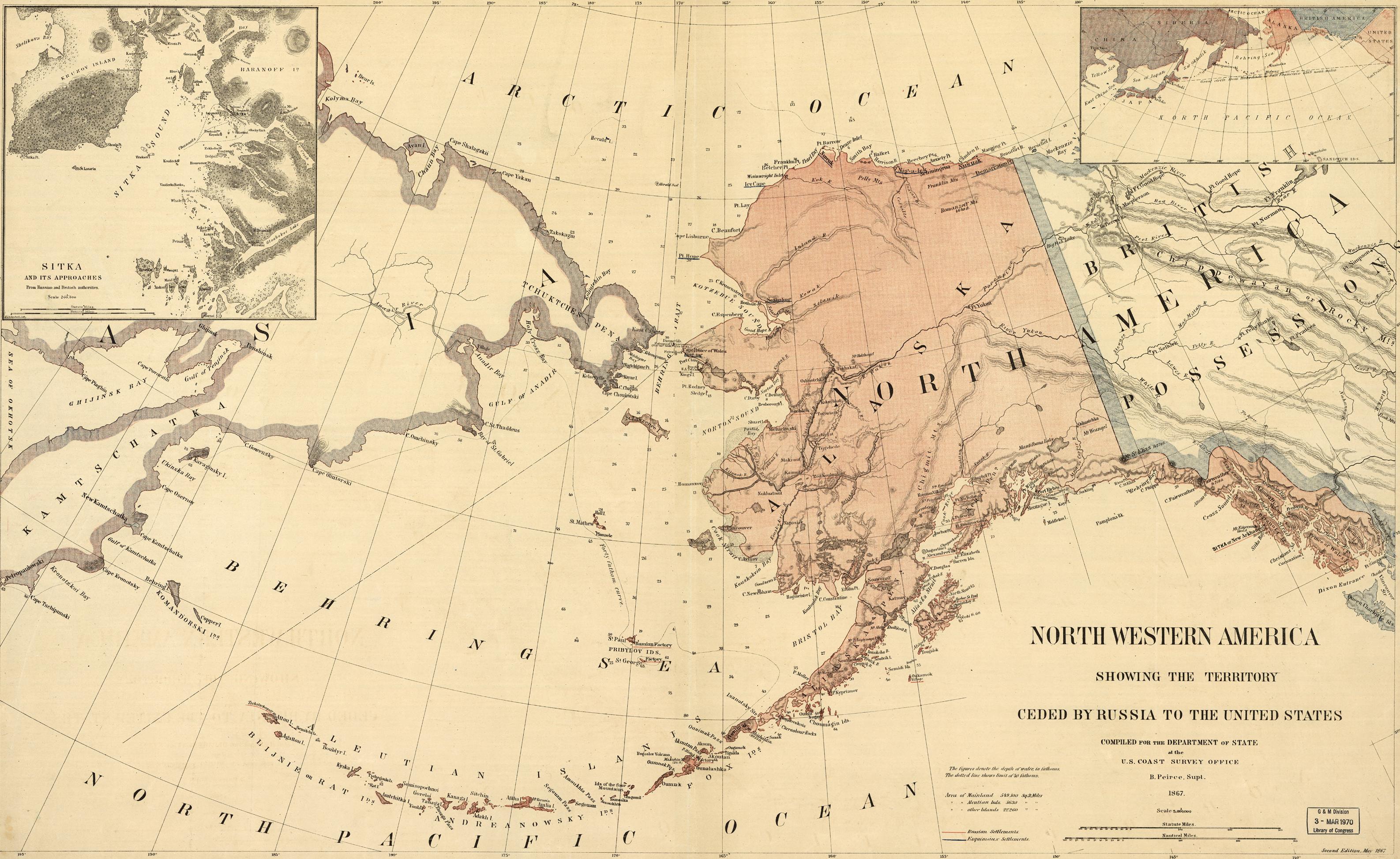
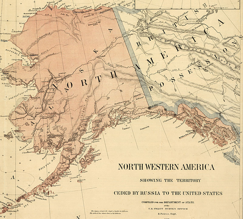
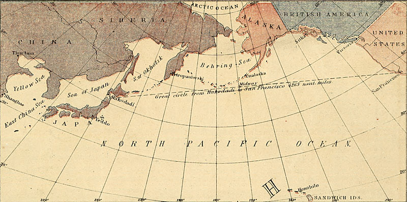
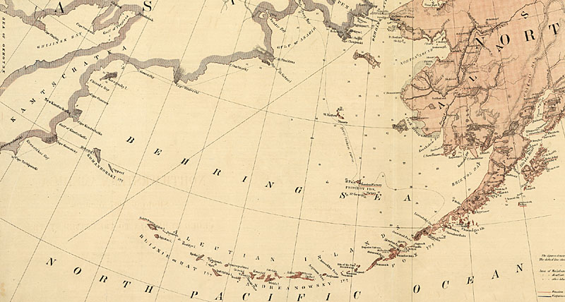
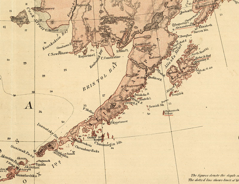
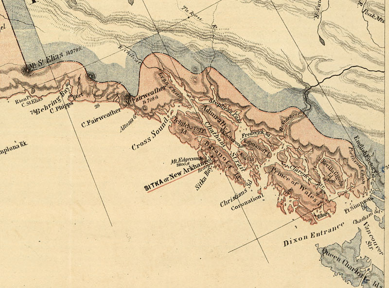
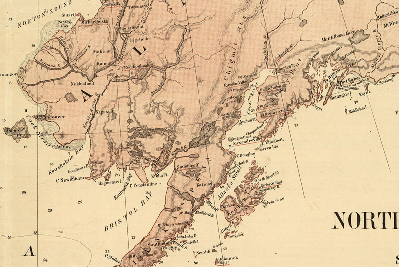
| 1867 Geodetic Map of Alaska and North Pacific, from LC |
|


revised 8/18/04 by Schoenherr | Map list