 |
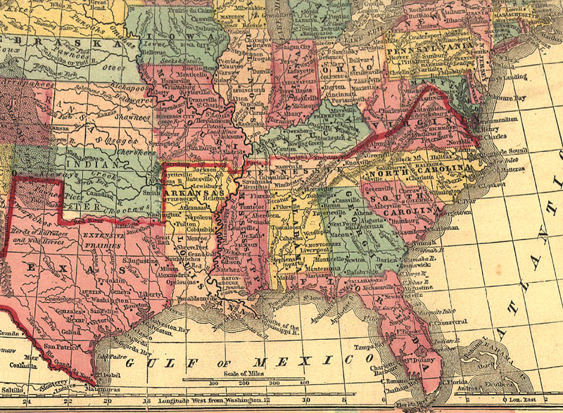
1861 Mitchell or South or Georgia from LC
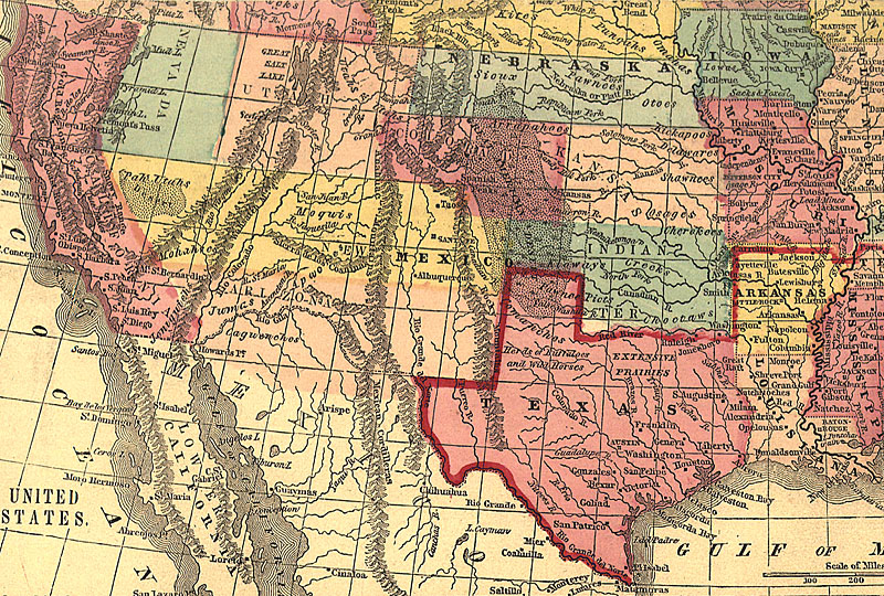
1861 Ettling and bg and west and west bg and southwest and Texas and Texas bg
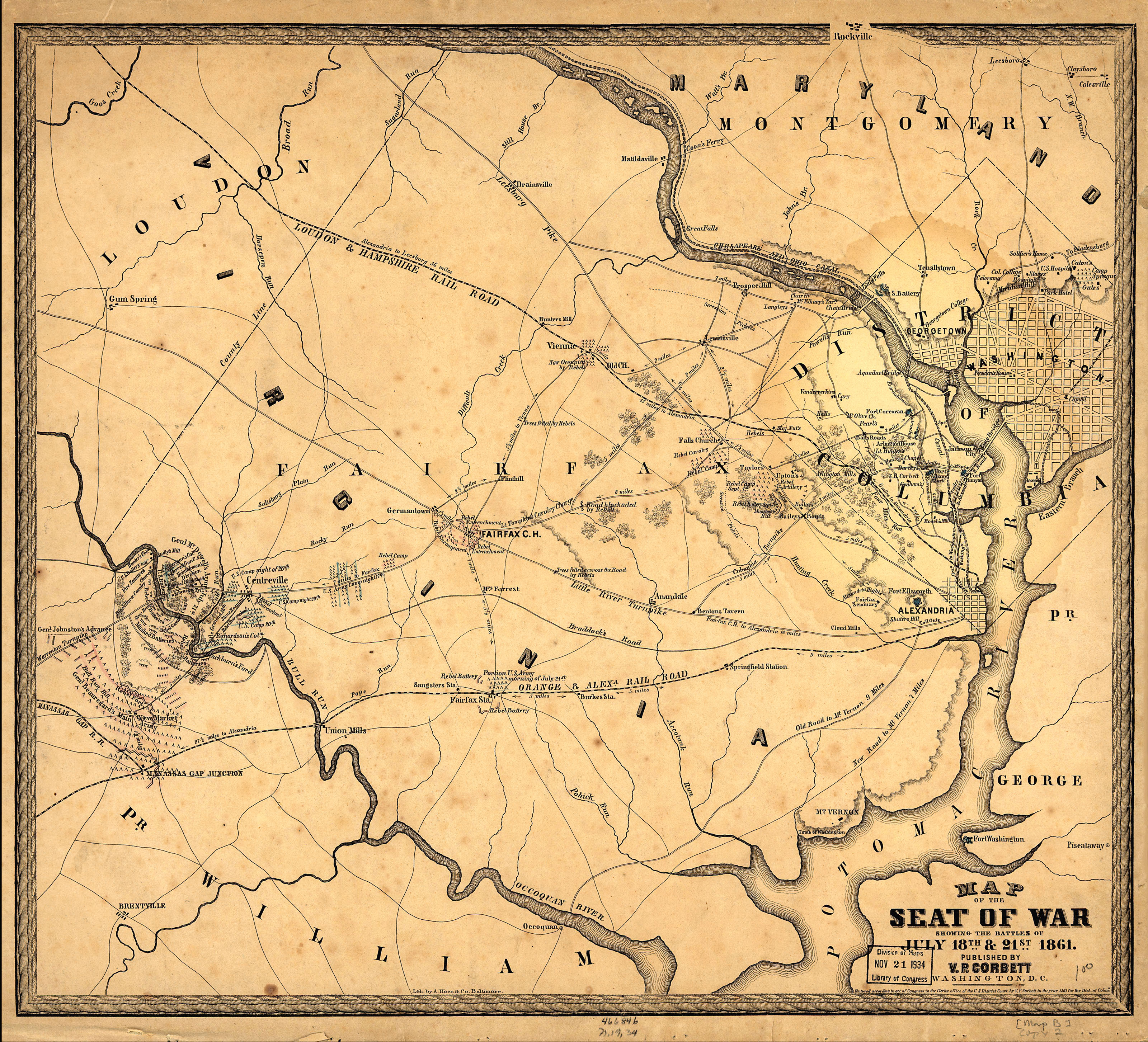
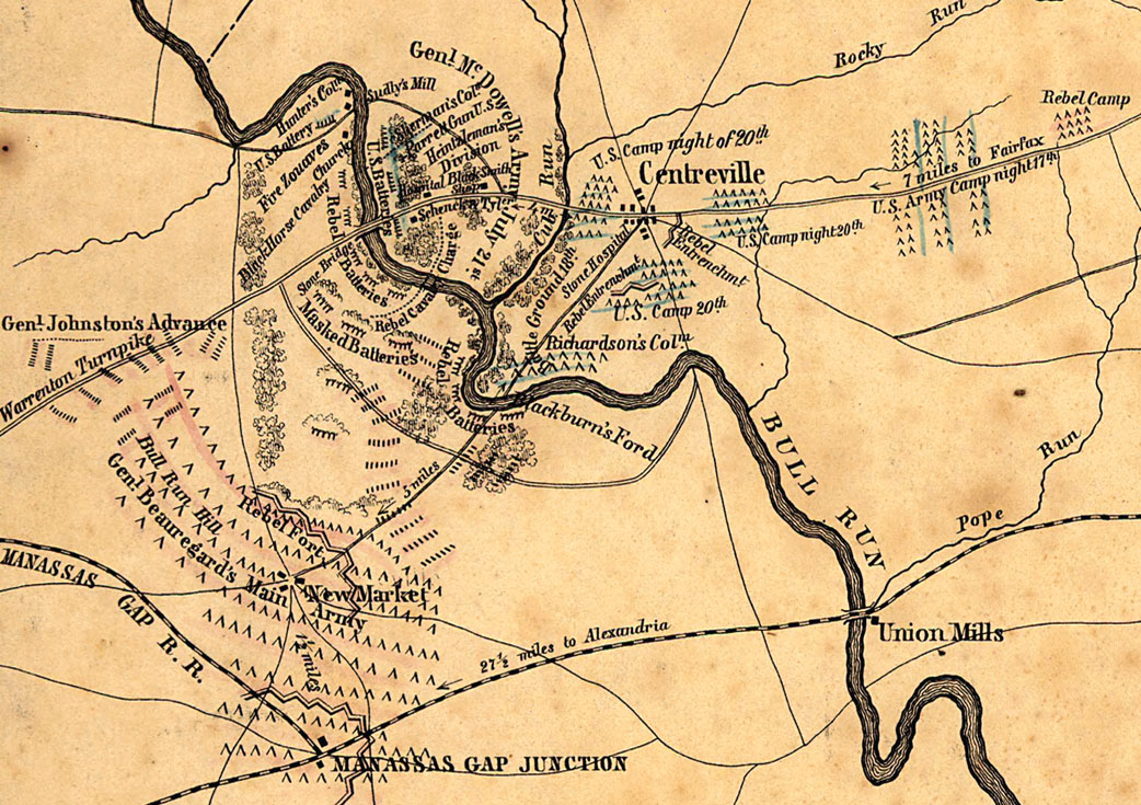
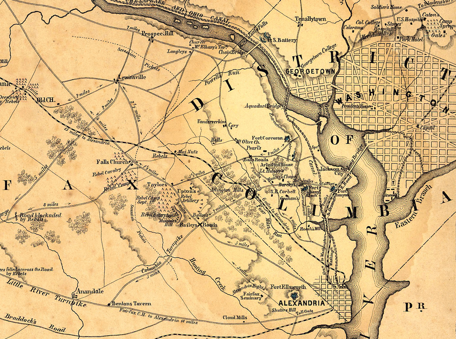
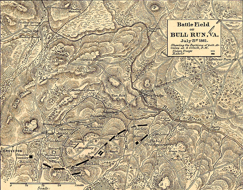
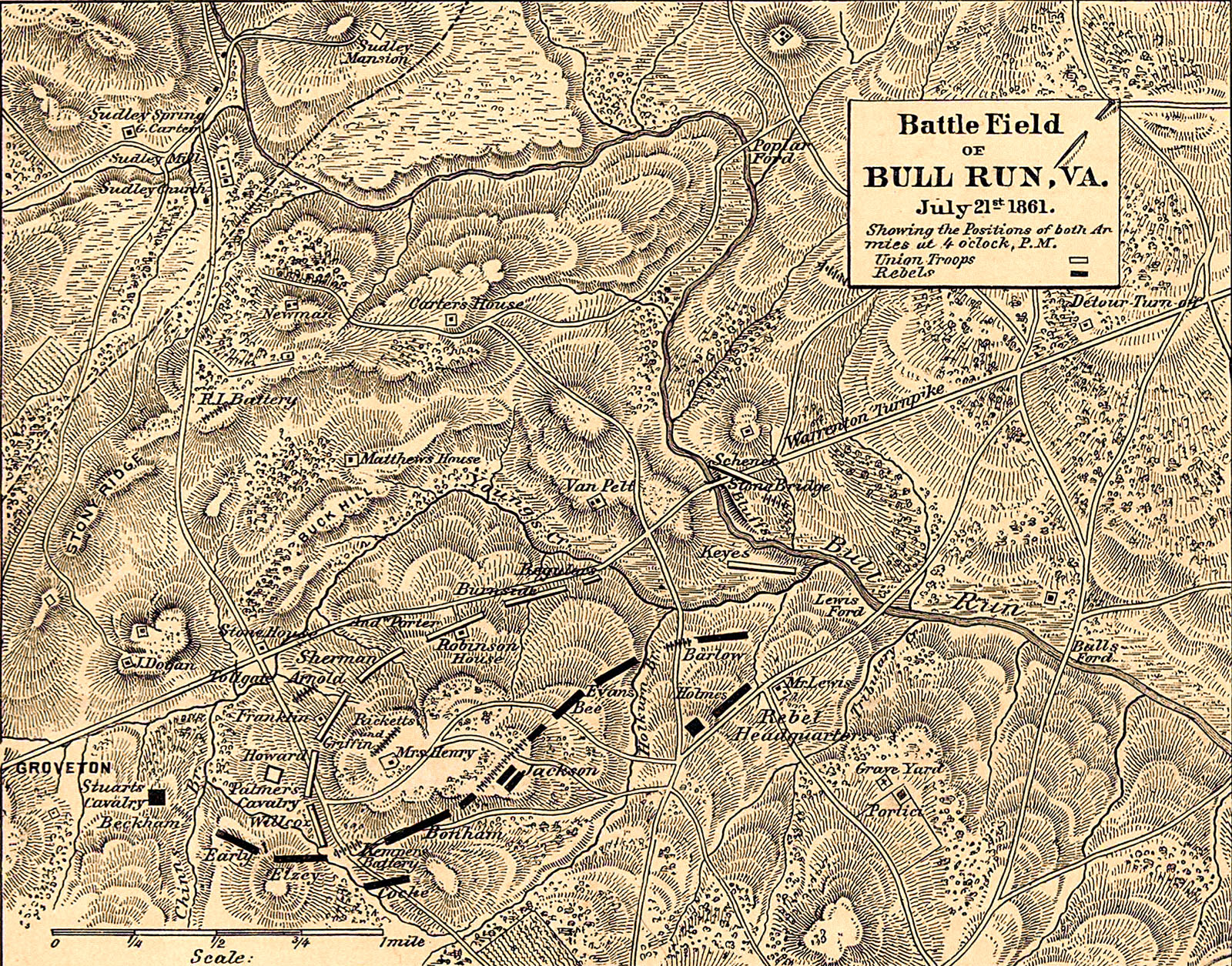
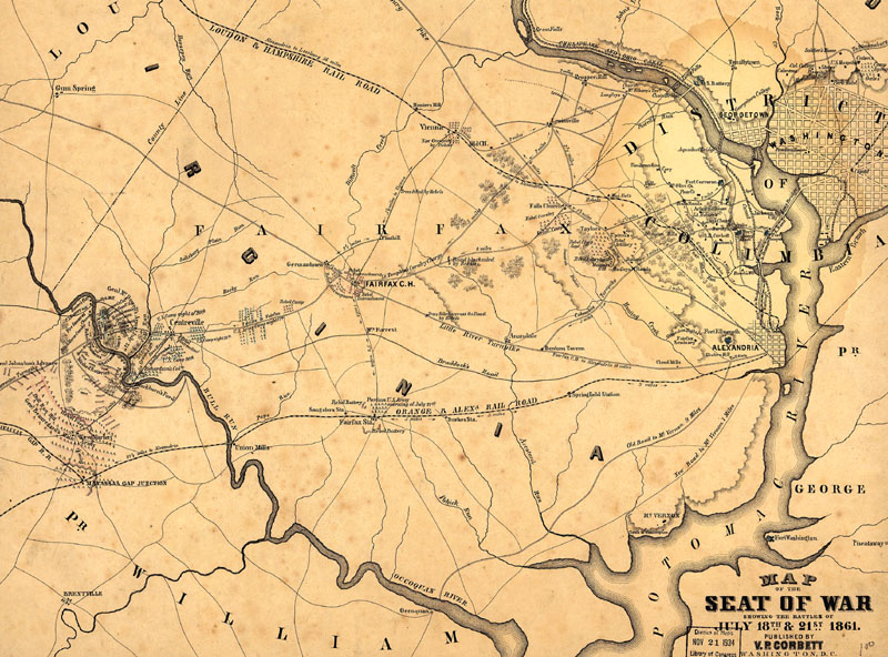
First Manassas 1861 bg cu1 cu2
First Manassas 1861 topographic bg
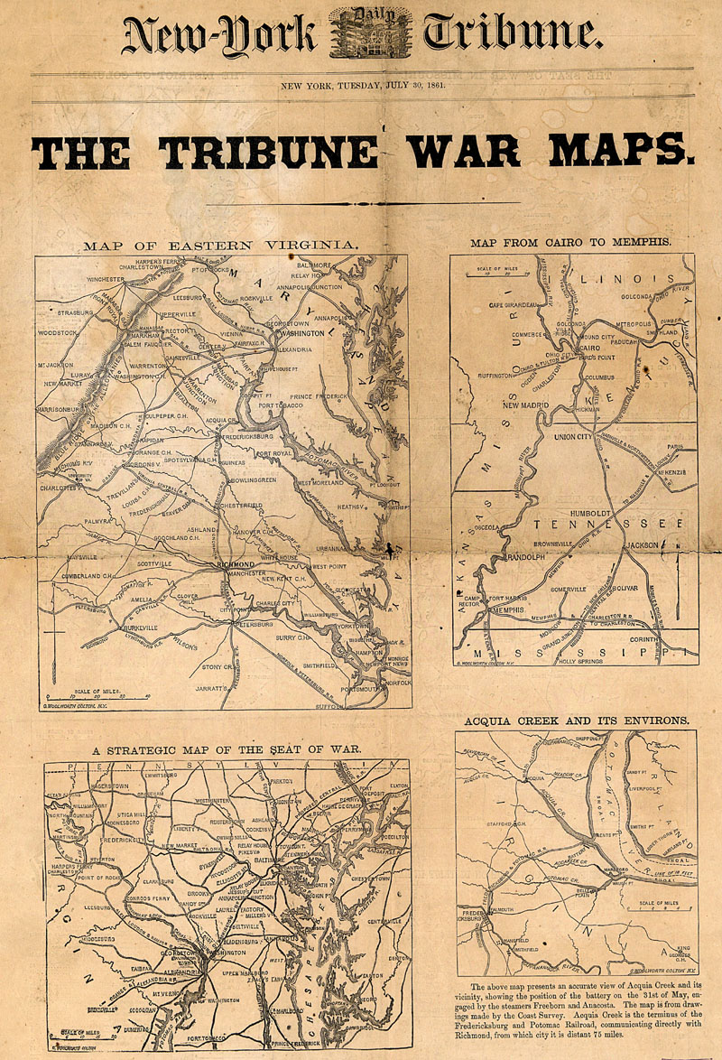
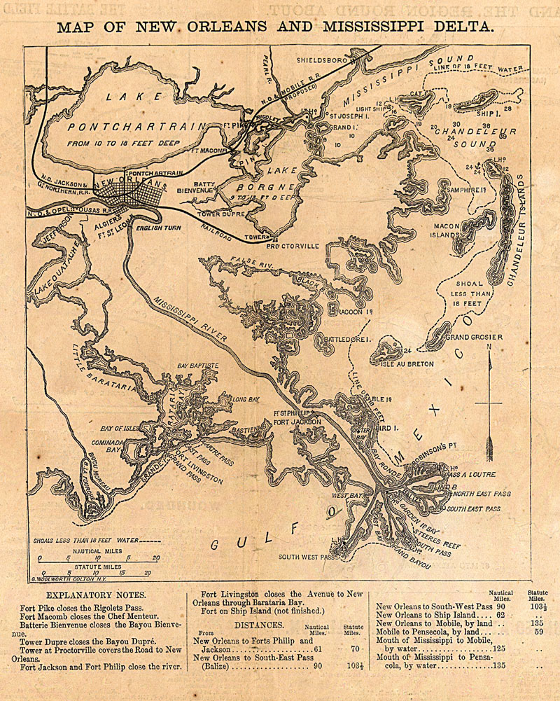
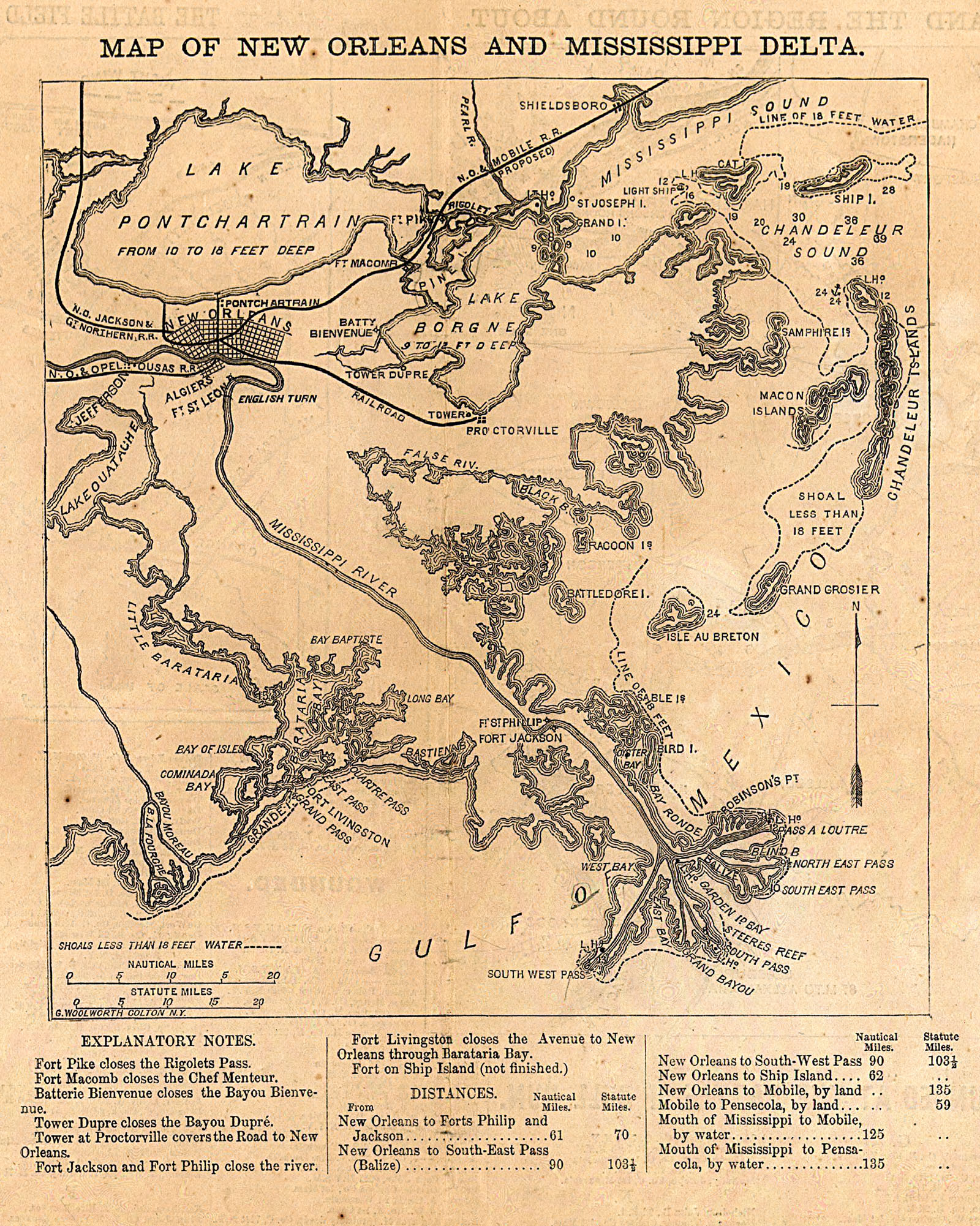
Tribune war maps cu1 and bg - cu2 and bg - cu3 and bg - cu4 and bg - cu5 and bg - cu6 and bg
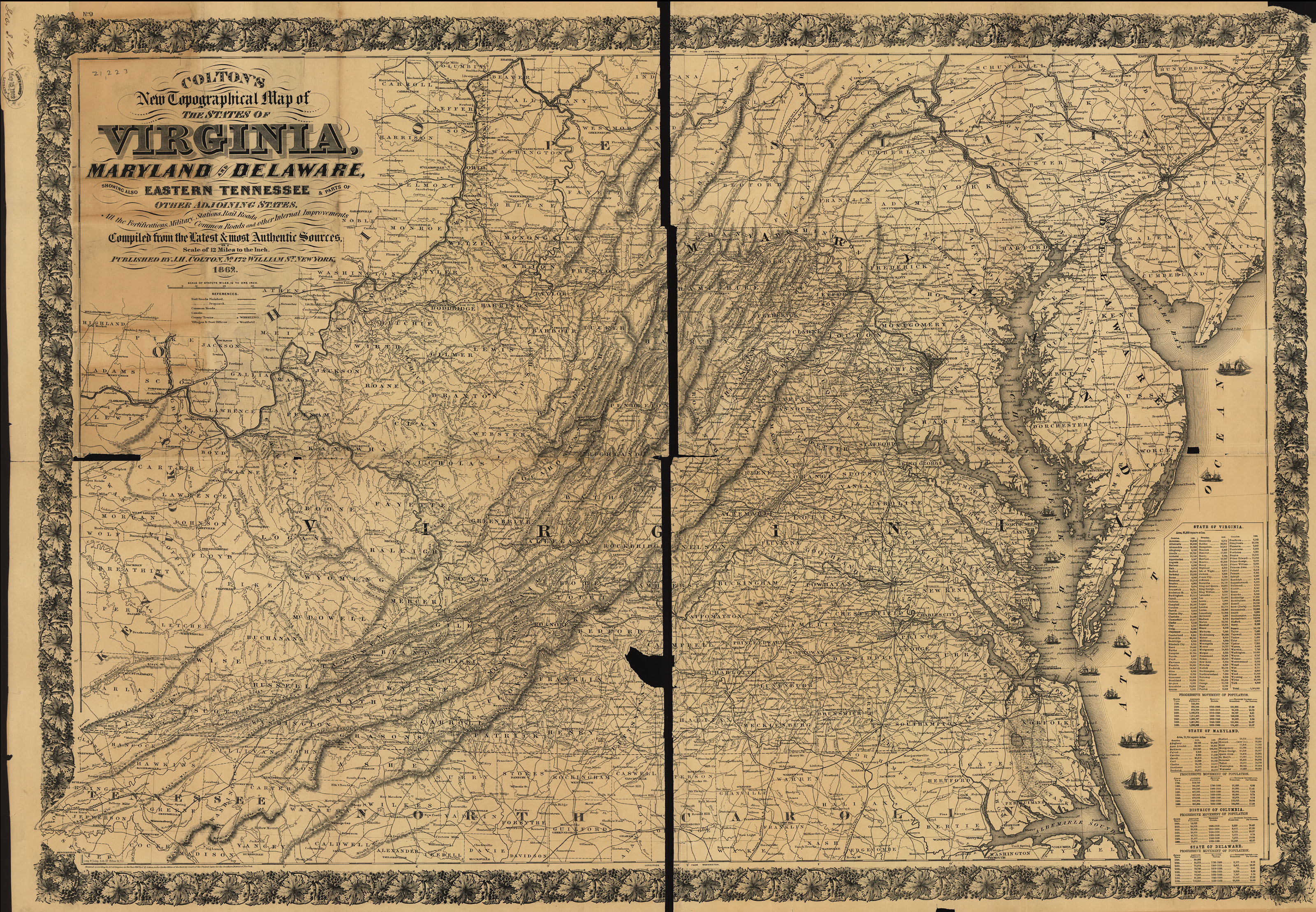
1862 Colton and bg and east and bg and DC and bg and south and bg and west and bg and southwest and bg and Texas and bg
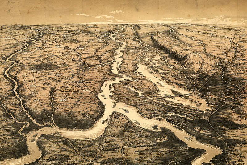
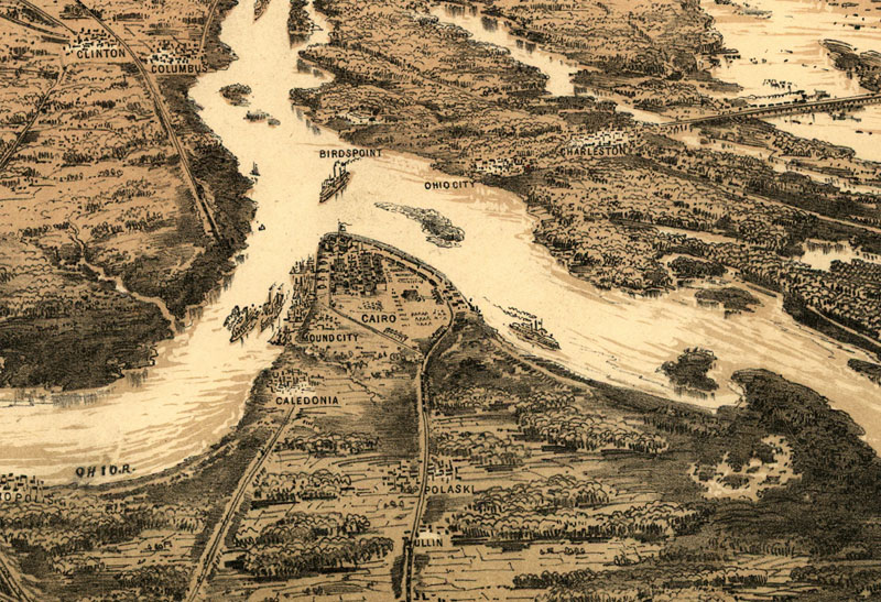
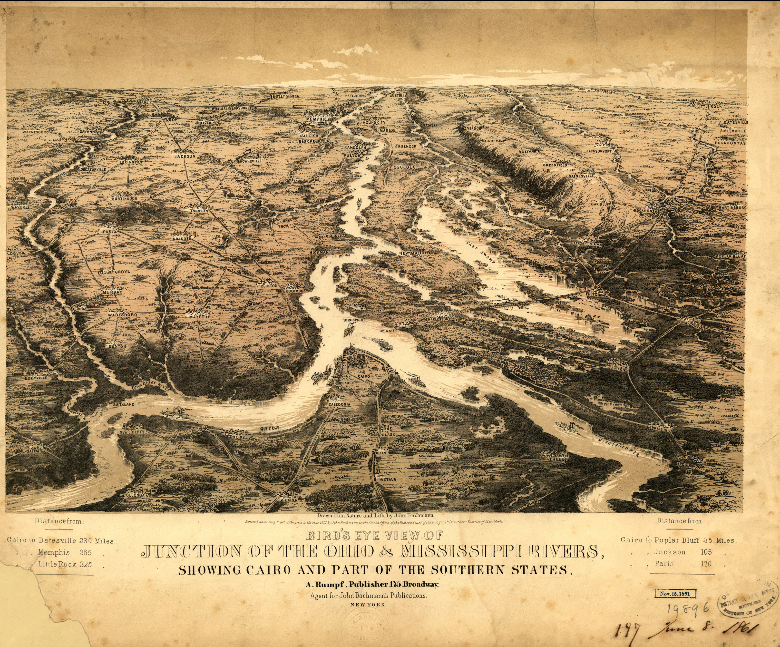
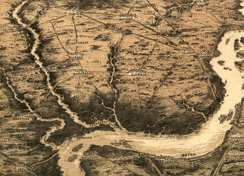
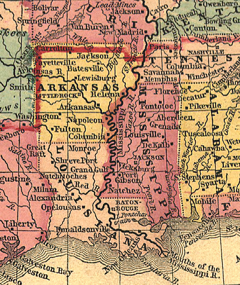
view 1861 of western rivers south from Cairo 1861 or bg - Tenn River or bg
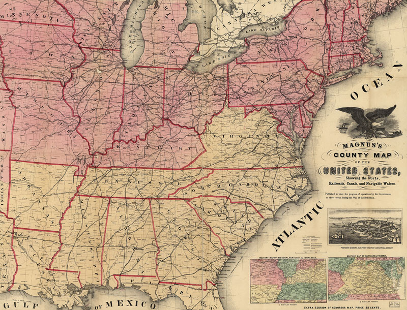
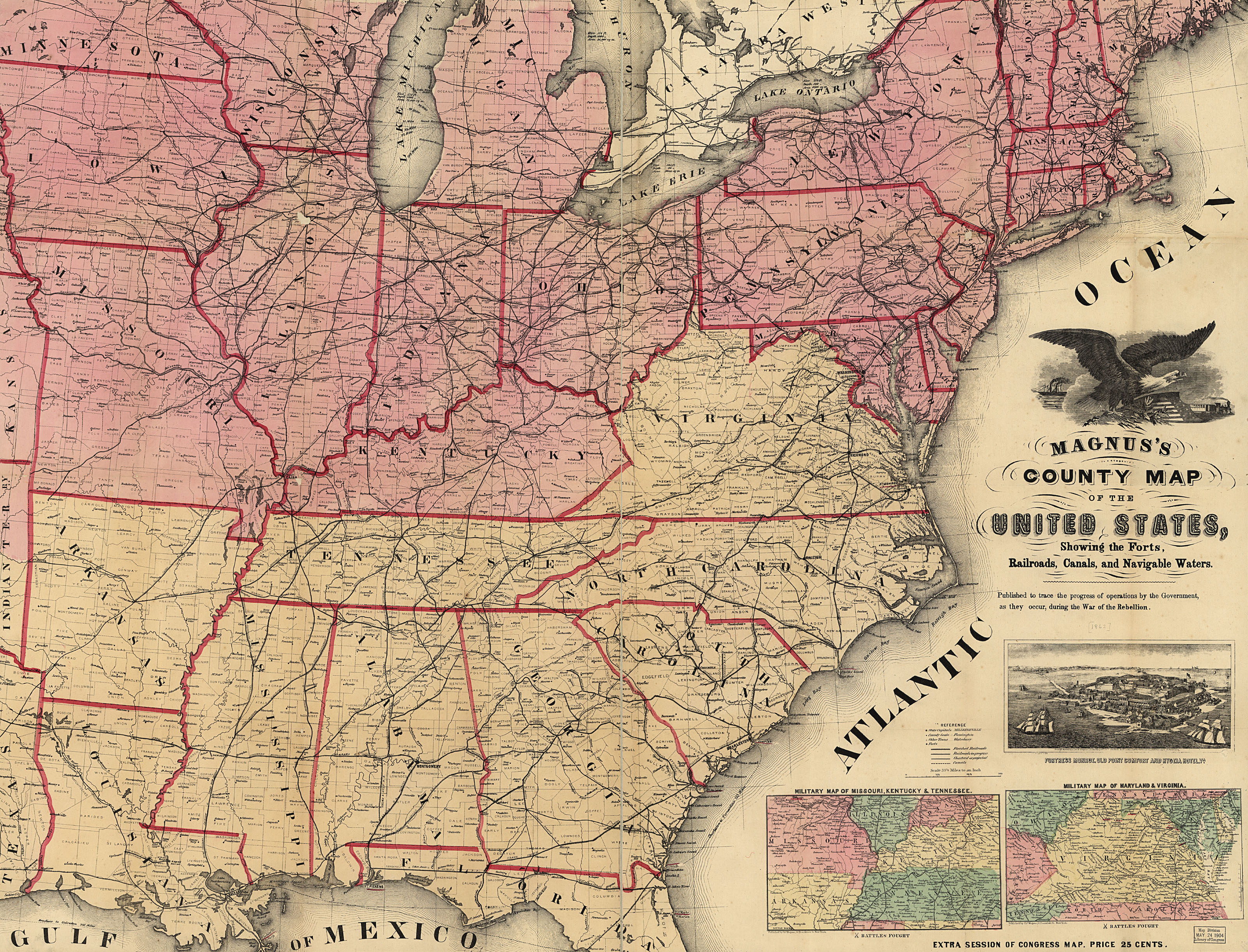
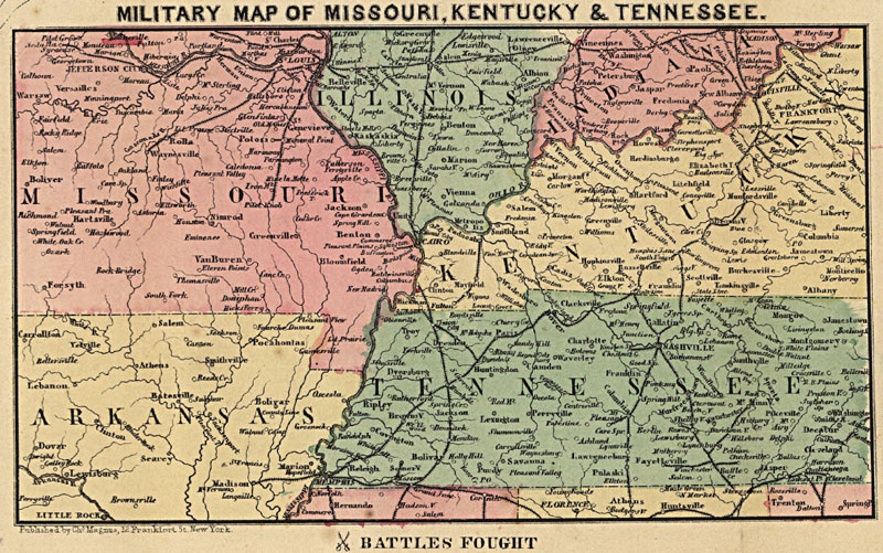
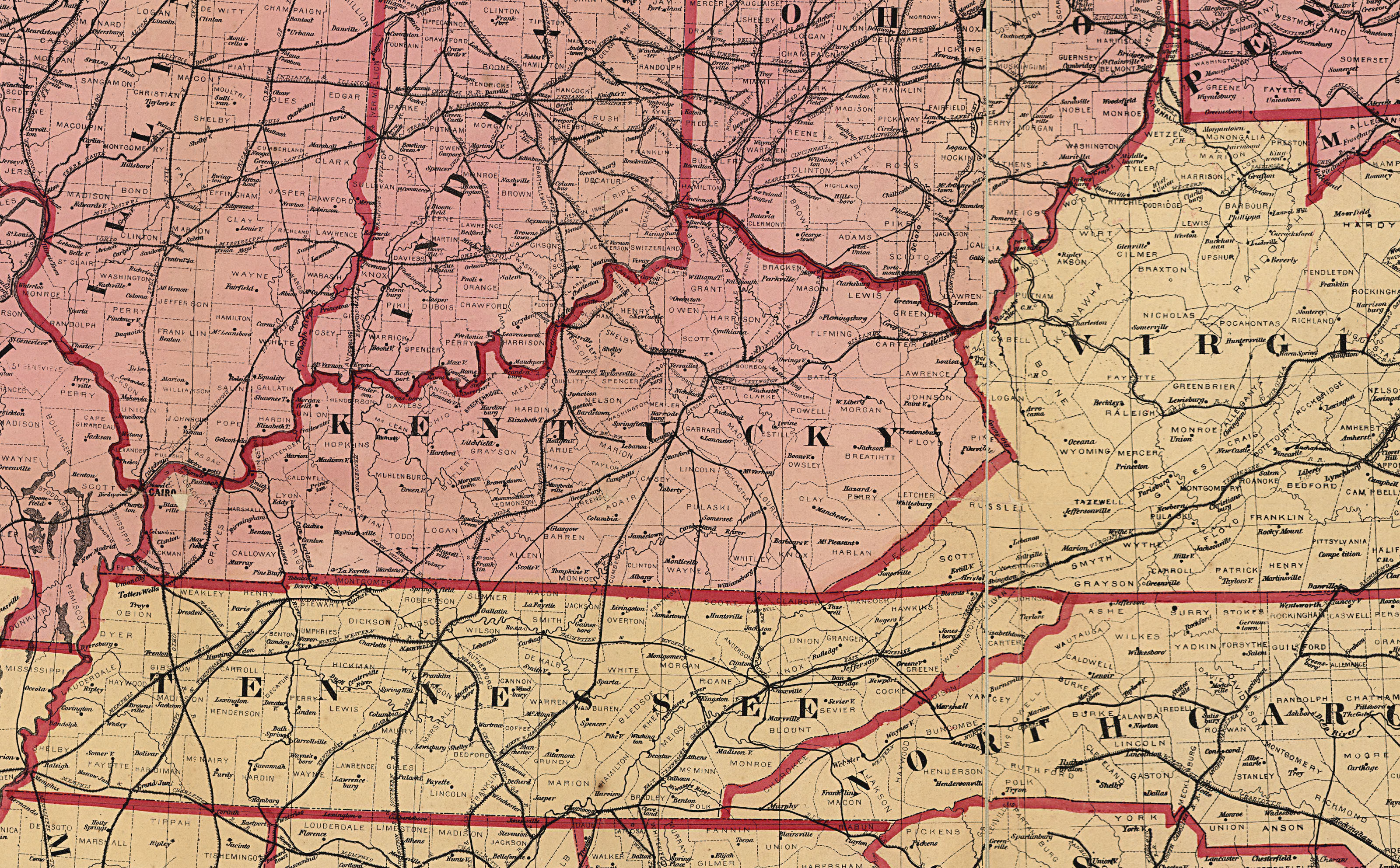
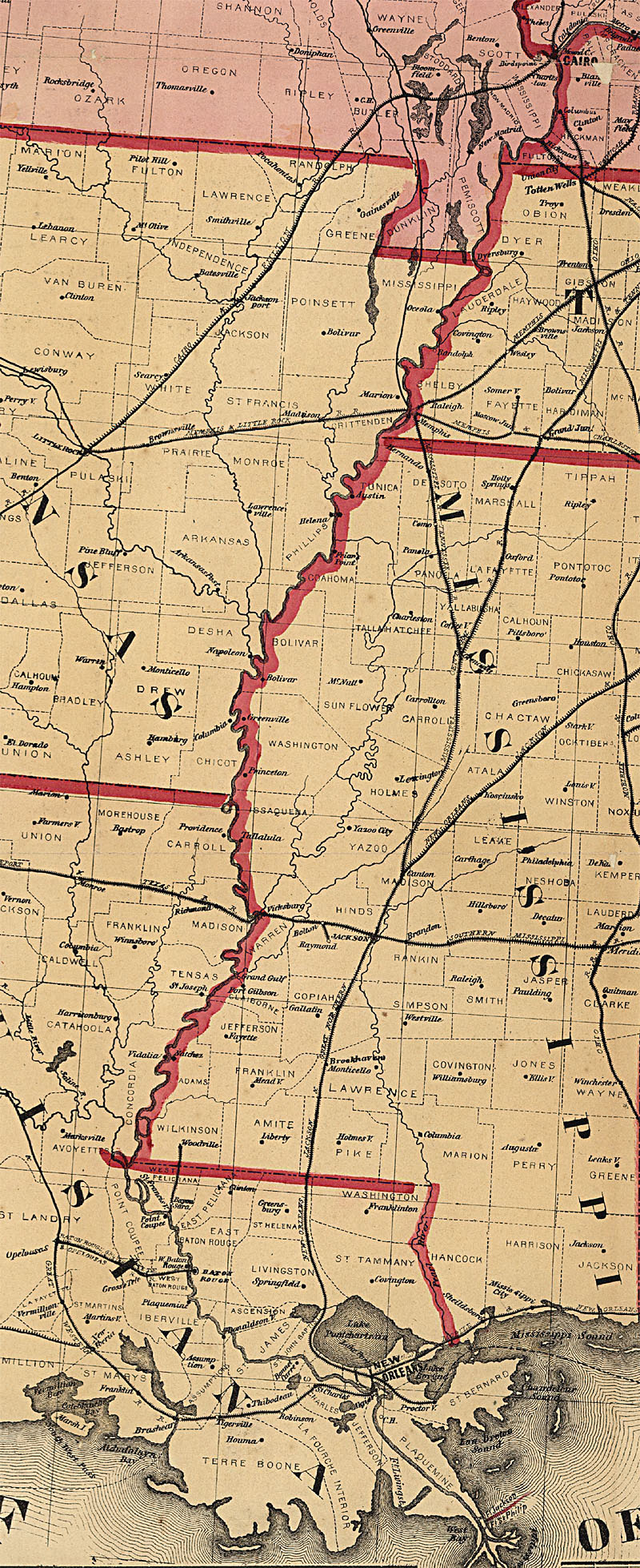
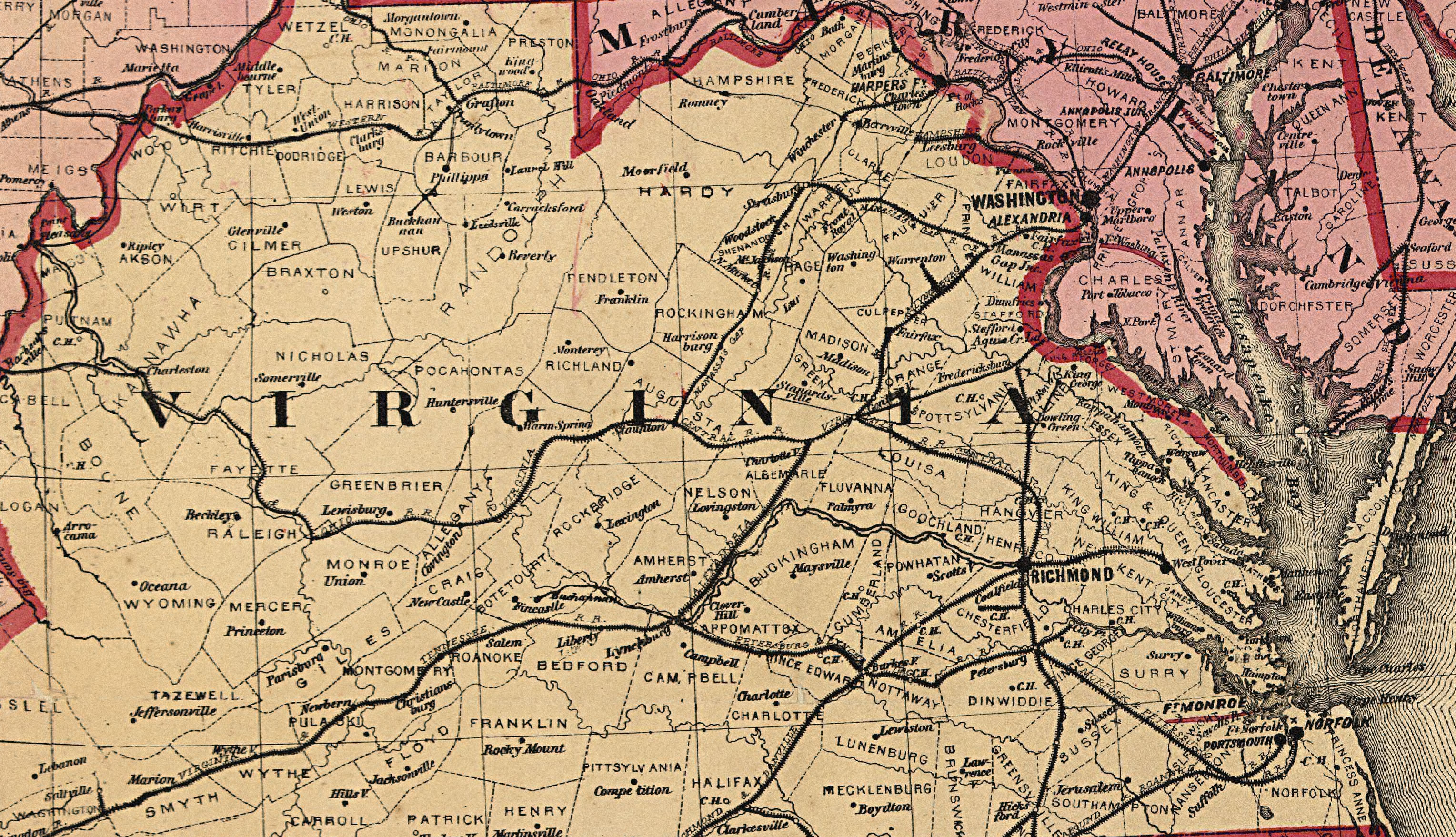
US map 1862 by Magnus or bg - MO-KY or bg - VA or bg - TN or bg - LA-MI-AL or bg - KY or bg - VA or bg or East VA cu
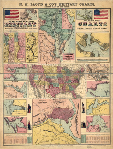
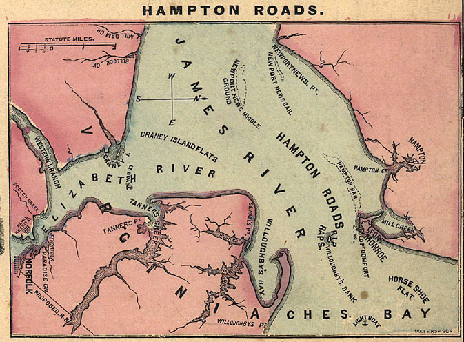
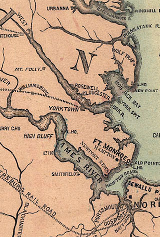
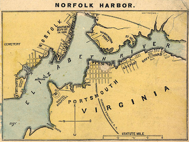
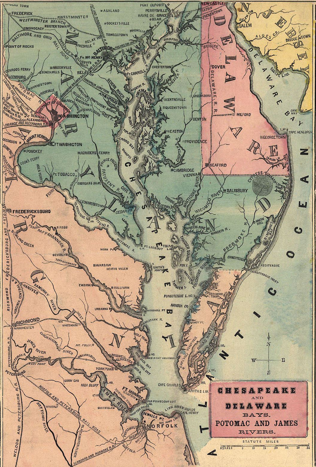
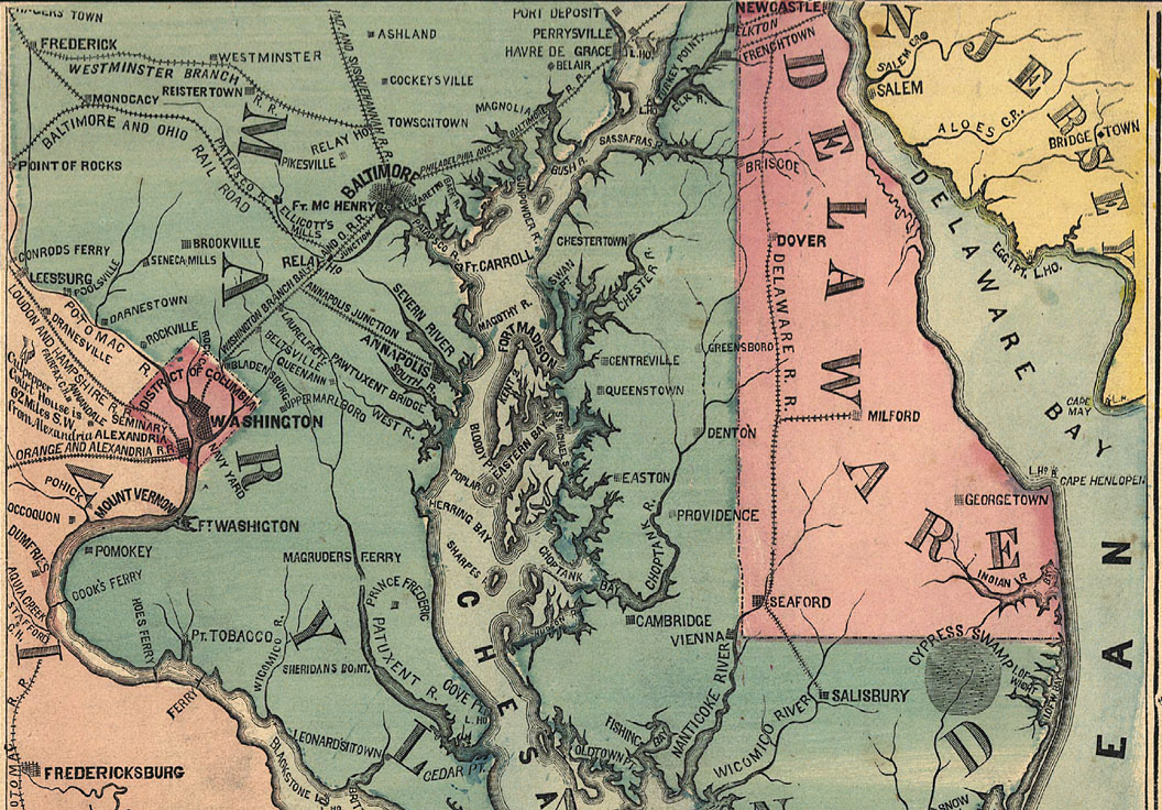
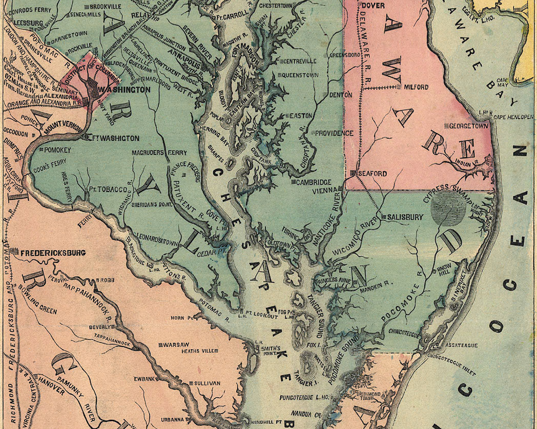
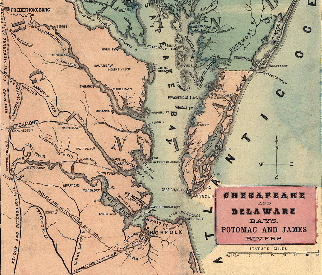
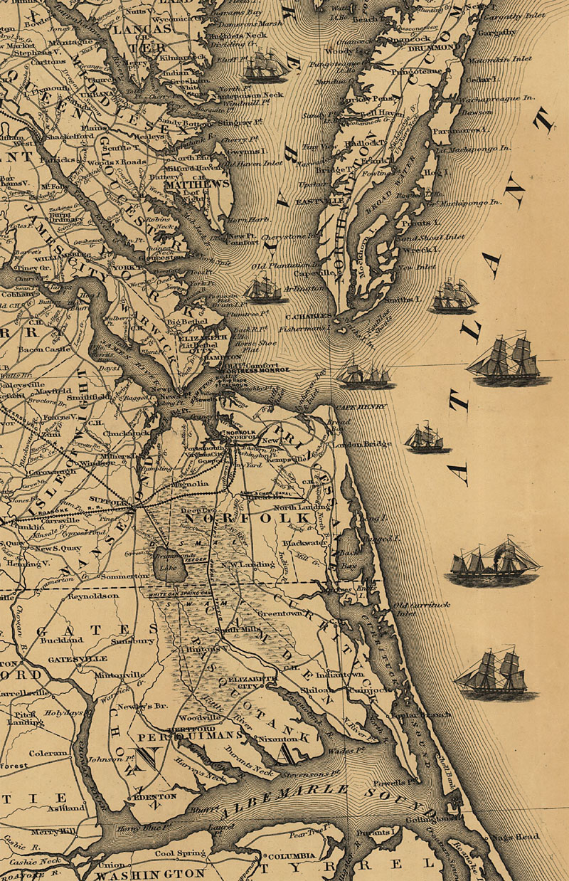
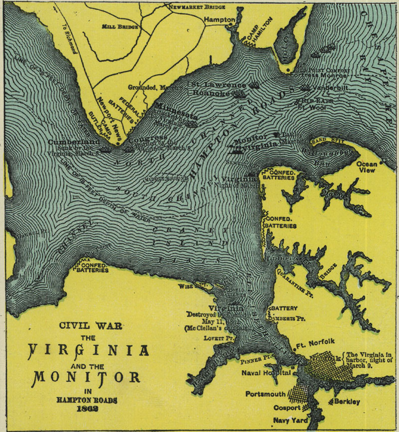
Harbors map 1861 by Lloyd and bg or east or west and bg or Miss or Hampton Roads or Peninsula or Norfolk or Potomac top mid bott from LC ("H. H. Lloyd & Co's. military charts. Sixteen maps on one sheet." Maps of Annapolis, Key West, the Mississippi River, Chesapeake Bay and vicinity, Charleston, New Orleans, Savannah, Mobile Bay, the United States, Cairo, Pensacola Bay, Galveston Bay, Norfolk, Hampton Roads, Washington, D.C., and Harpers Ferry. Compiled from official data, by Egbert L.Viele and Charles Haskins, military and civil engineers." http://hdl.loc.gov/loc.gmd/g3701s.cw0018000)
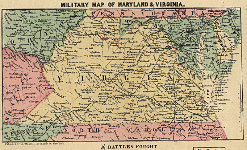
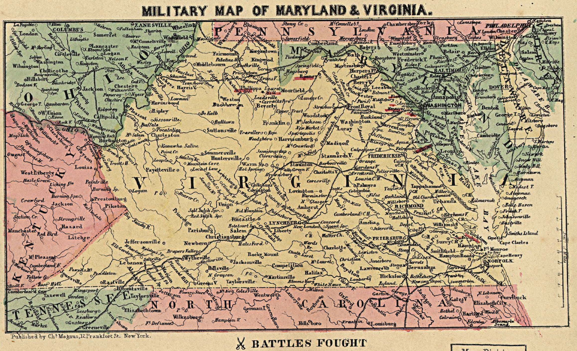
Virginia 1862 and bg or med from LC
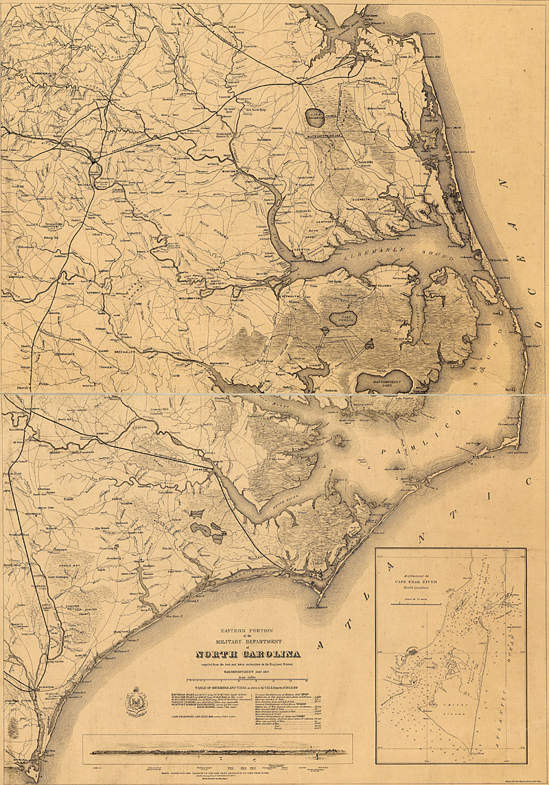
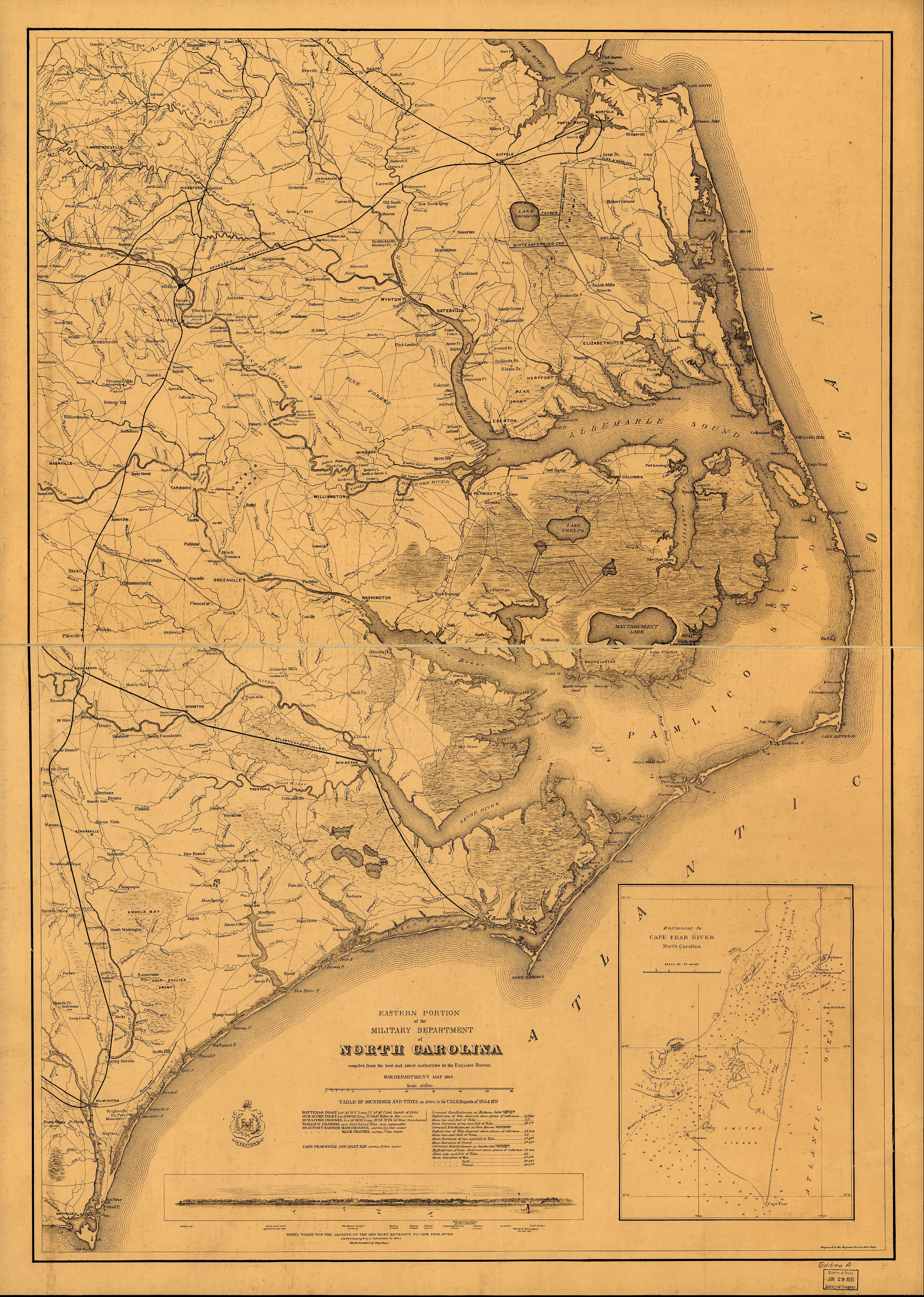
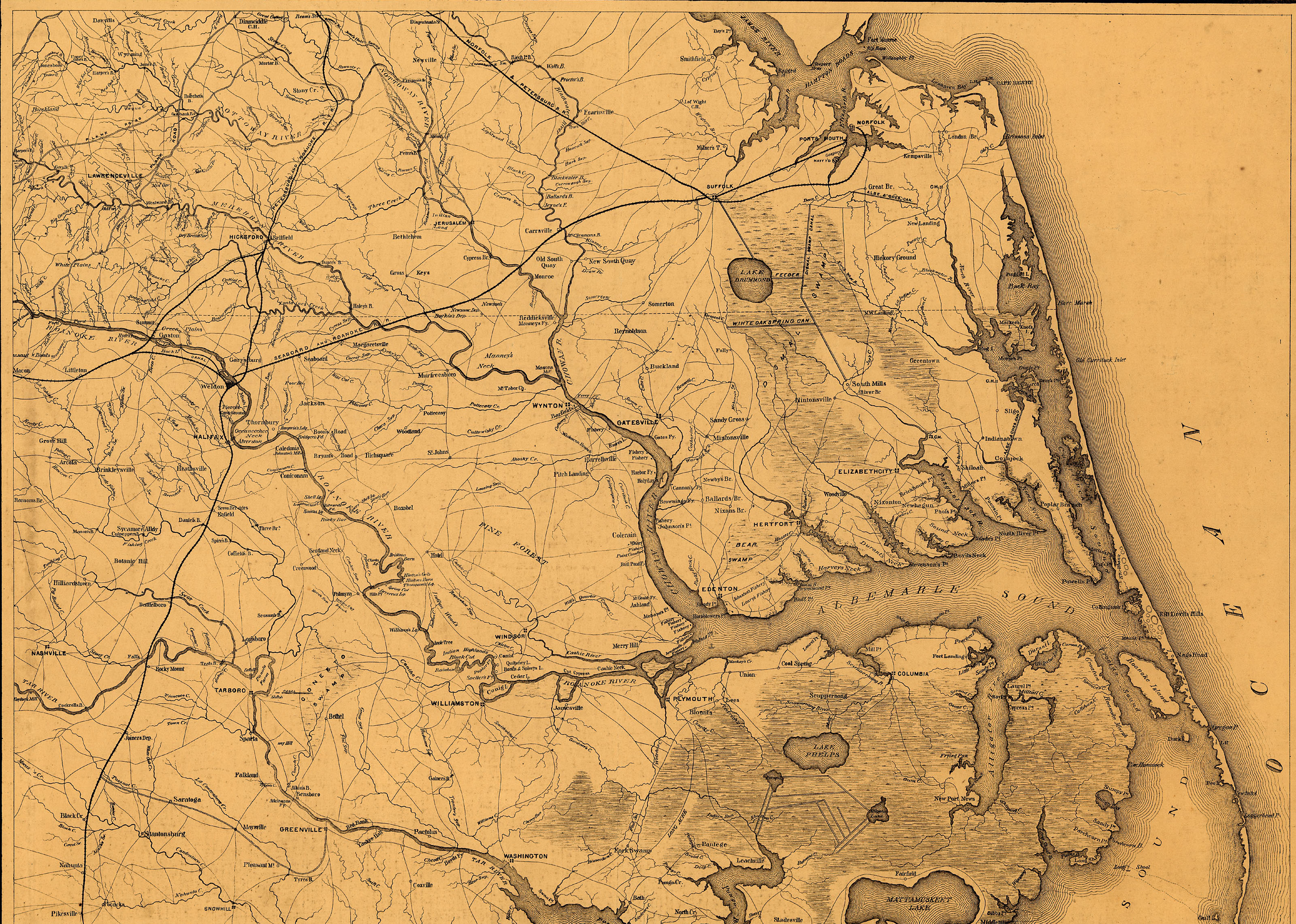
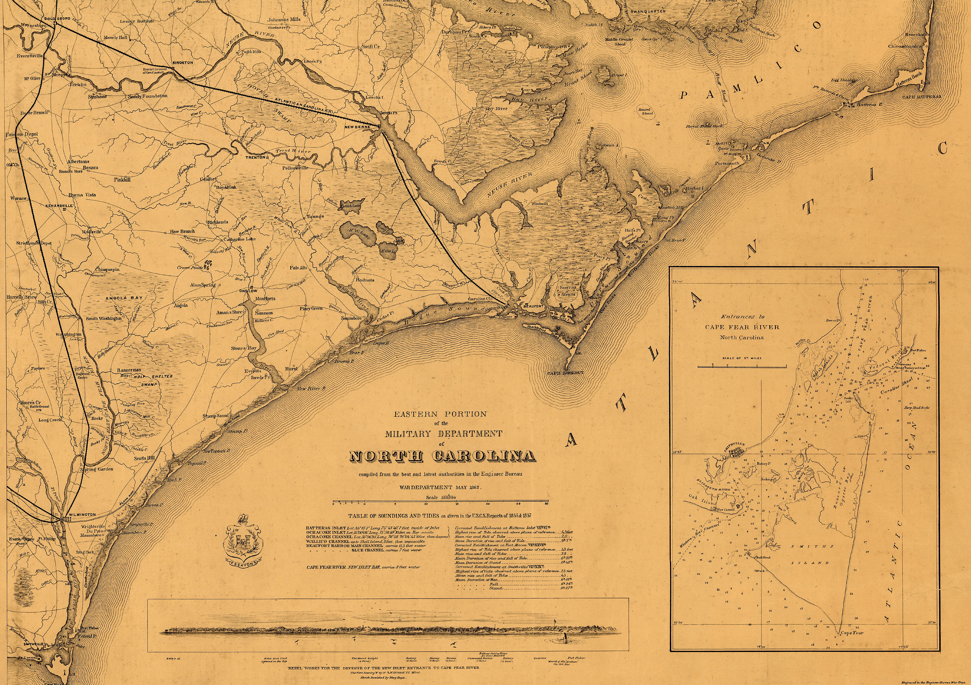
North Carolina coast May 1862 and bg and 2 and 3 - from LC ("Eastern portion of the military department of North Carolina compiled from the best and latest authorities in the Engineer Bureau, War Department, May 1862. Insets: Entrances to Cape Fear River. http://hdl.loc.gov/loc.gmd/g3902c.cw0306000)
North Carolina coast 1861 and bg and med - from LC ("Colton's new topographical map of the eastern portion of the State of North Carolina with part of Virginia & South Carolina from the latest & best authorities. Coastal forts and naval blockade are depicted. Inset: Plan of the sea coast from Virginia to Florida. " New York, 1861. http://hdl.loc.gov/loc.gmd/g3900.cw0304750)
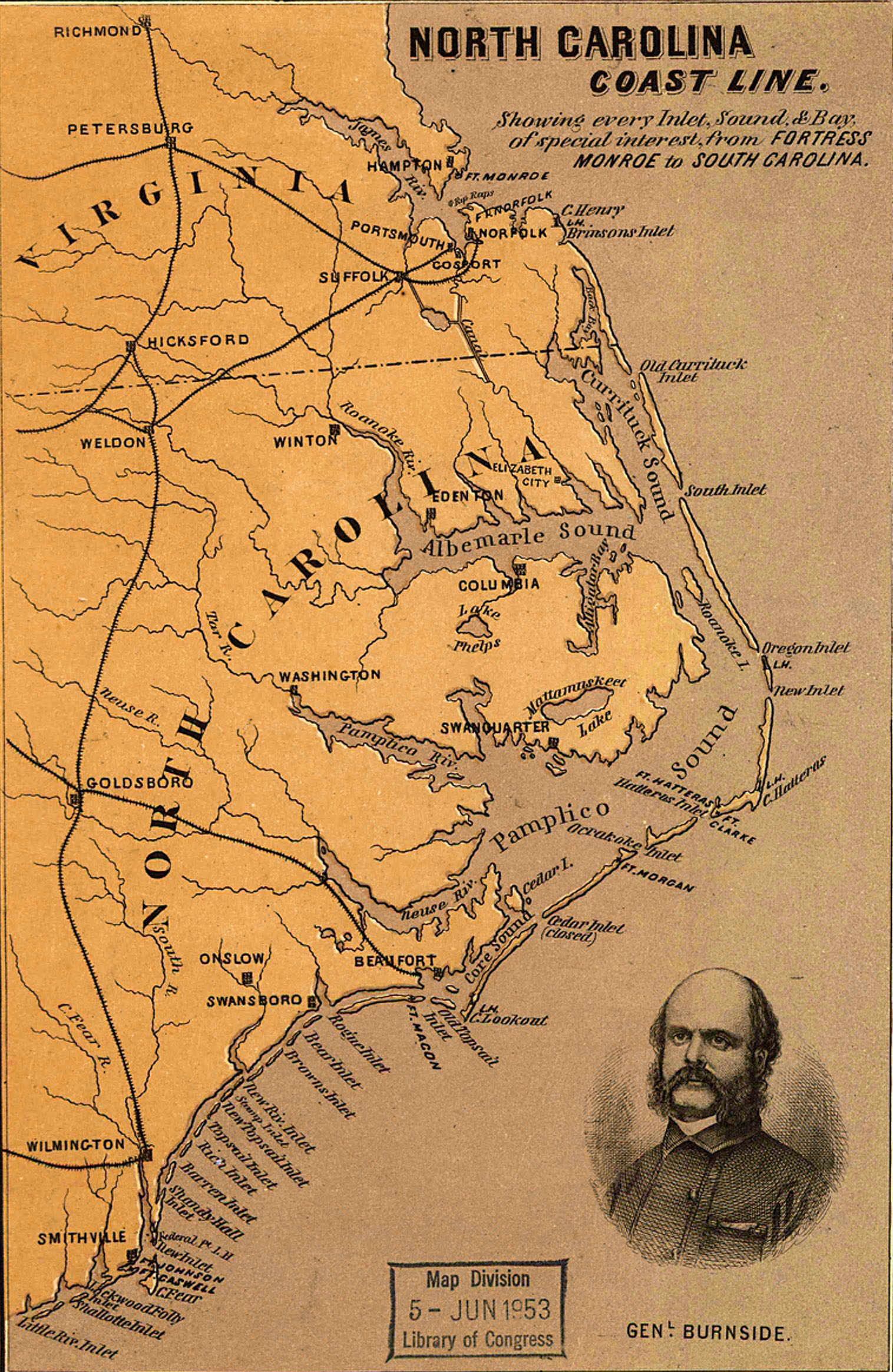
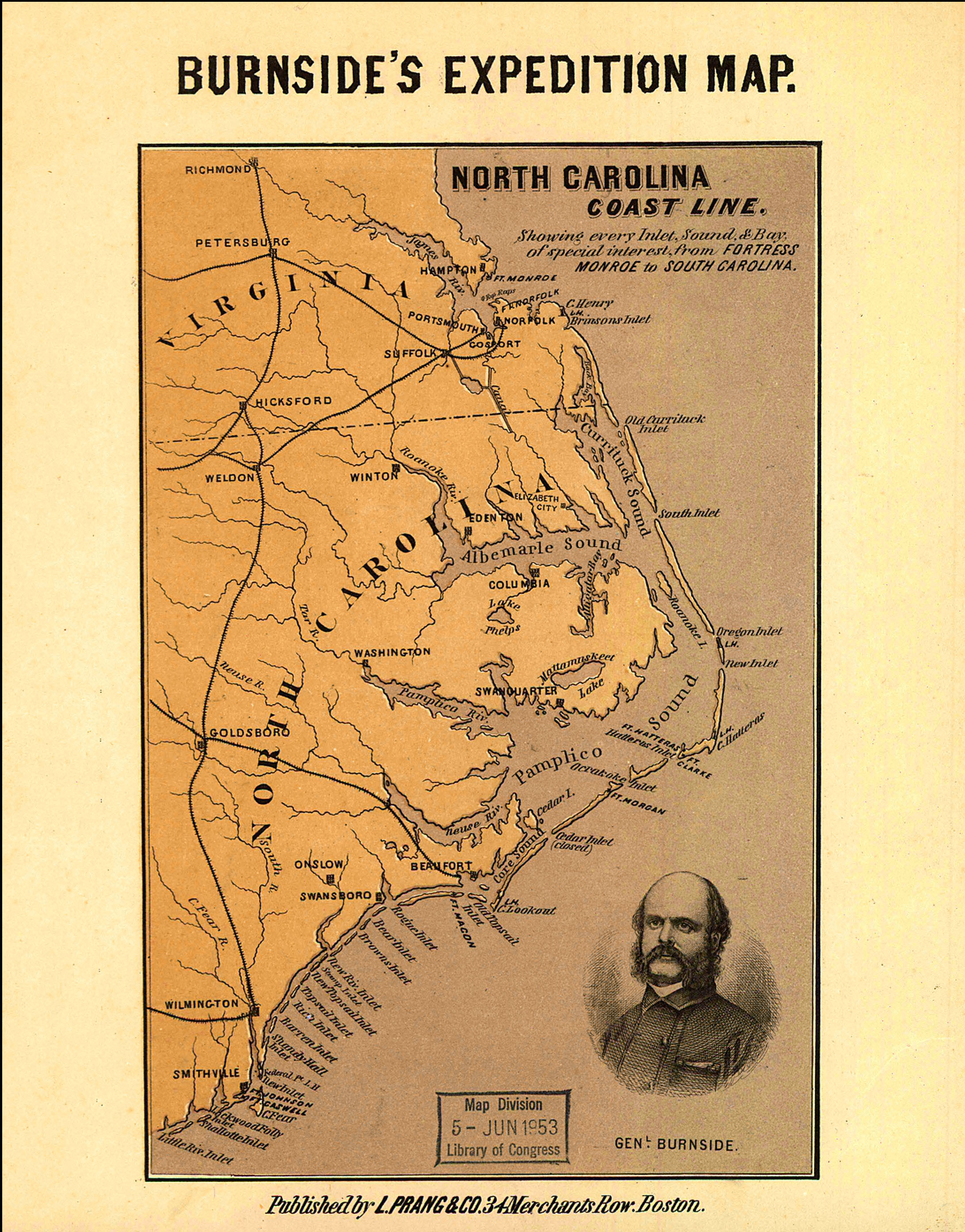
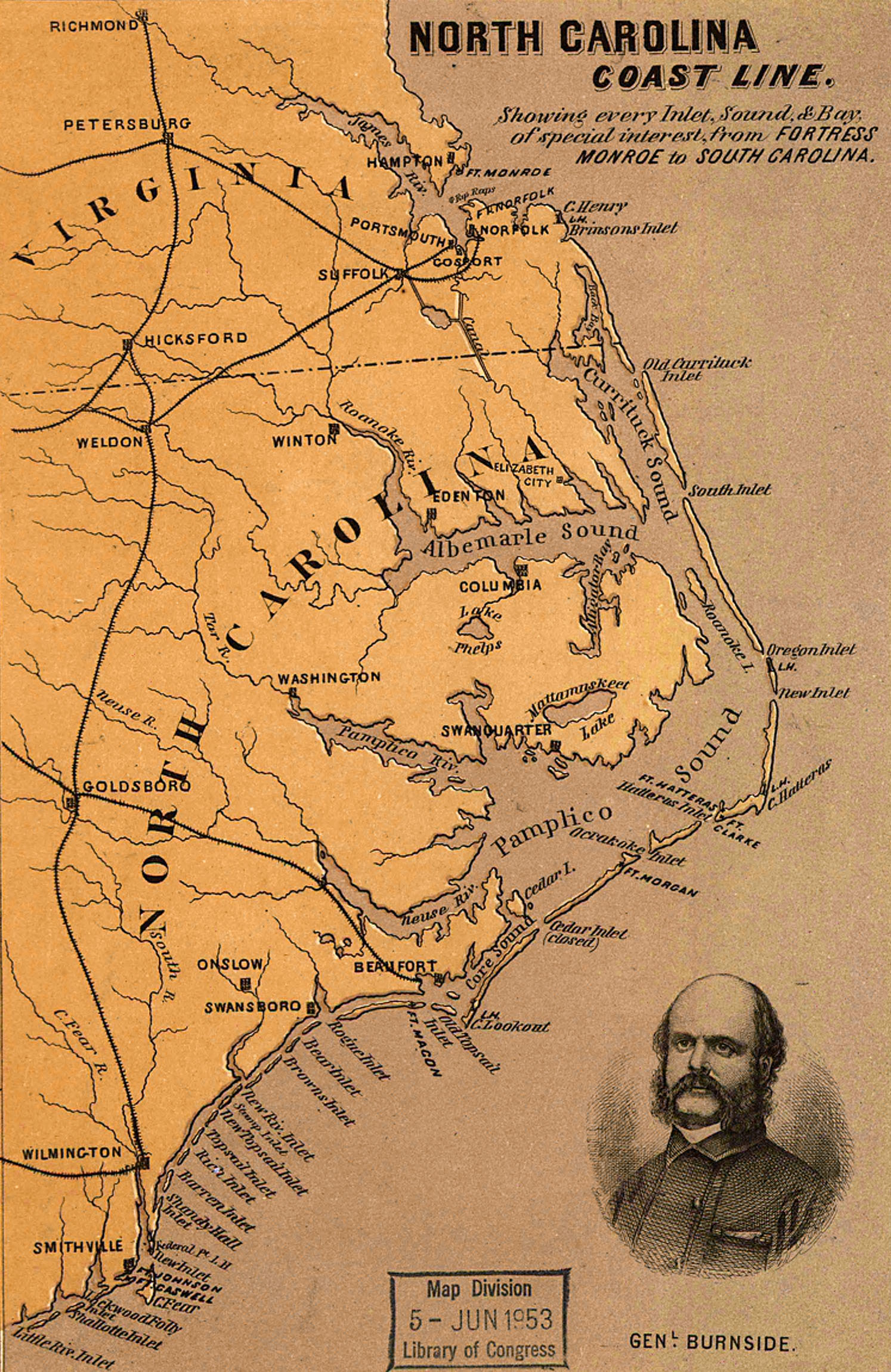
Burnside Expedition to North Carolina coast 1862 and bg - from LC ("North Carolina coast line. Showing every inlet, sound & bay of special interest, from Fortress Monroe to South Carolina. At top of map: Burnside's expedition map. Portrait of "Genl. Burnside" is in the lower right corner. Map identifies coastal forts. By L. Prang & Co., Boston, 1862." http://hdl.loc.gov/loc.gmd/g3902c.cw0305a80)
Goff's Historical maps 1907. and bg and Maryland and bg and c and d and Antietam and f and g and h
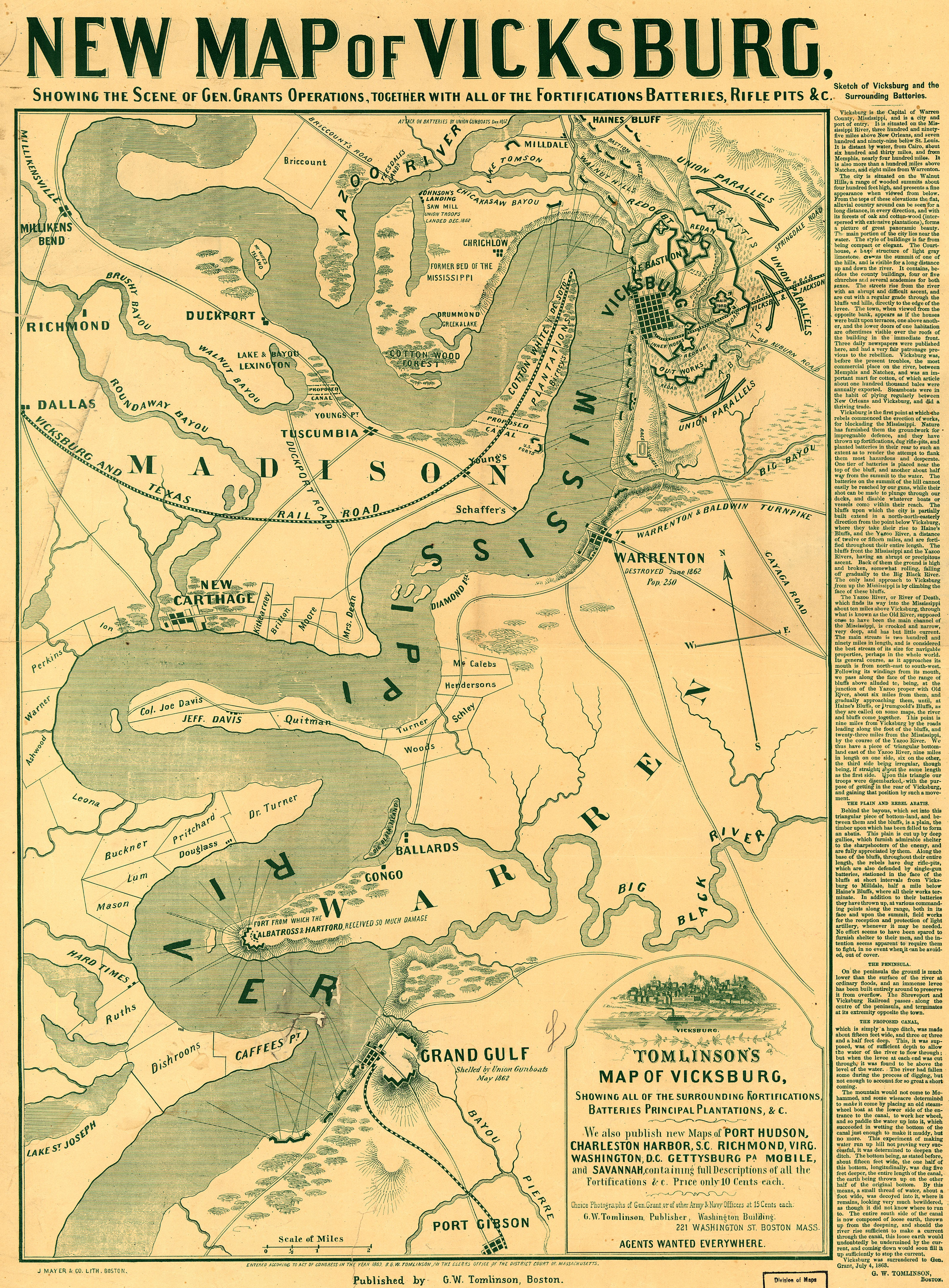
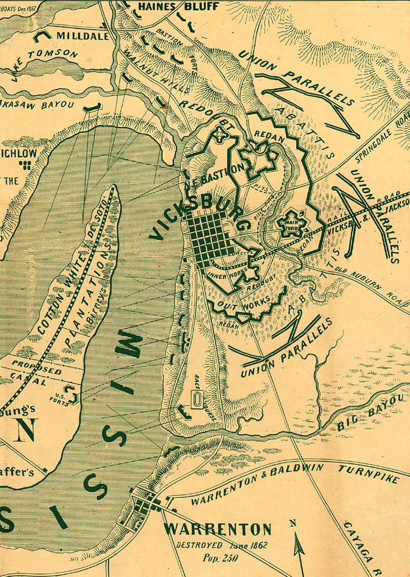
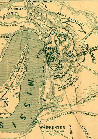
Vicksburg 1863 and bg or cu and vert from LC
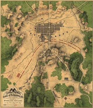
Gettysburg 1863 and vert from LC
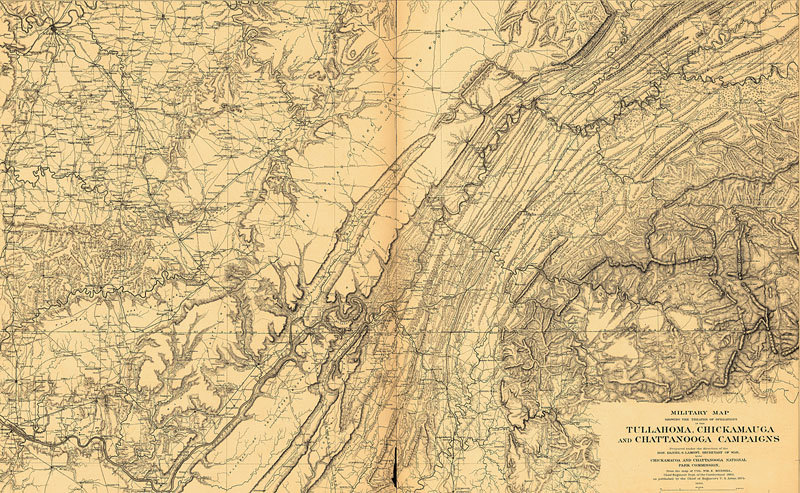
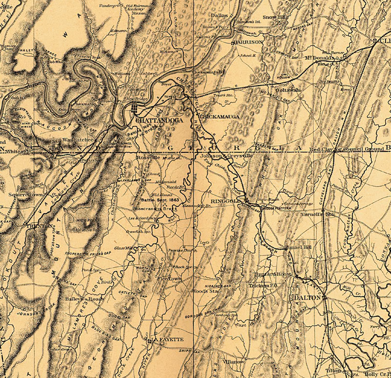
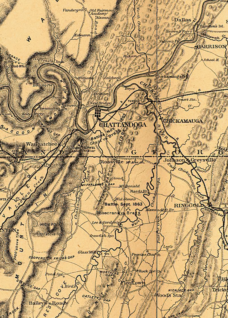
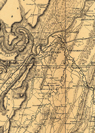
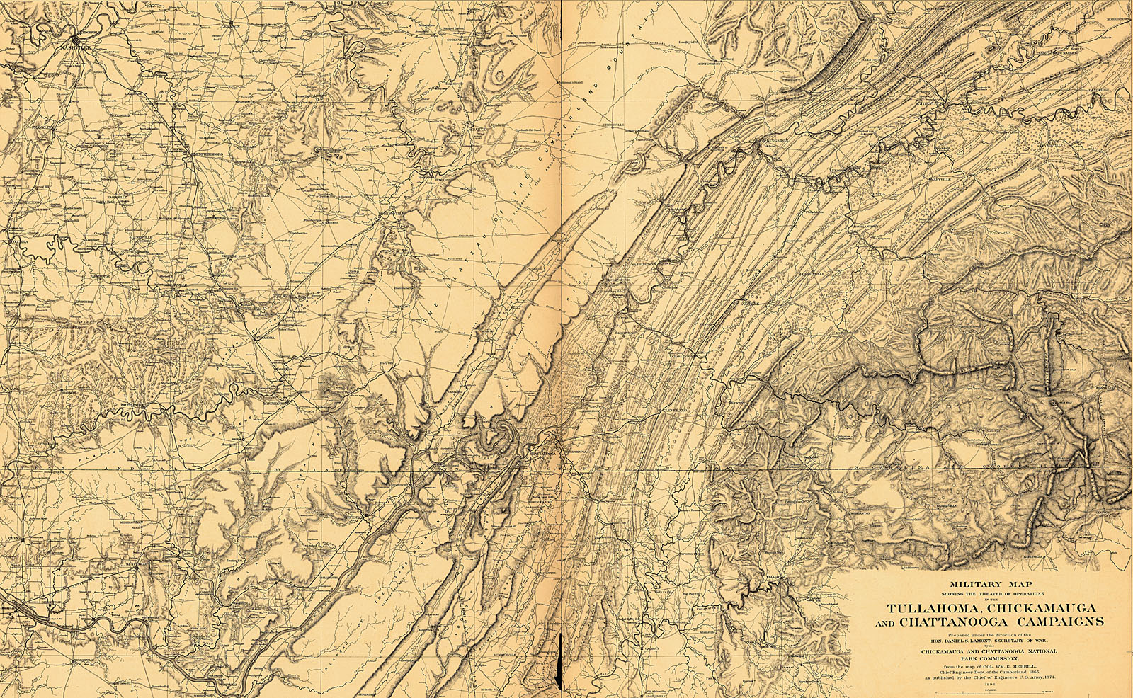
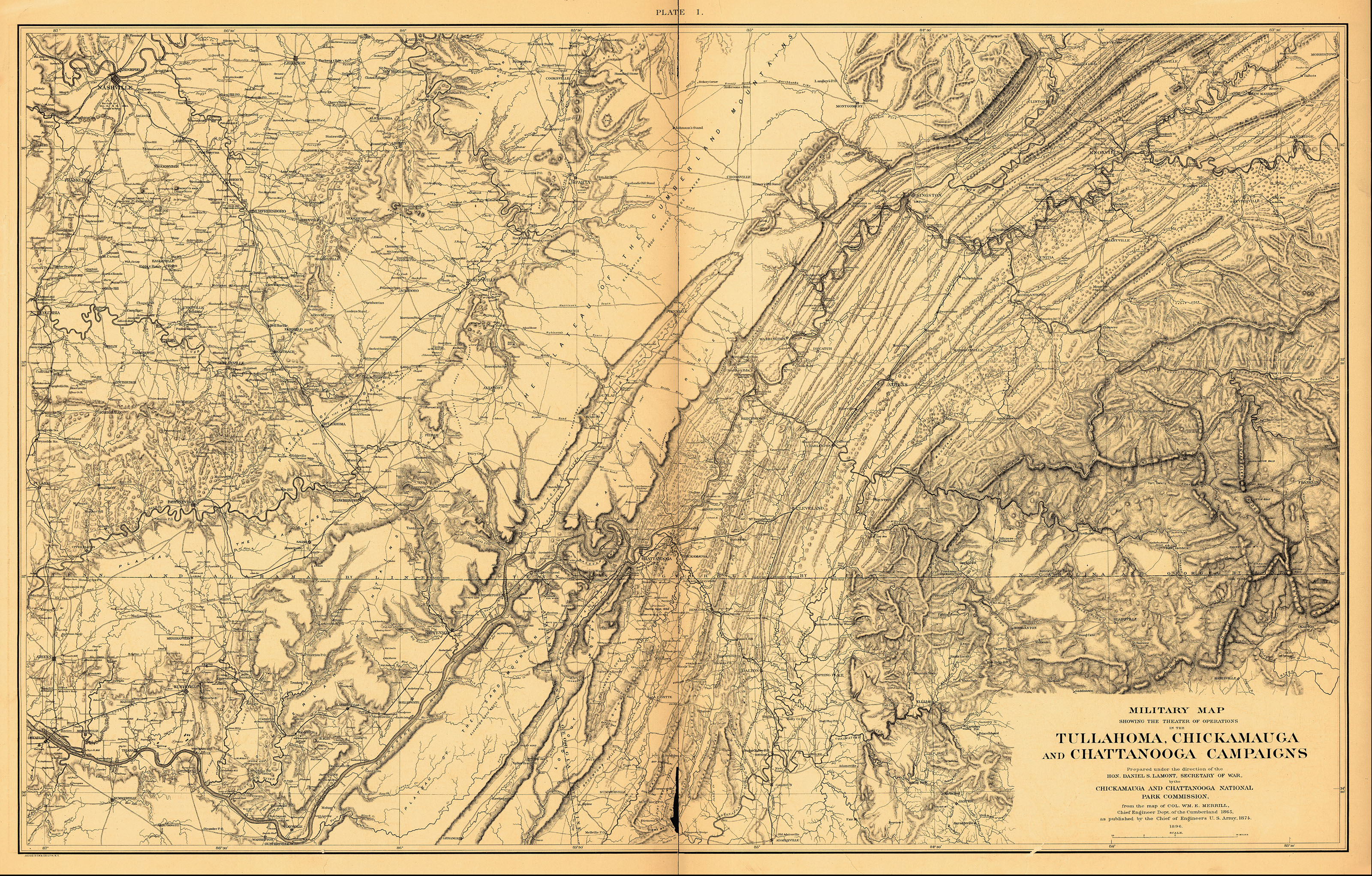
Chattanooga 1863 or b or c and c vert or bg or vbg from LC: "Atlas of the battlefields of Chickamauga, Chattanooga and vicinity. Published 1896-7 under the direction of Daniel S. Lamont and Russell A. Alger, Secretaries of War. United States. Chickamauga and Chattanooga National Park Commission." or park map 1968 and text
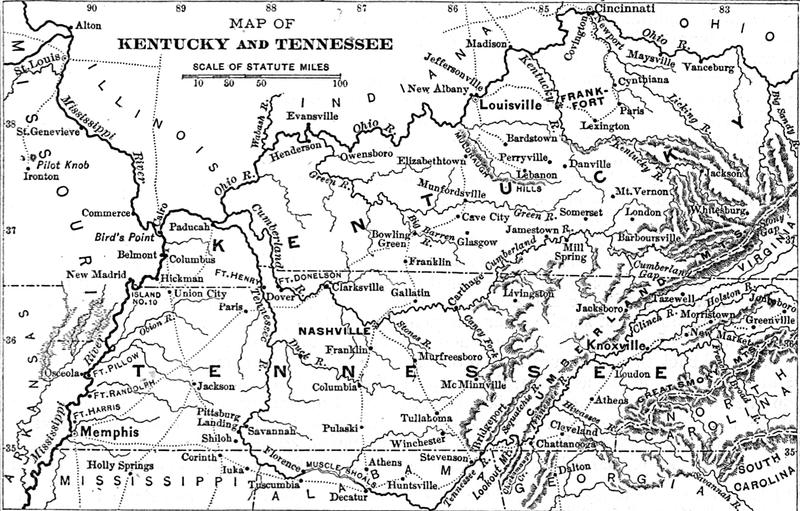
KY-TN 1864 and vert or bg from LC: "Map of Kentucky and Tennessee. From Century illustrated monthly magazine, v. 34, Aug. 1887. p. 596. Map of Hood's invasion of Tennessee."
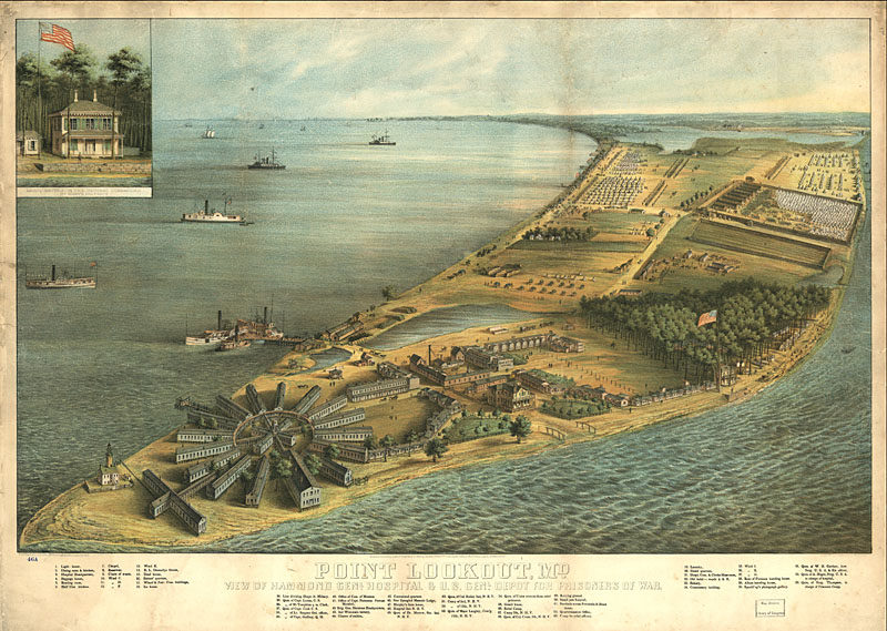
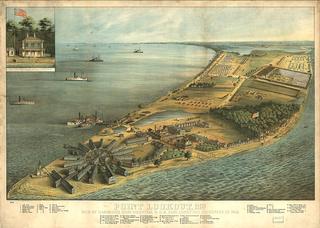
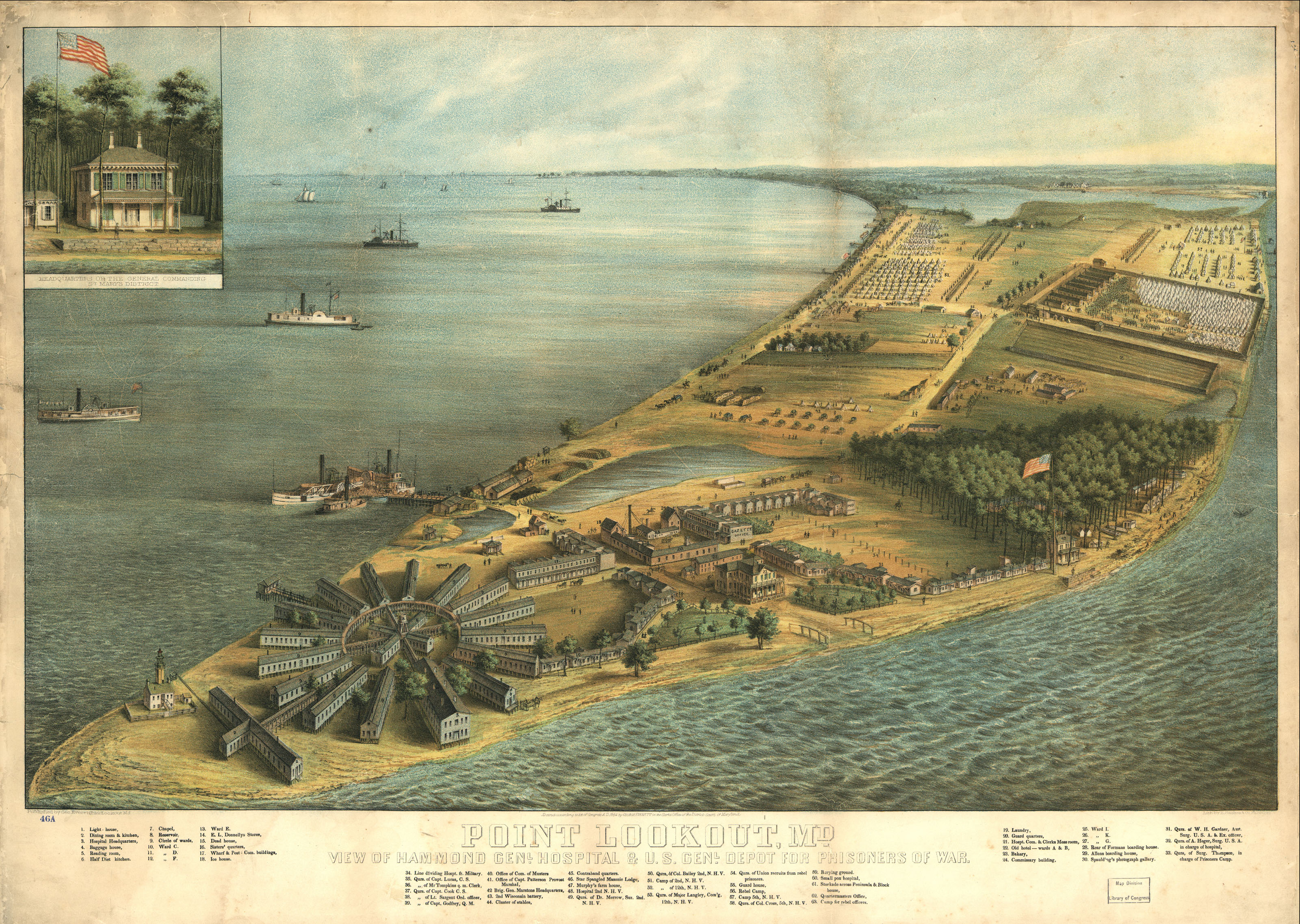
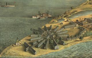
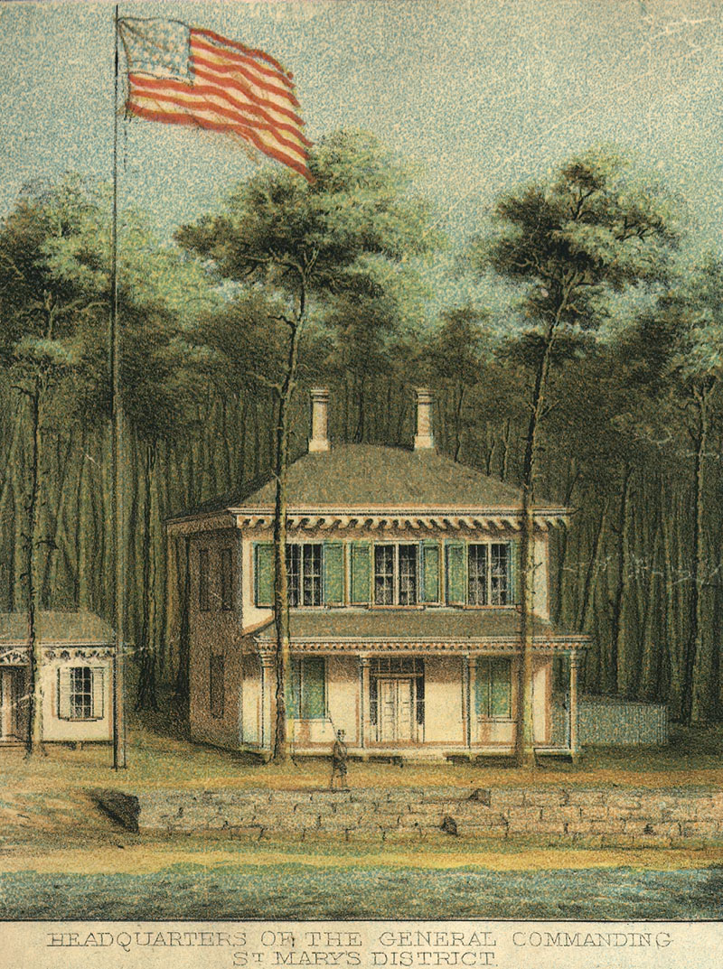
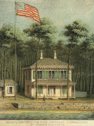
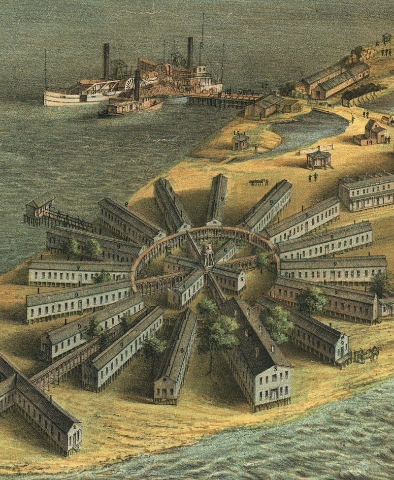
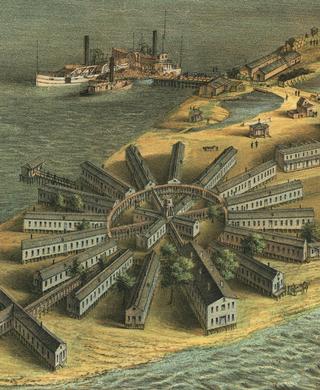
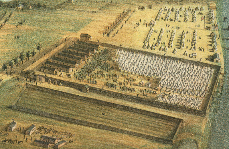
Point Lookout MD 1864 and vert and bg or cu1 and vert or cu2 and vert or cu3 and vert or cu4 and vert from LC: "Point Lookout, Md. view of Hammond Genl. Hospital & U.S. genl. depot for prisoners of war. Inset: Headquarters of the general commanding St. Mary's District. Lith. by E. Sachse & Co., Baltimore. 1864."
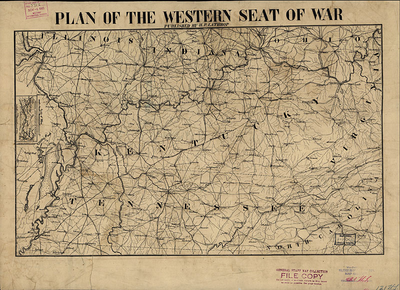
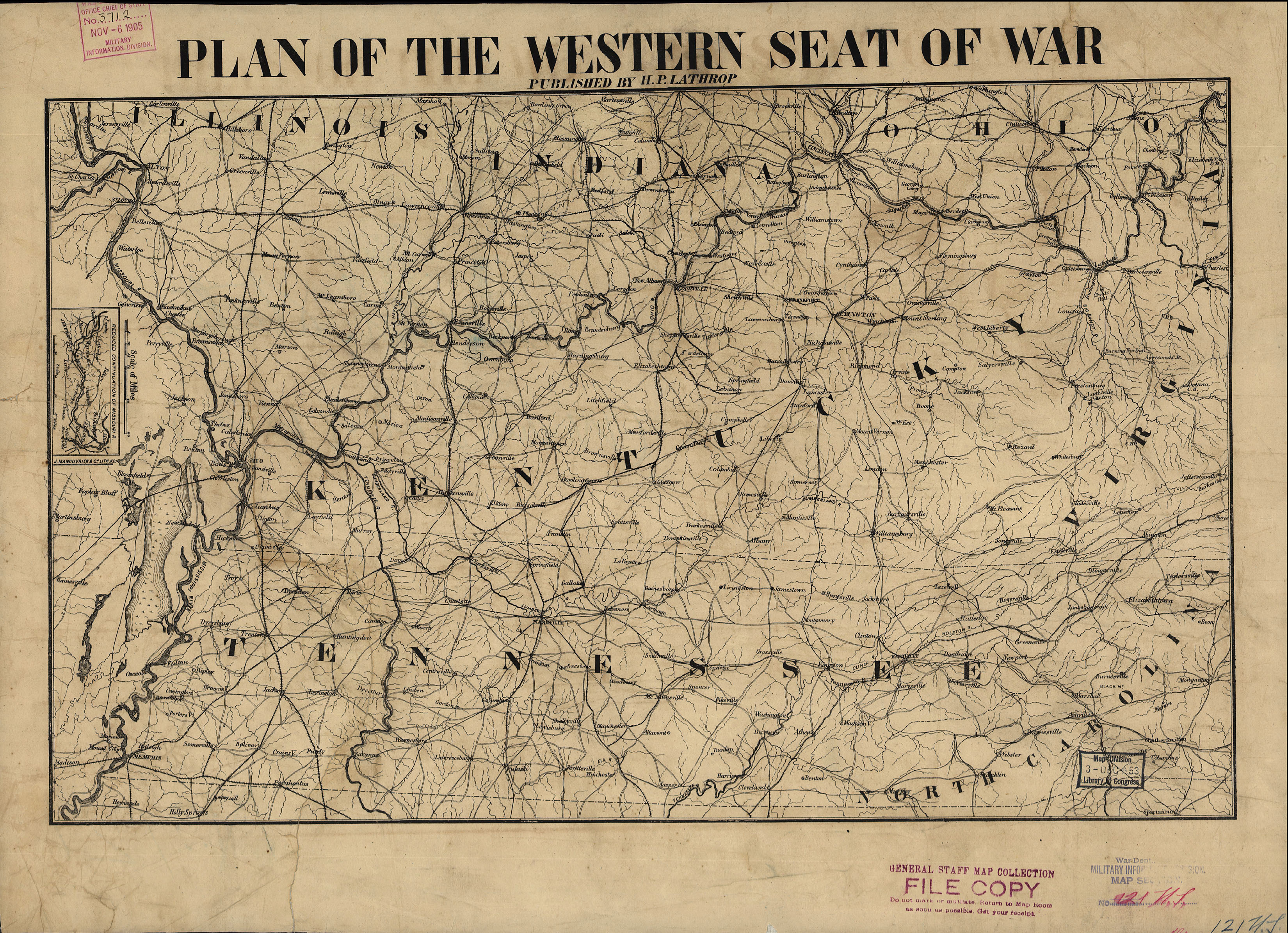
Western Seat of War 1865 and bg from LC: "Plan of the western seat of war. H. P. Lathrop, 1865, printed by J. Manouvrier & Co. lith, N. O."
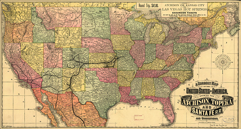
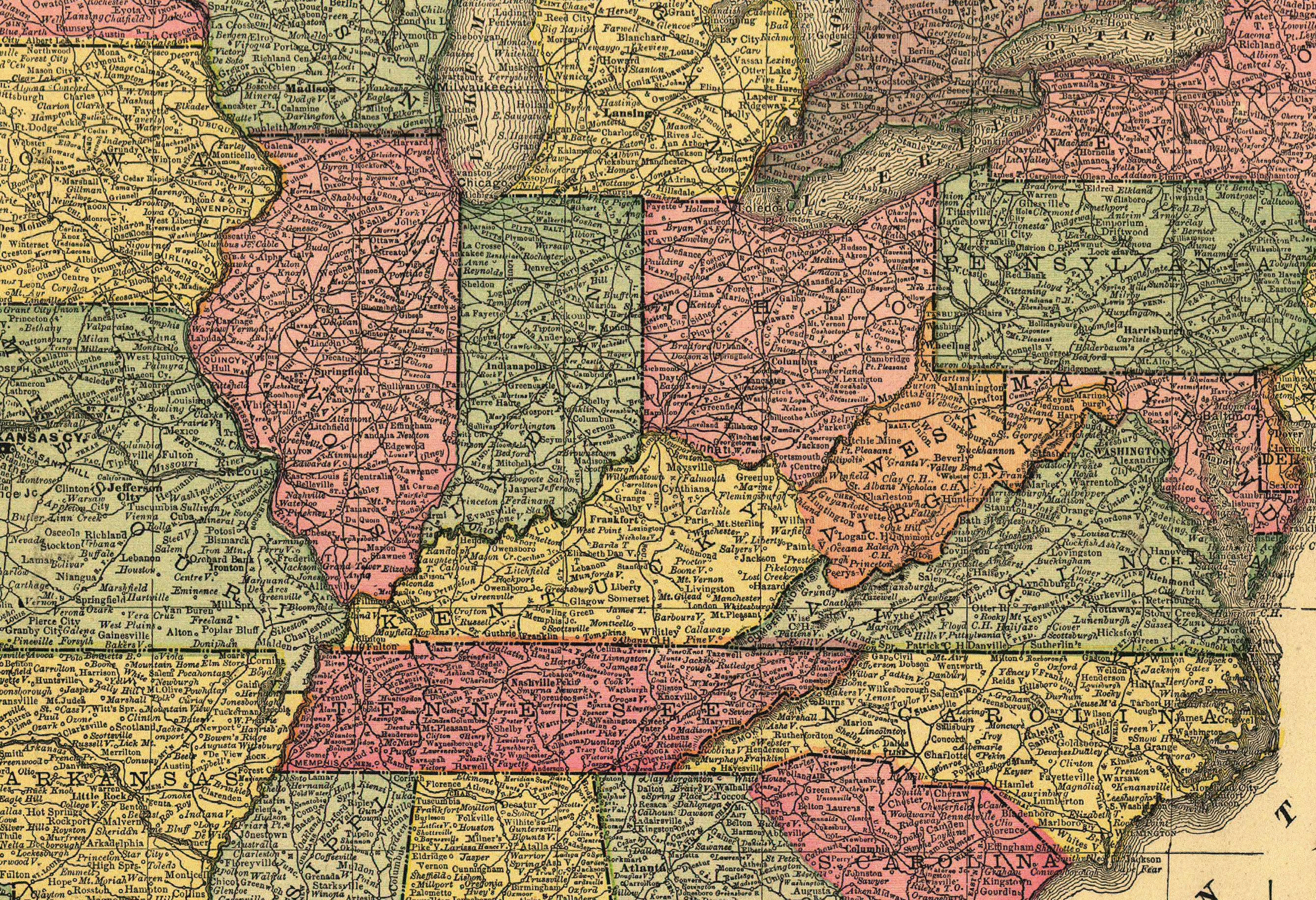
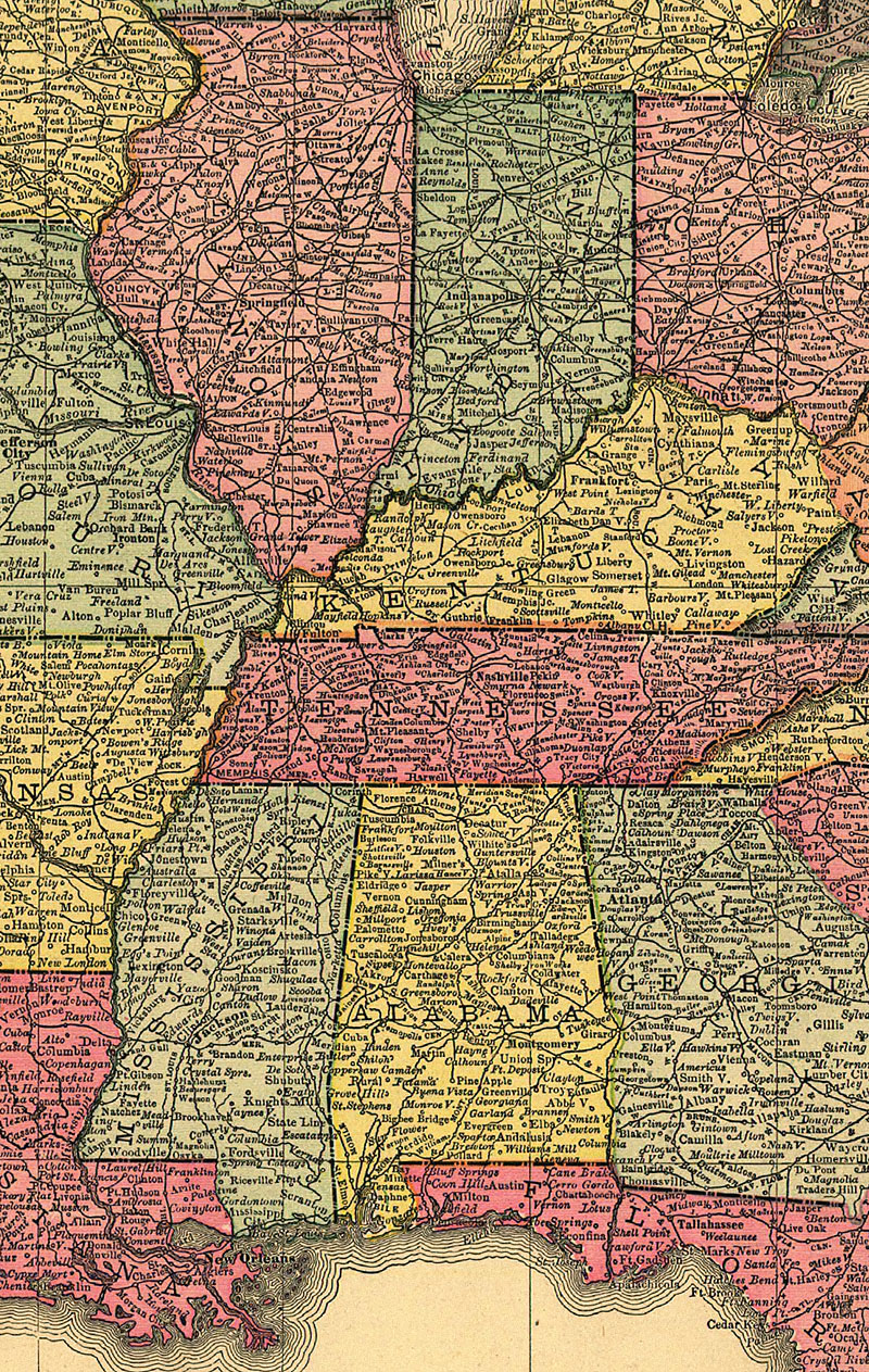
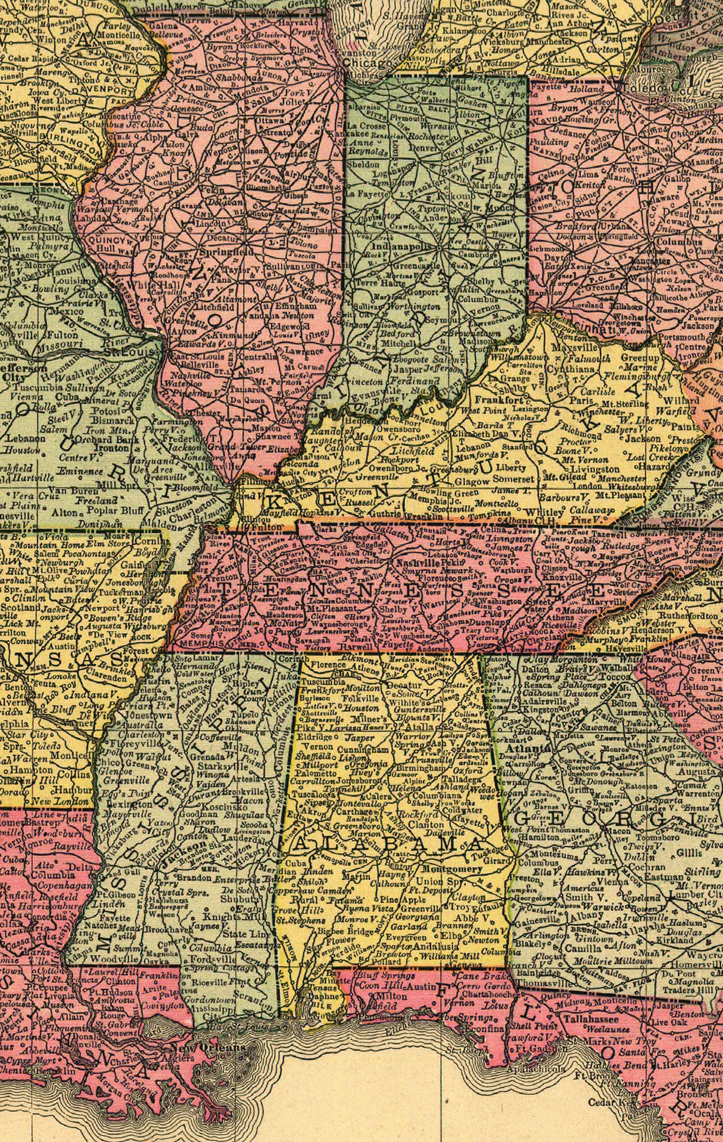
US 1888 or east and bg or mid and bg and cu and vert or west and bg from LC: "A correct map of the United States of America showing the Atchison, Topeka, and Santa Fé R.R. and connections. Rand McNally and Company. Chicago, 1888."
|
|
See also Civil War Seminar maps and Alaska and reserve maps