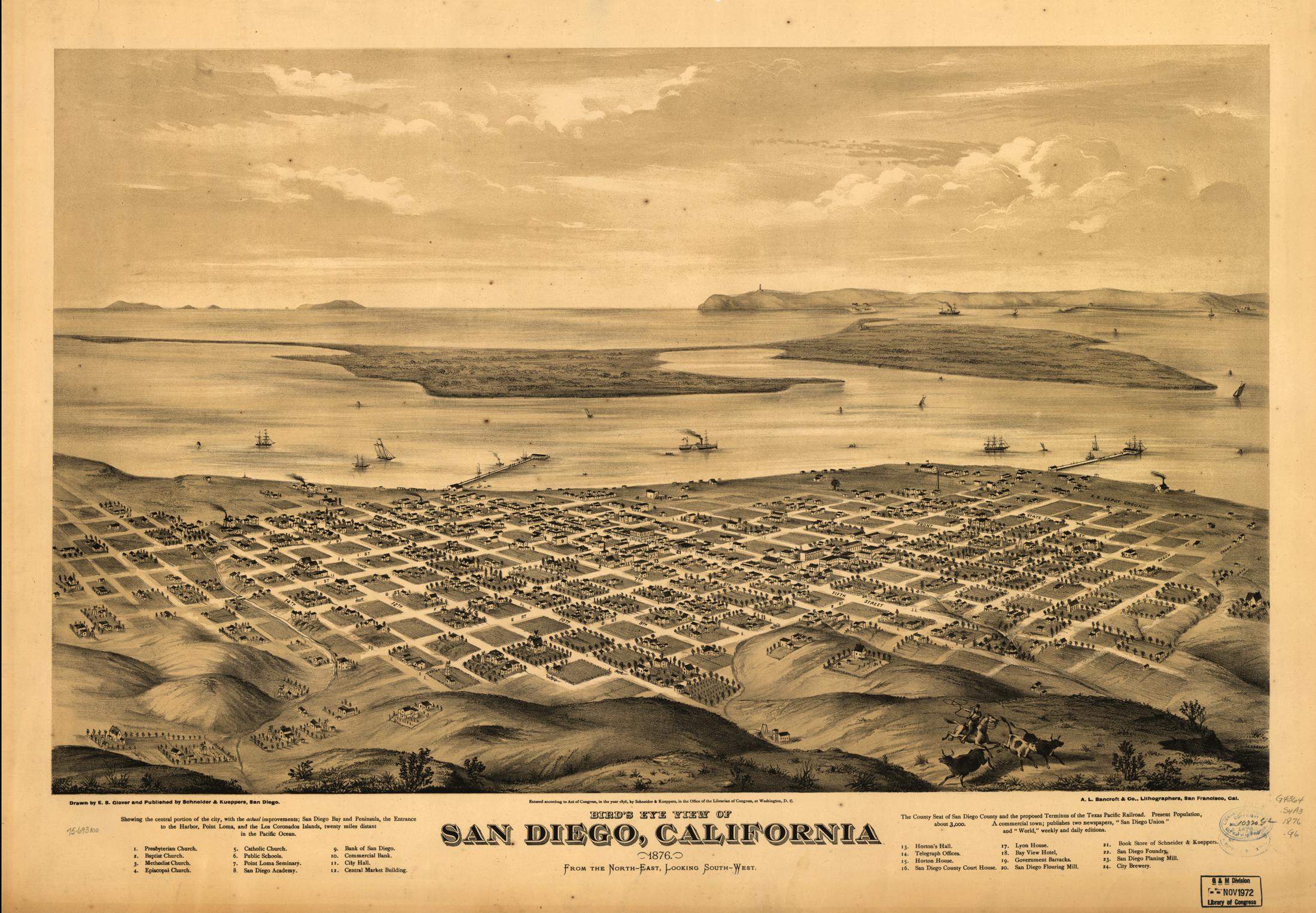
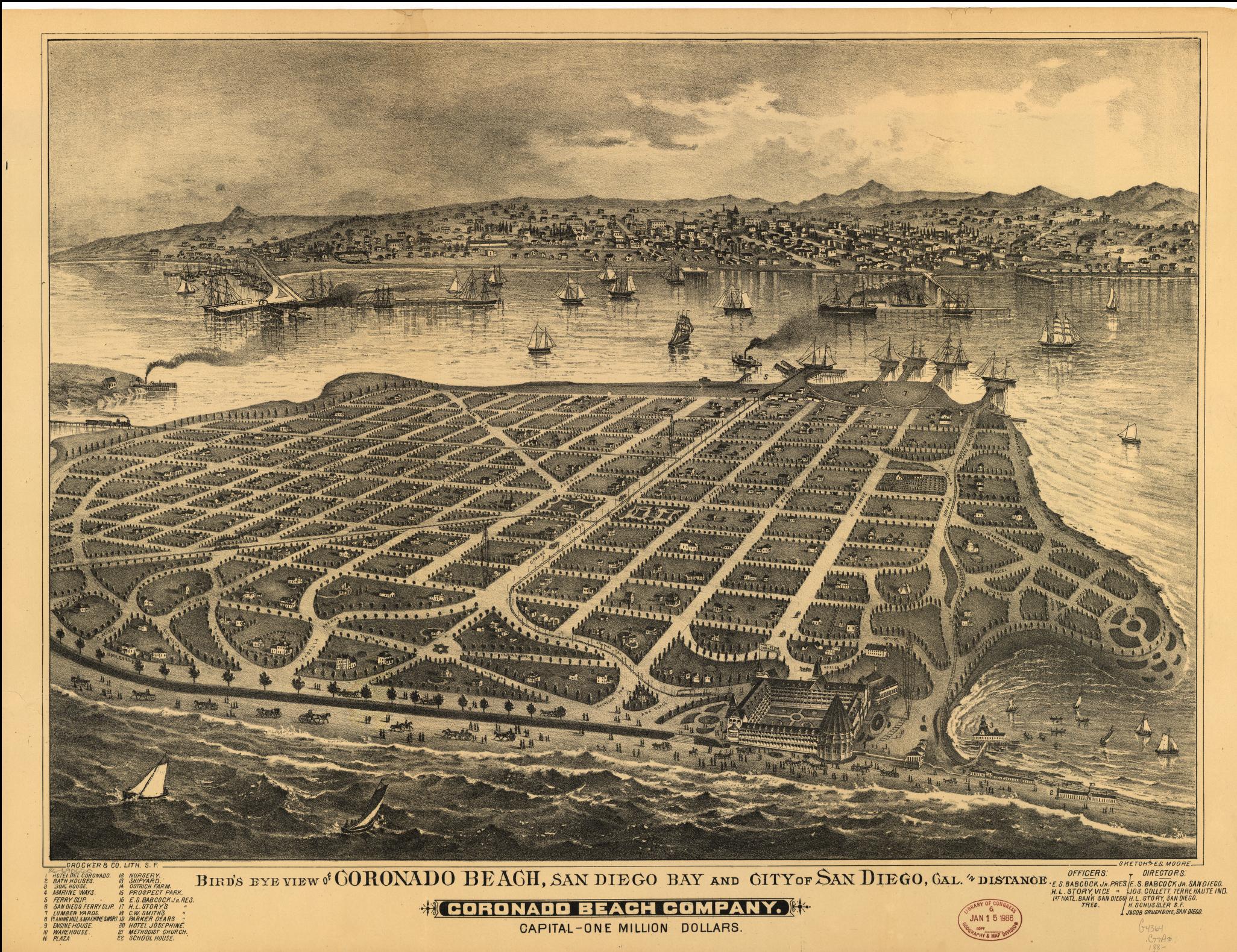
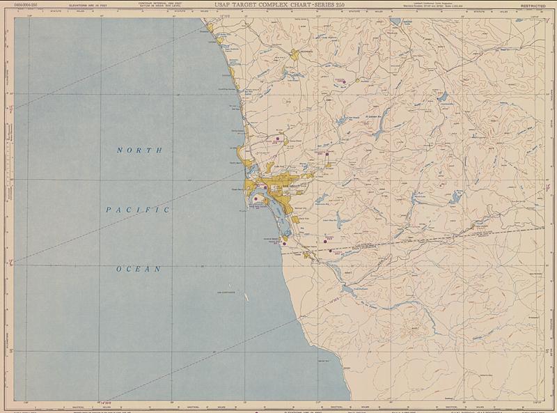
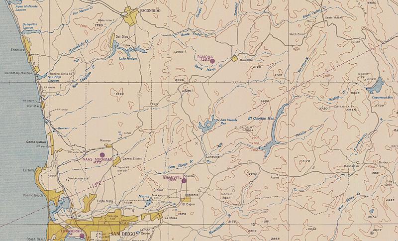
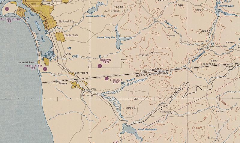
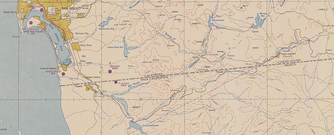
Historical Maps of San Diego

1603 Vizcaino map,
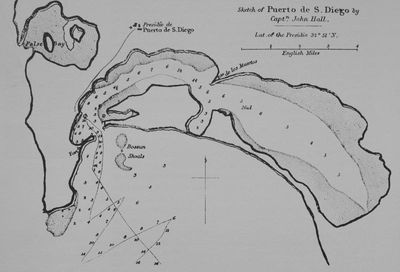
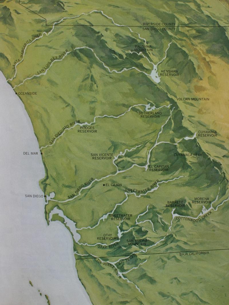
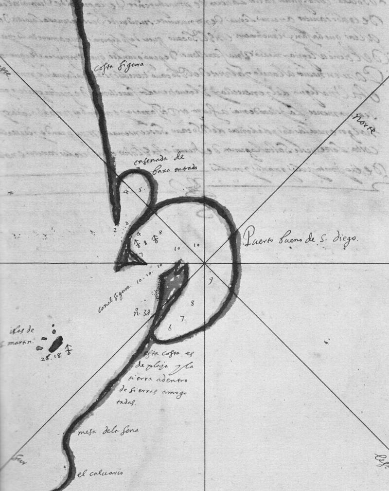
from Pourade, Richard F. The Explorers, p. 60
1783 Velasquez map of the Fages trail,
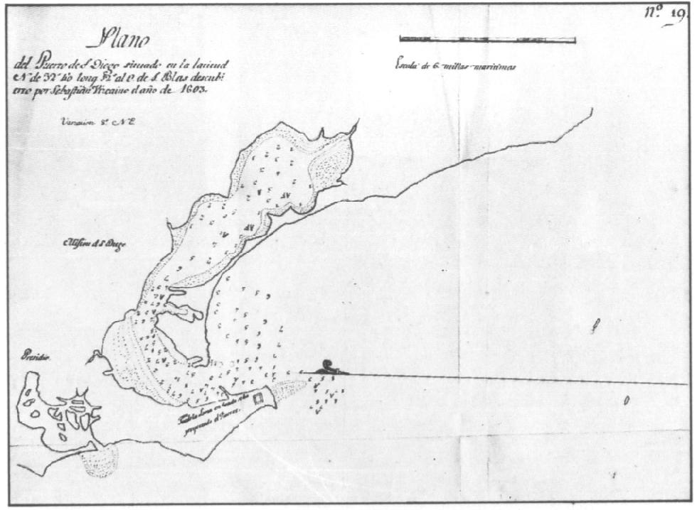
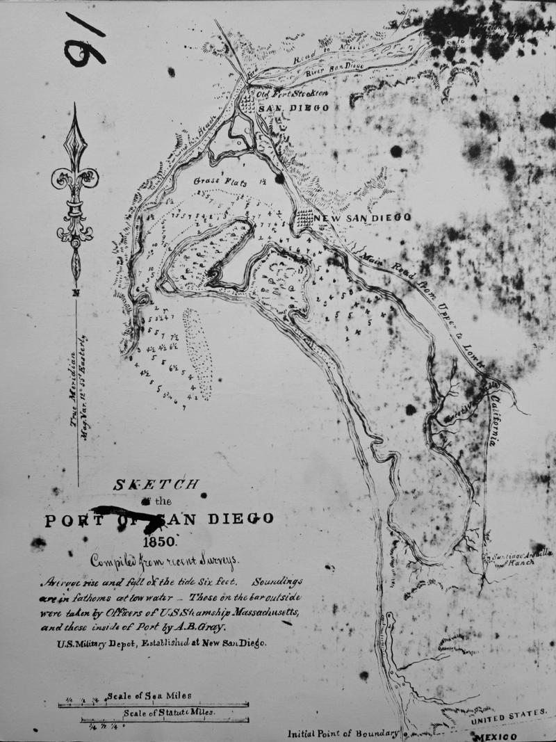
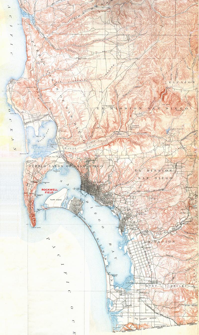
from Pourade, Richard F. Time of the Bells, p. 48 - bg
1786 revised copy of the 1782 Pantoja map, from Pourade, Richard F. The Explorers, p. 149. - bg
1793 Bodega copy of the 1786 Pantoja map, from Engstrand p. 15

1839 map of port of San Diego made by English sea captain John Hall, from Pourade, Richard F. The Silver Dons, p. 10.
1850 military map of New San Diego, by A. B. Gray in 1850, from Pourade, Richard F. The Silver Dons, p. 157. - bg
1873 map of San Diego by George B. Hensley, from Pourade, Richard F. The Glory Years, p. 68. - bg
1906 map of Nolen Plan for San Diego, from Pourade, Richard F. Gold in the Sun, p. 100.

San Diego 1876 bg - "Bird's eye view of San Diego, California, 1876, drawn by E. S. Glover." from LC
Coronado 1888 bg - "Bird's-eye view of Coronado Beach, San Diego Bay and city of San Diego, Cal. in distance, ca. 1888 in San Diego, by E. S. Moore" from LC

San Diego 1912 ""Keep Your Eye on San Diego - Gateway to the Orient" from Union-Tribune 1/1/1912
San Diego 1917 from UT
Military bases in San Diego ca. 1930, from Pourade, Richard F. City of the Dream., p. 37.
Reservoirs in San Diego ca. 1950, from Pourade, Richard F. The Rising Tide, p. 110.

San Diego 1902 from USGS
San Diego 1930 from USGS
San Diego 1979 from USGS

San Diego 1950 bg or 1600 - USAF Target Complex Chart Series 250, map no. 0404_0004_250, from NOAA
San Diego (north) 1950 bg - USAF Target Complex Chart Series 250, map no. 0404_0004_250, from NOAA
San Diego (south) 1950 bg - USAF Target Complex Chart Series 250, map no. 0404_0004_250, from NOAA
San Diego (south county) 1950 bg or 1600 - USAF Target Complex Chart Series 250, map no. 0404_0004_250, from NOAA

Sources:


revised 11/1/04 by Schoenherr | Maps