World Maps
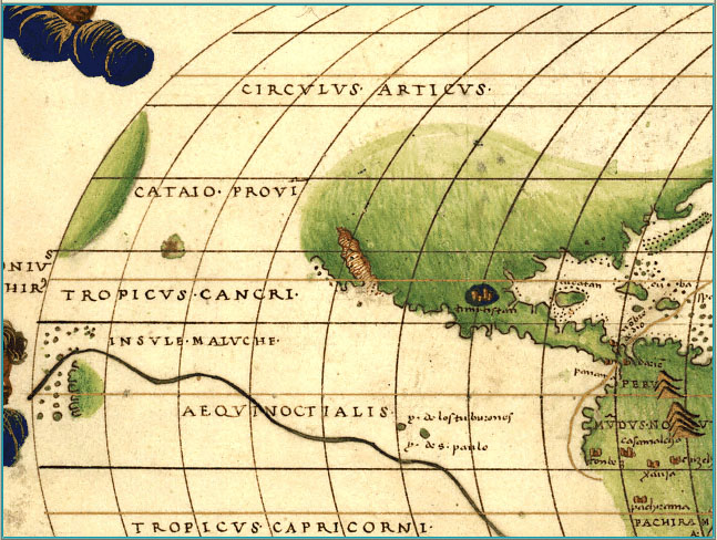
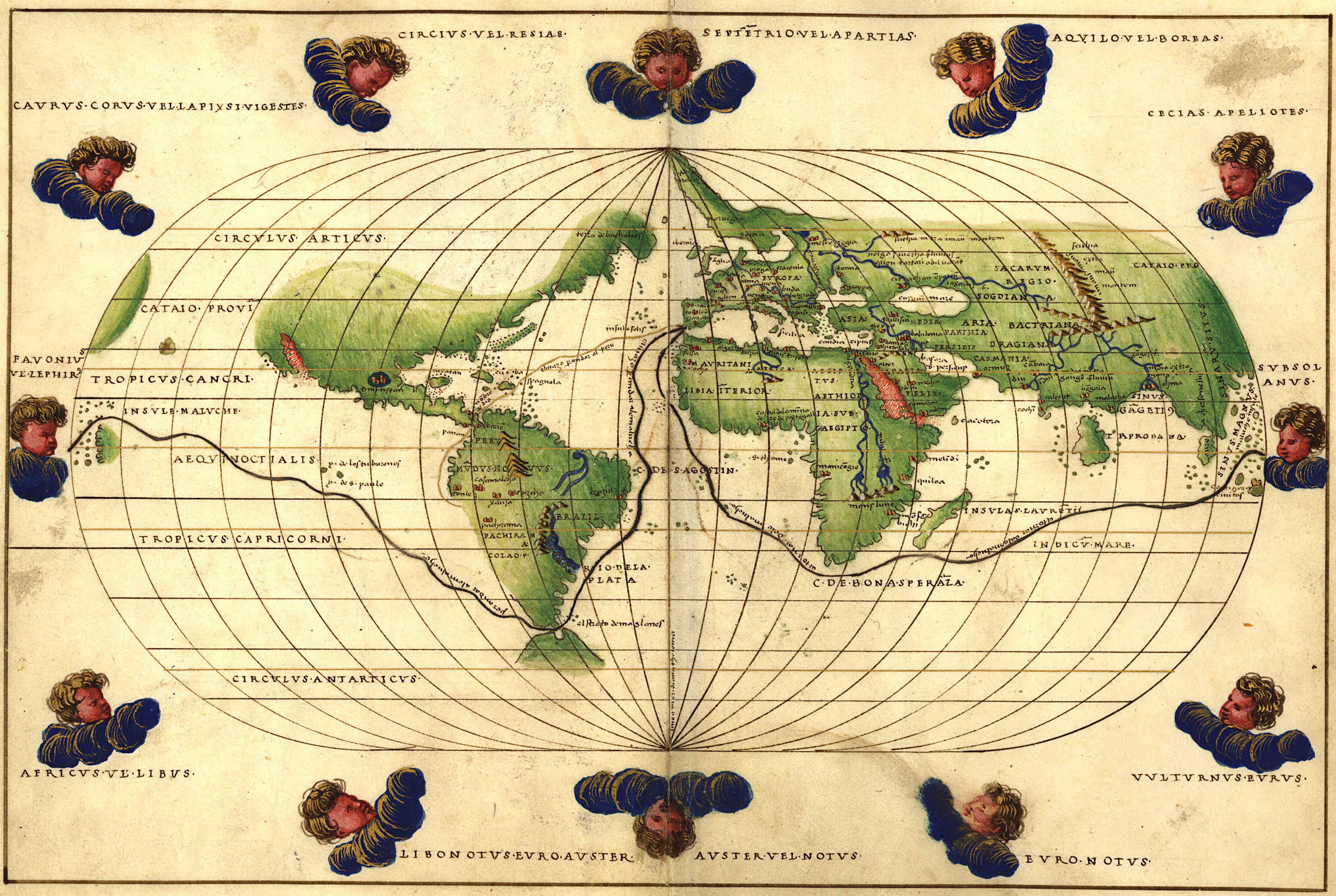
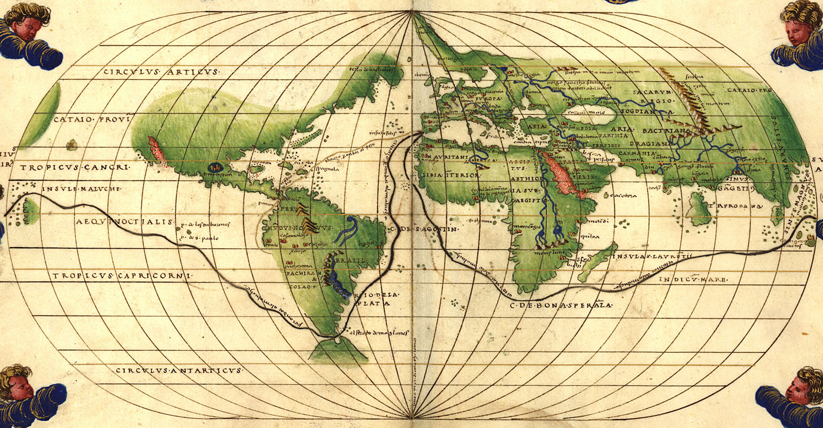
| Portolan atlas of 9 charts and a world map. Manuscript, pen-and-ink and watercolor, on vellum, by Battista Agnese ca. 1544. Dedicated to Hieronymus Ruffault, Abbot of St. Vaast. Each double-page illumination (col. diagrs., col. maps) 21 x 29 cm. Compass rose on inside back cover. "Maps 1, 2, and 10 show America. No. 1 shows the Gulf of California which Ulloa discovered in 1539. On the same map Yucatan is shown as an island, and the east and west coasts of North and South America are only partially shown. On no. 2, the east coasts of North and South America are shown in their entirety and the west coasts only partially. Clumps of trees in green and gold are shown on no. 1, near the Noluccas, and on no. 2, in the Brazilian region of South America. The oval world map (no. 10) shows Magellan's route around the world and a route from Spain to Peru. The 12 wind cherubs on this map are named." -- Ristow and Skelton, Nautical charts on vellum in the Library of Congress, 1977. DIGITAL ID: g3200m gct00001 URL: http://hdl.loc.gov/loc.gmd/g3200m.gct00001 SOURCE: Library of Congress Geography and Map Division Washington, D.C. |
|

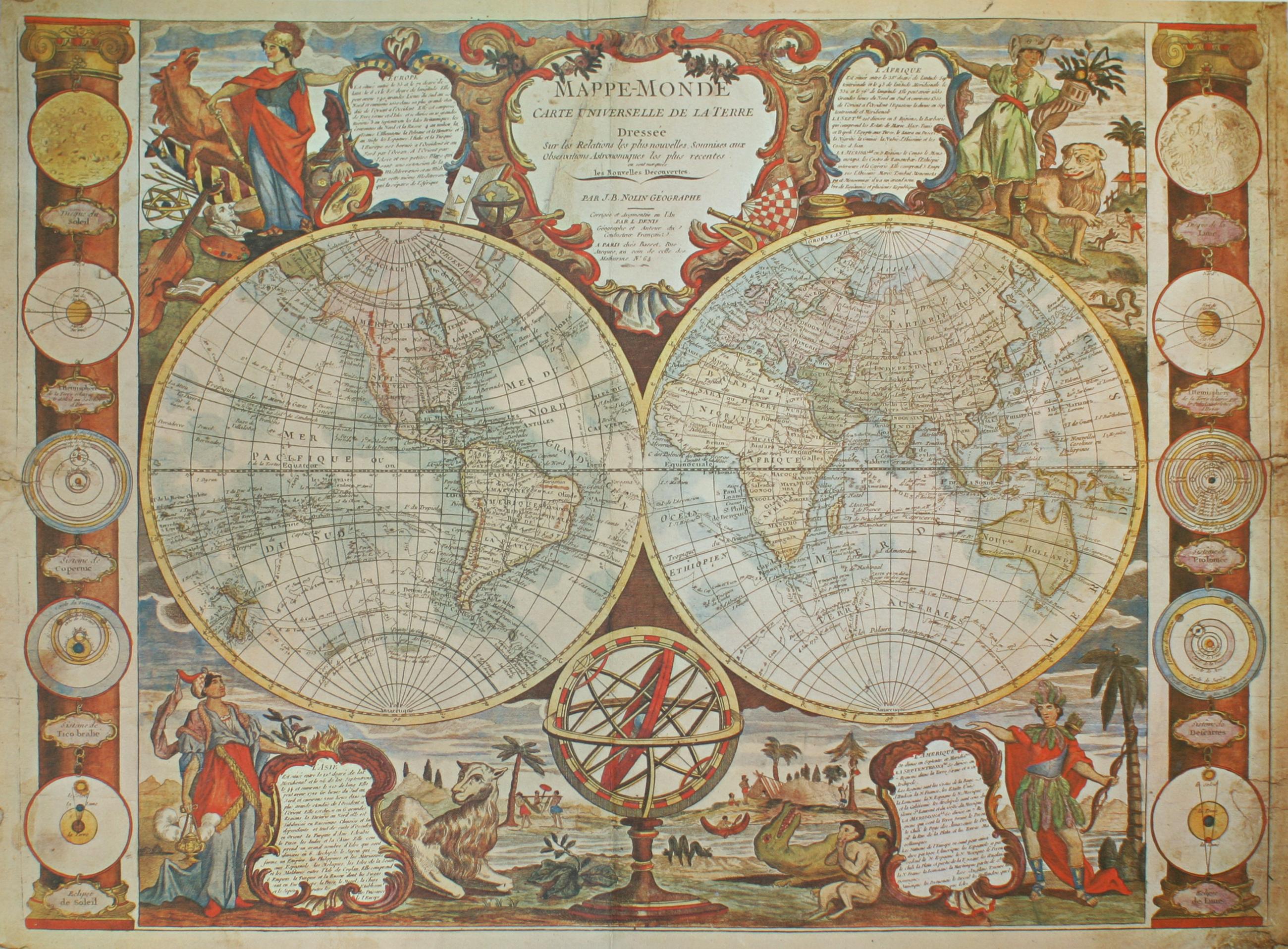
| 1775 world map, from Pourade, Richard F. Time of the Bells. The History of San Diego. v. 2. San Diego, California: The Union-Tribune Publishing Company, 1961, p. xiv |
|
|
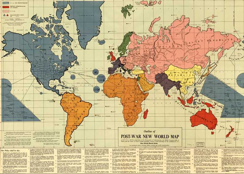
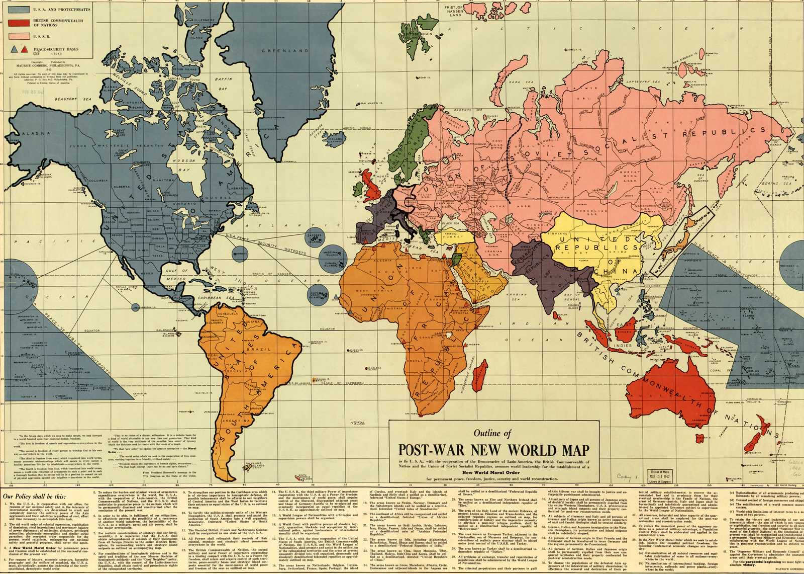
1942 world map. "Outline of post-war new world map" by Maurice Gomberg, Philadelphia, Feb. 25, 1942. Shows protectorates and peace-security bases. Includes quotes from President Franklin Roosevelt's message to the 77th Congress on the State of the Union, including the Four Freedoms and the Moral Order. SOURCE: Library of Congress Geography and Map Division Washington DC. DIGITAL ID: g3200 ct001256 URL: http://hdl.loc.gov/loc.gmd/g3200.ct001256 |
|
|
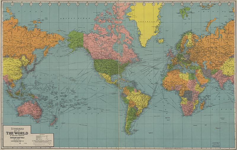
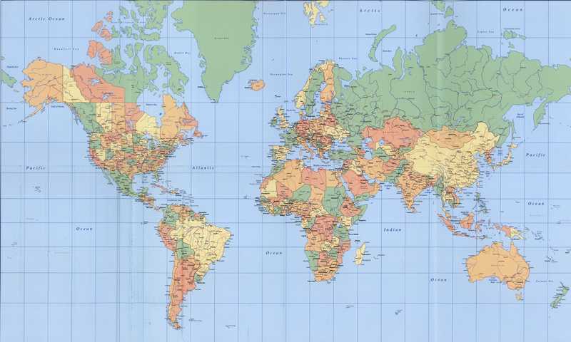
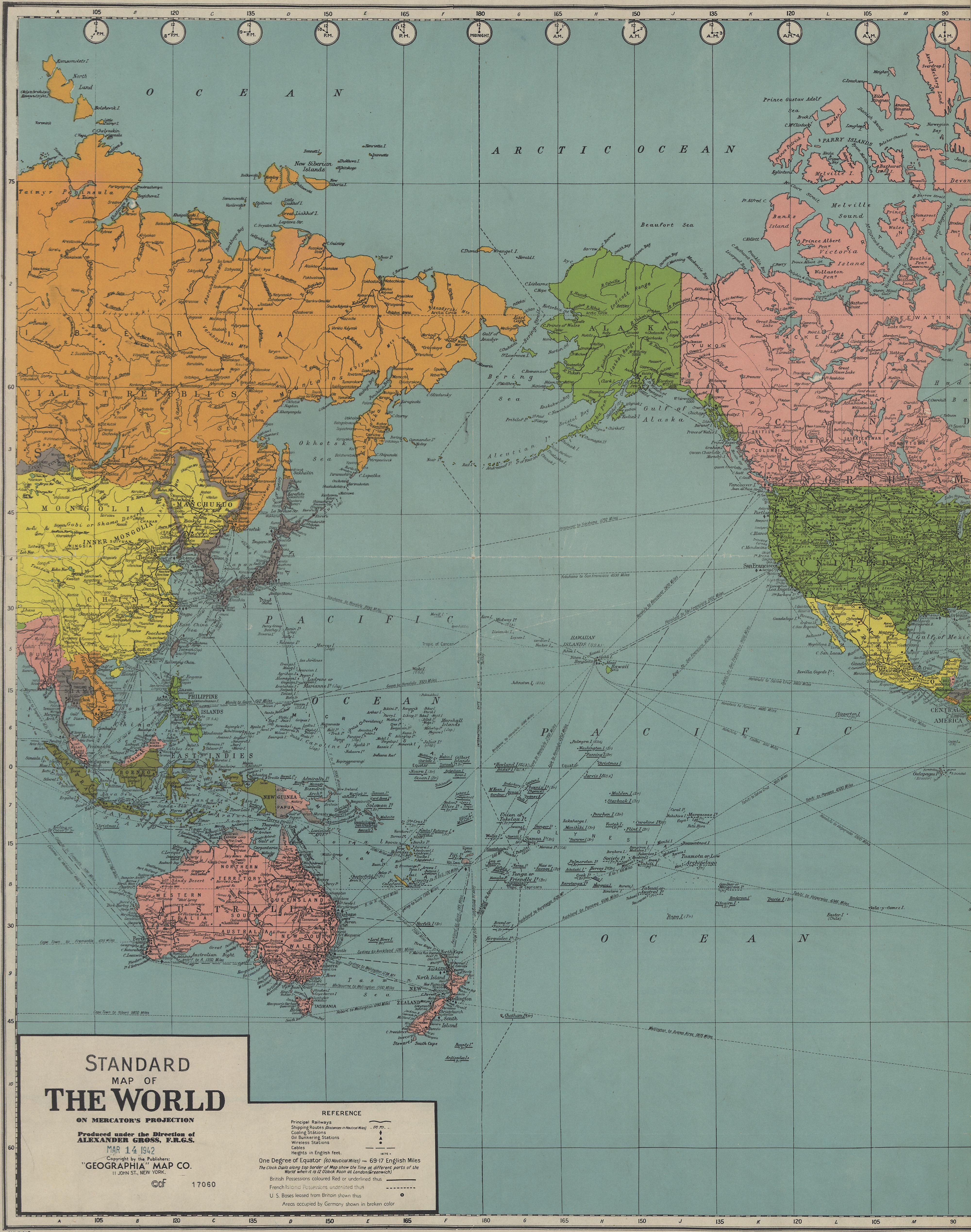
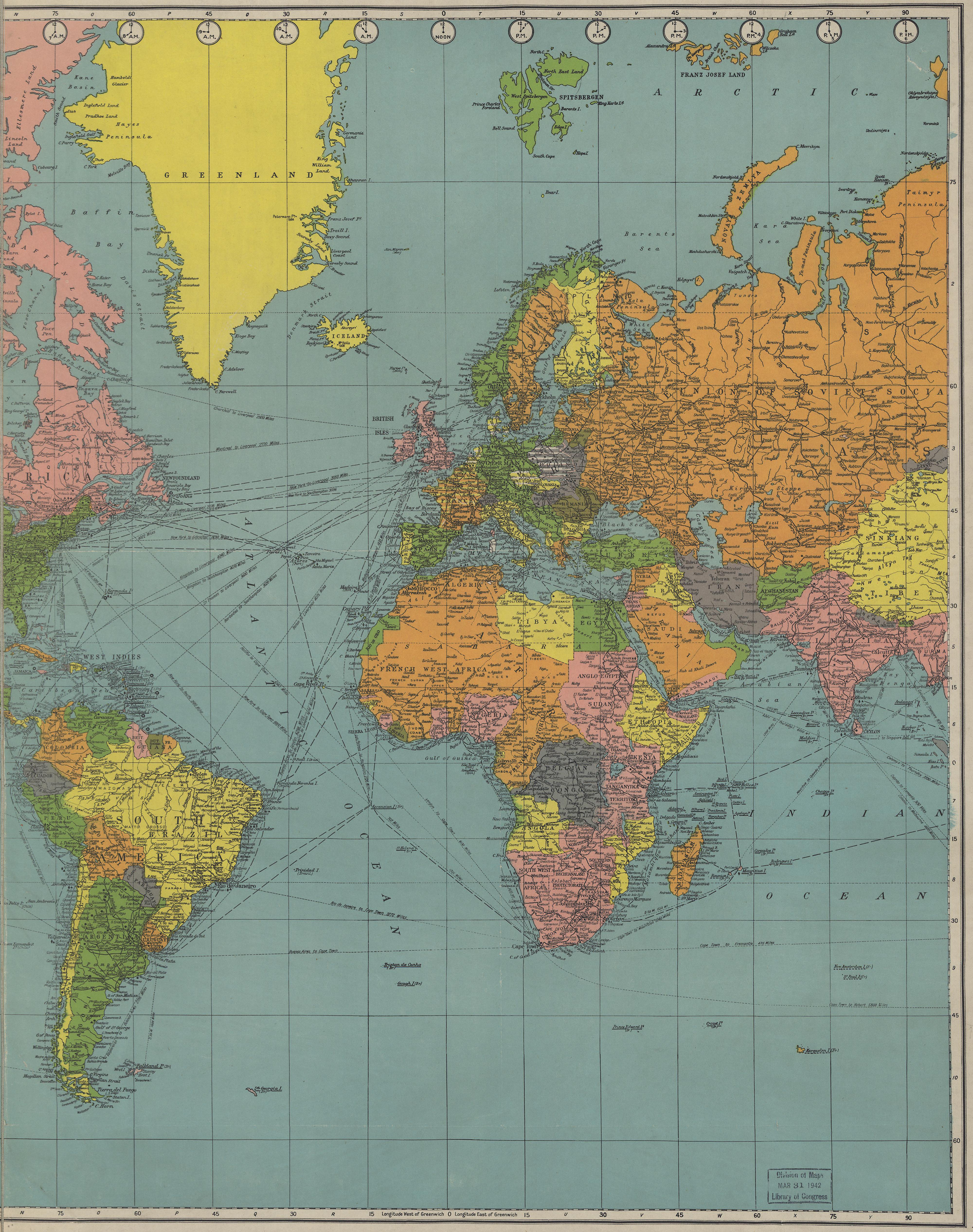
"Standard map of the World." by the Geographia Map Company. SOURCE: Library of Congress Geography and Map Division Washington DC. DIGITAL ID: g3200 ct000575 URL: http://hdl.loc.gov/loc.gmd/g3200.ct000575 |
|
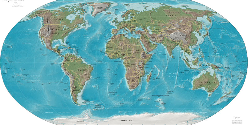
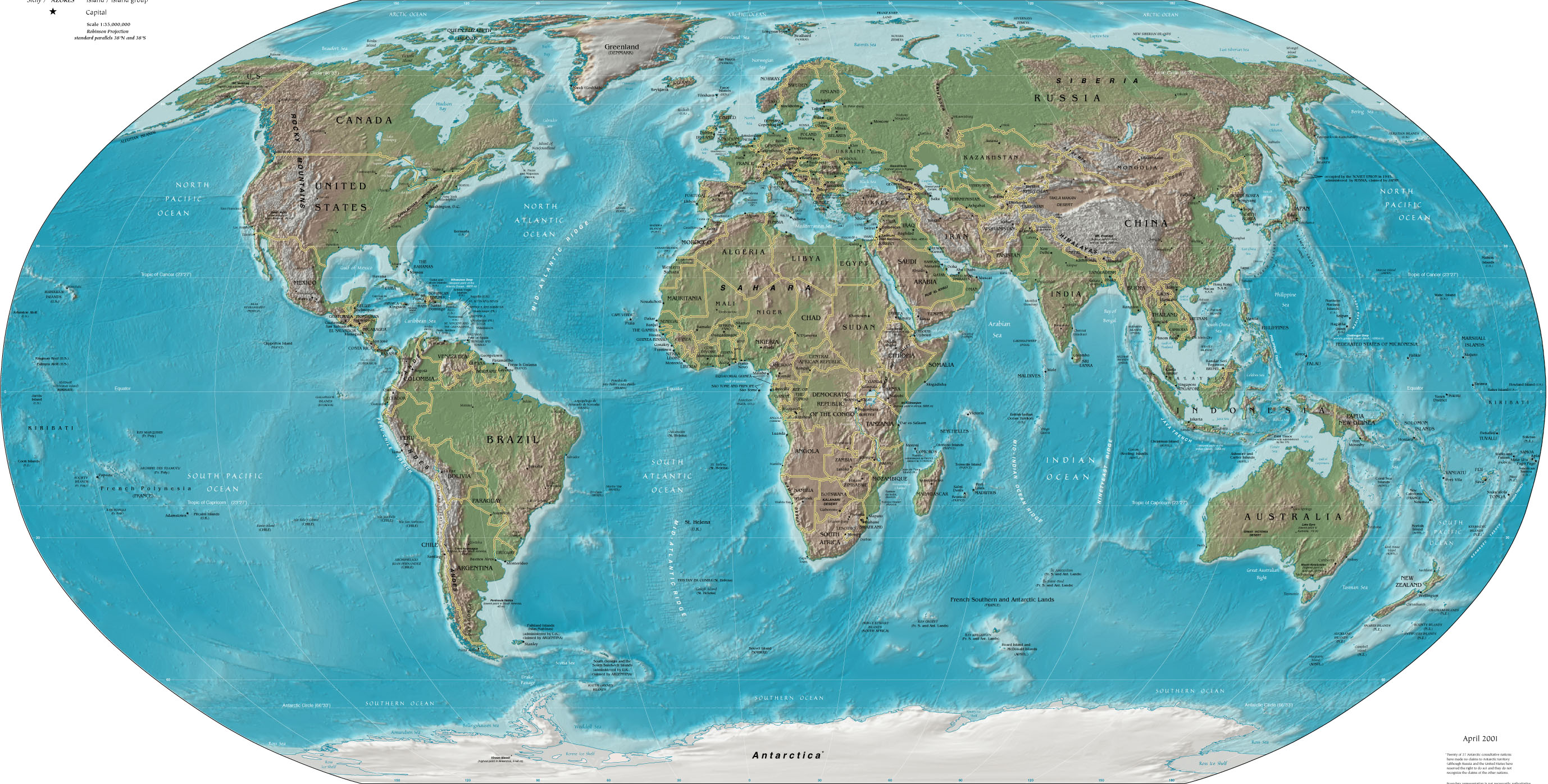
| 2001 world map, from CIA |
|
|
2004 world map, from U.S. Army. "Special insert from Soldiers, the official U.S. Army magazine, January 2004, v. 59, no. 1." SOURCE: Library of Congress Geography and Map Division Washington DC. DIGITAL ID: g3200 ct001177 URL: http://hdl.loc.gov/loc.gmd/g3200.ct001177 |
|
Sources:
- Map Collections from LC American Memory
- World Factbook from CIA
- Perry-Castaneda Map Collection from UT