National City
 JSDH article page 163
|
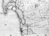
The Rancho El Nacion was a grazing pasture for Presidio livestock in 1795, and a Mexican land grant in 1845 to John Forster who sold it to F. A. L. Pioche in 1854. The Kimball brothers bought the ranch in 1868, surveyed a town site in the northwest corner of the 42-square mile grant, sold home and farm lots. The Wheeler map of 1872 shows the survey made by Kimball and George Morrill in 1868, dividing the rancho of 26,632.10 acres into quarter-section squares of 160 acres each. The northern side started at the lower edge of San Diego's pueblo lands surveyed by James Pascoe. The southern side bordered the ranchos La Punta, Tijuana and Otay. The eastern boundary stopped at the foothills of the San Miguel mountain. Kimball put his townsite of National City on the northwest side, close to the bay and to the road from Mexico to San Diego, but north of the marshy estuaries of the Paradise and Sweetwater rivers. The Wheeler map shows the first county roads in San Diego, No. 1 from Mexico north along the bay, No. 2 north through the City Park past the Old Mission, No. 3 east from San Diego, No. 4 east to Jamacha, and No. 5 east from National City that Frank Kimball opened in 1872 for a stage route to Campo and a military telegraph line route that he called the Telegraph Canyon Road.
|
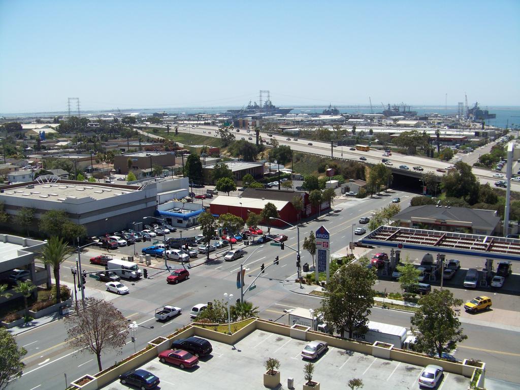 National City looking west from the center of town. Interstate 5 along the bay follows the route of County Road No. 1.
|